Country:

 City:
City:


Access by car:
From the Route de Mauvoisin, in the Val de Bagnes, a road branches off to the right towards the Cabane Brunet. The road then gives way to a track suitable for vehicles, which you follow to a small car park, situated just before the Cabane Brunet, and the starting point of the hike. Please note that the track is relatively narrow. Although there are passing places, it is best to use compact vehicles. Furthermore, there are relatively few parking spaces. You’ll need to arrive early, especially during the peak tourist season.
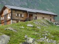
(S/E) Continue along the track, heading east-southeast and then east until you reach the Brunet hut.
(1) Turn right (south-east) onto the Bec de Sery circular path, passing a small lake on your right. Climb steadily.
(2) At a Fork in the road, keep to the right towards the Col des Avouillons. Head south-west, following a stream below on the left.
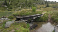
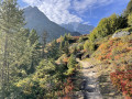
(3) Cross the stream via a small wooden bridge. On the other side, continue due south. Then take two hairpin bends, first to the left then to the right, and continue climbing until you reach a junction.
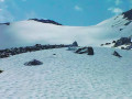
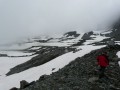
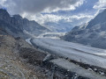
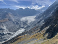
(4) Turn left onto the main path, still heading towards the Col des Avouillons. Navigate a section of boulders via a series of tight hairpin bends. After a steep final stretch, you’ll reach the pass. There’s a superb panoramic view of the Corbassière Glacier, though sadly you can see just how far it has receded.
(5) Descend very steeply down the other side. The path heads south-east at first, then turns north-east, continuing downhill, before finally turning south-east again to reach a junction.
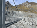
(6) Turn right towards the Cabane Panossière. Head uphill and you’ll soon reach the entrance to the Corbassière Footbridge (there was a time when, at this point, you would have crossed the glacier itself; the footbridge was built as a result of the glacier’s retreat and was opened in 2014).
(7) Cross the footbridge, which can be quite daunting as it is 70 metres above the abyss but is perfectly safe.
(8) On the other side, turn left and head uphill until you reach a fork in the path.
(9) Turn right towards the Cabane Panossière. Head up, generally south-east, to the hut. There’s a stunning view of the Corbassière Glacier.
(10) Return via the same route, cross the footbridge again and head back up to the junction you passed on the way out.
(6) Turn right towards La Maye. After a long stretch of seemingly level ground, the path descends steeply via tight hairpin bends. The slope then levels out: you’ll soon reach a junction.
(11) Carry on straight ahead, heading north-west. The path then turns west, then south-west, before the gradient levels out again. Cross a stream via a footbridge and you’ll soon reach a junction you passed earlier in the walk.
(2) Carry on to the right (north-north-east) and, following the same route as on the way out but in the opposite direction, head back to the Cabane Brunet and then the car park (S/E).
 Visorando Member
 Moderate

 Very difficult