


Refine your search for walks in Pierre Avoi
Pierre Avoi walks


 The Pierre Avoi from the Col des Planches
 Visorando Member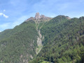
 12.93 mi
 +4,957 ft
 -4,948 ft
 10h 15
 Difficult
 Departure from Vollèges (Valais)
Pierre Avoi is the local dialect term for ‘rock worth seeing’: that certainly makes you want to go there! It is an isolated rocky peak on the Verbier ridge, making it an iconic summit. The route suggested here, starting from the Col des Planches, is a slightly less busy alternative to the one from Verbier or Savoleyres.
Walks near Pierre Avoi
La Tzoumaz - Nendaz
 9.23 mi
+2,001 ft
-2,372 ft
6h 00
9.23 mi
+2,001 ft
-2,372 ft
6h 00
 Moderate
Departure from Riddes (Valais)
Moderate
Departure from Riddes (Valais)
The elevation profile says it all about this day. Most of the route runs along the Grand Bisse de Saxon. This section has been beautifully restored. In Taillay, you will discover a water wheel and a hammer powered by the stream. This ingenious invention was an alarm signal. The sound of the hammer could be heard 2 km away. The absence of sound alerted the bisse guard. You will recognise the Muverans massif on the other side of the Rhône valley.
From Ruinettes to La Chaux
1.36 mi
+243 ft
-46 ft
0h 50
 Easy
Departure from Bagnes (Valais)
Easy
Departure from Bagnes (Valais)
An extremely easy walk on a very gentle slope. Take the ski lifts from Verbier to Ruinettes (or walk up), and you can continue to Mont-Fort by cable car. At La Chaux, the restaurant “Le Dahu”, with sun loungers and occasional entertainment (such as concerts), awaits you.
From Col des Planches to Grimentz via the bisses trail
 62.19 mi
+17,077 ft
-16,499 ft
6 days
Difficult
Departure from Vollèges (Valais)
62.19 mi
+17,077 ft
-16,499 ft
6 days
Difficult
Departure from Vollèges (Valais)
The word ‘bisse’ is used in Valais to refer to an irrigation channel carrying water from the mountains to farmland. They may be buried underground, carved into the rock or suspended from cliffs. Some bisses date back over 500 years and their channels have deteriorated or even ceased to exist following rockfalls. Water is therefore not available everywhere, despite efforts to restore this precious heritage.Over the course of six days, you will explore these trails steeped in history.
Col des Planches - La Tzoumaz
 8.55 mi
+3,048 ft
-2,720 ft
6h 35
Difficult
Departure from Vollèges (Valais)
8.55 mi
+3,048 ft
-2,720 ft
6h 35
Difficult
Departure from Vollèges (Valais)
During this first stage, you will discover part of the Old Saxon Bisse (the longest of the bisse: 26 km from its water source in Siviez to La Boveresse). The bisse starts at the point (6). Built in the 1850s, the pipes no longer exist, so you will have to wait until you reach La Tzoumaz to finally see water flowing along the path. The bisse is currently being restored in sections.
The Farinet Footbridge
6.84 mi
+1,486 ft
-1,545 ft
4h 25
Moderate
Departure from Chamoson (Valais)
An autumn walk through the lands of Farinet, the Robin Hood of Valais, a beautiful climb through the vineyards to a spectacular footbridge that crosses the Salentze valley at a height of over 130 metres. There are no particular difficulties, but the footbridge is strongly discouraged for people who are prone to vertigo. The thermal baths of Saillon, 500 m from the finish, offer a great way to relax at the end of the day.
Nendaz - Veysonnaz
 8.84 mi
+1,781 ft
-1,870 ft
5h 35
Moderate
Departure from Nendaz (Valais)
8.84 mi
+1,781 ft
-1,870 ft
5h 35
Moderate
Departure from Nendaz (Valais)
Two bisses are on the agenda for this third day. Very quickly in Nendaz, you will reach the "Bisse Vieux" against the current, then after Planchouet, you will stroll along the magnificent "Grand Bisse de Vex". Opposite, the Rhône valley is often visible, and you will clearly see the Derborance and Sanetsch valleys, Mont Gond, the Wildhorn and its glacier.
Ovronnaz – Lac de Derborence Mountain Hut
11.10 mi
+4,803 ft
-4,505 ft
9h 15
 Very difficult
Departure from Leytron (Valais)
Very difficult
Departure from Leytron (Valais)
The hike described below covers the first of two days of the Tour des Muverans. It connects the resort of Ovronnaz (chairlift car park) with the Lac de Derborence mountain hut, crossing the Col de la Forcle (2,543 m), the highest point of the route.
Brunet Hut - Louvie Hut
 5.46 mi
+3,333 ft
-2,930 ft
5h 25
Difficult
Departure from Bagnes (Valais)
5.46 mi
+3,333 ft
-2,930 ft
5h 25
Difficult
Departure from Bagnes (Valais)
This fifth stage crosses the Val de Bagnes. To the right of the Cabane Brunet, follow the path that descends directly to Fionnay. Be careful, this very steep path with countless tree roots can be slippery and dangerous in wet weather. Cross the road that leads to Fionnay. The path to the Louvie Hut is signposted in the centre of the village, on the right bank of the torrent. The trail is well marked all the way to the hut. Ibex often come close to the hut. A little further on, it is possible to see chamois.
Brunet Hut - Panossière Hut
 4.16 mi
+2,815 ft
-1,070 ft
4h 20
Moderate
Departure from Bagnes (Valais)
4.16 mi
+2,815 ft
-1,070 ft
4h 20
Moderate
Departure from Bagnes (Valais)
The route passes through the Col des Avouillons before descending to the rest of the Corbassière glacier, which is crossed via a spectacular 200 m long footbridge over a 70 m drop. The high mountains reveal themselves after the pass in a grandiose setting.
Louvie Hut - Prafleuri Hut
 7.26 mi
+4,019 ft
-2,654 ft
6h 50
Difficult
Departure from Bagnes (Valais)
7.26 mi
+4,019 ft
-2,654 ft
6h 50
Difficult
Departure from Bagnes (Valais)
This sixth stage takes place in the high mountains and, depending on the season, may involve crossing snowfields.From Lake Louvie, climb up to Col Termin and rejoin the balcony path that comes from the Montfort Hut. Continue to Col de Louvie (possibility of snowfields). After descending Col de Louvie, the path passes at the foot of the Grand Désert Glacier. The trail then crosses scree; look out for the red and white markings and follow the signs for Prafleuri. Climb Col de Prafleuri. Descend to Torrent de Prafleuri (small bridge); on the left, a trail leads to the Prafleuri Hut.