


Refine your search for walks in Ranspach-le-Haut
Ranspach-le-Haut walks
 From Ranspach-le-Bas to Ranspach-le-Haut
 Visorando Member
 7.04 mi
 +528 ft
 -515 ft
 3h 40
3h 40
 Moderate
 Departure from Ranspach-le-Bas (Haut-Rhin)
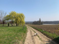
A lovely walk along the Sundgau trails through meadows, fields and woods. Near the D419, there’s a stunning view of the border region.
Of interest: a memorial to a plane crash in 1915… there weren’t many of those back then!
Around the Oberholz
 6.03 mi
+377 ft
-400 ft
3h 05
Moderate
Departure from Kappelen (Haut-Rhin)
6.03 mi
+377 ft
-400 ft
3h 05
Moderate
Departure from Kappelen (Haut-Rhin)
A lovely circular walk starting from Kappelen, passing through Ranspach-le-Bas and the hills of Helfranzkirch, combining woodland, fields and village outskirts.
Via the Oratory of the Three Virgins from Wentzwiller
6.40 mi
+502 ft
-502 ft
3h 25
Moderate
Departure from Wentzwiller (Haut-Rhin)
The route starts at the car park by the church in Wentzwiller, a pretty little village typical of the Sundgau, a region in southern Alsace. A lovely walk with beautiful views over the Rhine Valley and Basel.
Sundgau route: Hundsbach-Franken
 3.75 mi
+184 ft
-194 ft
1h 55
Moderate
Departure from Haut-Rhin
3.75 mi
+184 ft
-194 ft
1h 55
Moderate
Departure from Haut-Rhin
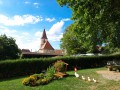
Below the Hochistross, the high road from Altkirch to Basel, villages dot the Thalbach valley. The old grain mill in Hundsbach has recently been restored, much to the delight of artists and history lovers.
The hills of Hésingue
3.90 mi
+381 ft
-358 ft
2h 05
 Easy
Departure from Hésingue (Haut-Rhin)
Easy
Departure from Hésingue (Haut-Rhin)
Partly in the forest and partly in open countryside, this route will allow you to discover the forest and countryside to the west of Hésingue: the passage over and under the D105, the Fichtag discovery trail with its numerous informative and entertaining displays and panels, the Liesbach passage with its beautiful wooden footbridges, the Finnish track, the tranquillity of the forest, the beauty of the countryside and the views towards the Black Forest.
The Schneckenberg Forest
 4.72 mi
+371 ft
-374 ft
2h 30
Easy
Departure from Bartenheim (Haut-Rhin)
4.72 mi
+371 ft
-374 ft
2h 30
Easy
Departure from Bartenheim (Haut-Rhin)
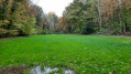
Overlooking the Rhine’s alluvial plain—a barren landscape where the Hardt Forest struggles to survive—the hills of the Bartenheim heights enjoy very rich soil. Set upon this fertile silt, on either side of the ridge between Helfrantzkirch and Bartenheim, lies the most beautiful forest in the Sundgau: the Schneckenberg Forest (see Practical Information).
A short walk through the forest or along the forest edge for tree lovers.
The heights of Blotzheim via the snail hills
 8.25 mi
+623 ft
-604 ft
4h 20
Moderate
Departure from Bartenheim (Haut-Rhin)
8.25 mi
+623 ft
-604 ft
4h 20
Moderate
Departure from Bartenheim (Haut-Rhin)
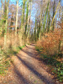
On the heights of Blotzheim, the Grand and Petit Schneckenberg (snail hills) form a wooded area close to its natural state, criss-crossed by streams and surrounded by fields, copses and a few vineyards.A multitude of trails and paths offer beautiful walks in the hills, where you can enjoy the peace and quiet and a few views of the neighbouring mountain ranges, the Vosges, the Black Forest and the Jura.Two versions are available, 10 or 13 km.
A short tour of Brestenberg through fields and forests
 2.51 mi
+174 ft
-174 ft
1h 20
Easy
Departure from Bartenheim (Haut-Rhin)
2.51 mi
+174 ft
-174 ft
1h 20
Easy
Departure from Bartenheim (Haut-Rhin)
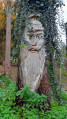
Family walk around Brestenberg hill between Bartenheim and Brinckheim, passing through sunken lanes typical of the Sundgau hills. Enjoy the forest and the view of the Vosges mountains and the Black Forest.
Bartenheim - Kappelen circular loop
 4.67 mi
+174 ft
-174 ft
2h 20
Easy
Departure from Bartenheim (Haut-Rhin)
4.67 mi
+174 ft
-174 ft
2h 20
Easy
Departure from Bartenheim (Haut-Rhin)
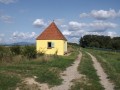
The hike alternates between fields, forest edges and villages. Go through the fields of Bartenheim and Brinckheim, passing the small village of Kappelen. The return journey is through the fields of Kappelen and Brinckheim, then HochaLoch along the Muehlgraben.
Bartenheim and Brinckheim Vines Trail
 3.93 mi
+246 ft
-256 ft
2h 00
Easy
Departure from Bartenheim (Haut-Rhin)
3.93 mi
+246 ft
-256 ft
2h 00
Easy
Departure from Bartenheim (Haut-Rhin)
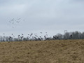
A trail giving you the possibility to explore a large number of running vineyards throughout the Bartenheim and Brinckheim hillsides.
Roman Road and the Ill Valley starting from Willer
8.06 mi
+531 ft
-558 ft
4h 10
Moderate
Departure from Haut-Rhin
A lovely walk in the Sundgau starting from Willer.
Circular Bartenheim route via the big oak tree in Stetten
 9.57 mi
+509 ft
-509 ft
4h 50
Moderate
Departure from Bartenheim (Haut-Rhin)
9.57 mi
+509 ft
-509 ft
4h 50
Moderate
Departure from Bartenheim (Haut-Rhin)
The hike alternates between fields, forest edges and villages. Go through the fields of Bartenheim and Brinckheim, pass the small village of Stetten to reach the Gros Chêne. The return route is via the village of Helfrantzkirch, the fields of Kappelen and Brinckheim, and the HochaLoch along the Muehlgraben.
Hills around Hagenthal-le-Haut
4.19 mi
+423 ft
-423 ft
2h 20
Easy
Departure from Hagenthal-le-Haut (Haut-Rhin)
A walk partly through the forest and partly in open countryside on the heights of Hagenthal-le-Haut. Several benches and picnic spots along the route. On the return journey, beautiful views of the Jura, Basel, Chrischona and the surrounding hills.
Sundgau route: Hagenthal-Neuwiller
 8.15 mi
+692 ft
-676 ft
4h 20
Moderate
Departure from Hagenthal-le-Bas (Haut-Rhin)
8.15 mi
+692 ft
-676 ft
4h 20
Moderate
Departure from Hagenthal-le-Bas (Haut-Rhin)
The Eptingen family, who had already settled on the edge of the Sundgau region in the 14th century, owned both Hagenthal
and Neuwiller, where they lived in comfortable castles. This walk crosses their former seigneury and passes through a one-kilometre-wide bottleneck between the borders, as Neuwiller forms a sort of French peninsula on Swiss territory. Text by Marc Glotz taken from the Sundgau hiking guide.
Bartenheim - Brinckheim circular along the Muehlgraben.
 2.66 mi
+174 ft
-144 ft
1h 20
Easy
Departure from Bartenheim (Haut-Rhin)
2.66 mi
+174 ft
-144 ft
1h 20
Easy
Departure from Bartenheim (Haut-Rhin)
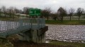
A short, unpretentious hike.
Starting at the ACL foyer in Bartenheim, the outward journey takes you through the fields of Bartenheim and Brinckheim, and the return journey takes you through Hochaloch along the Muehlgraben.
Between Le Homberg and the Bruchberg, in the heart of the Bas-Sundgau hills
 8.71 mi
+505 ft
-502 ft
4h 25
Moderate
Departure from Kœtzingue (Haut-Rhin)
8.71 mi
+505 ft
-502 ft
4h 25
Moderate
Departure from Kœtzingue (Haut-Rhin)
A varied family walk that climbs towards the Forêt des Deux Chênes, dotted with wooden sculptures and educational panels. The Schlierbach discovery trails, the return route via the Homberg and the Kœtzingue ecological pond, as well as the beautiful views of the surrounding mountains, will make you forget a few short but sometimes steep climbs.
From Linsdorf to Bettlach via the Casemates Trail
 6.63 mi
+384 ft
-384 ft
3h 25
Moderate
Departure from Linsdorf (Haut-Rhin)
6.63 mi
+384 ft
-384 ft
3h 25
Moderate
Departure from Linsdorf (Haut-Rhin)
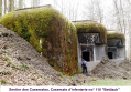
Starting from Linsdorf, between forest and fields, the route climbs to the Eichwald plateau, alternating between woods and fields, leading successively to the Abri de la Fuste, on the heights of Bettlach, and the Sentier des Casemates, connecting three imposing forts of the Maginot Line. The Casemates Trail is dotted with information panels explaining the history of the Maginot Line. The route also offers beautiful views of the Ill Valley and the Jura Mountains.
Following the route of the waters of Saint-Louis
 2.46 mi
+13 ft
-13 ft
1h 10
Easy
Departure from Saint-Louis (Haut-Rhin) (Haut-Rhin)
2.46 mi
+13 ft
-13 ft
1h 10
Easy
Departure from Saint-Louis (Haut-Rhin) (Haut-Rhin)
This is a small nature trail made by the city of Saint-Louis. It passes through the 3 of drinking water catchment points in the city where 535 cubic metres of water are pumped every hour and then stored in a 6000-metre-cubed tank.
The trail has a dozen panels explaining the difficulties of supplying drinking water and the surrounding environments.
Sundgau route: Durmenach - Luppach
 4.43 mi
+423 ft
-420 ft
2h 25
Moderate
Departure from Durmenach (Haut-Rhin)
4.43 mi
+423 ft
-420 ft
2h 25
Moderate
Departure from Durmenach (Haut-Rhin)
In warm weather, this is a pleasant walk from the Ill valley to the old bed of the Rhine at the foot of the Jura mountains. The well-marked path offers plenty of opportunities to rest and leads to a strange crypt, the last vestige of a convent destroyed during the Revolution, where the shadow of an exiled poet still lingers.
The Kenzo Trail
11.40 mi
+607 ft
-594 ft
5h 45
Moderate
Departure from Sierentz (Haut-Rhin)
A walk along easily accessible paths, ideal for families or those with pets.
A route through fields and along forest edges, starting from Sierentz, passing through Uffheim and Stetten to reach Helfrantzkirch, then returning via Kappelen towards Uffheim and back to Sierentz.
Around Rantzwiller
 5.35 mi
+459 ft
-463 ft
2h 50
Easy
Departure from Rantzwiller (Haut-Rhin)
5.35 mi
+459 ft
-463 ft
2h 50
Easy
Departure from Rantzwiller (Haut-Rhin)
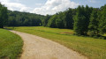
Rantzwiller, a small village in the Sundgau region, is a lovely place to live. The area around the village, particularly the hamlet of Heilhof, is well worth exploring and offers some lovely views.
The Saint Louis Neuweg neighbourhood and its discovery trail
 4.04 mi
+13 ft
-13 ft
1h 50
Easy
Departure from Saint-Louis (Haut-Rhin) (Haut-Rhin)
4.04 mi
+13 ft
-13 ft
1h 50
Easy
Departure from Saint-Louis (Haut-Rhin) (Haut-Rhin)
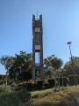
On the edge of the Petite Camargue Alsacienne is a quiet residential area that is part of the Saint-Louis conurbation: Neuweg. It is well worth a visit and, at the end of the walk, you will come to a small forest where you can learn more about water along a discovery trail.
The Hardt Forest
6.31 mi
+20 ft
-20 ft
2h 55
Easy
Departure from Sierentz (Haut-Rhin)
A pleasant, uneventful walk that starts in Sierentz and passes through fields and the Hardt Forest. The route is mostly on flat ground, part of which consists of tarmac paths for pedestrians and cyclists.
Walk in the old bed of the Rhine: the Petite Camargue Alsacienne
 4.36 mi
+30 ft
-30 ft
2h 00
Easy
Departure from Bartenheim (Haut-Rhin)
4.36 mi
+30 ft
-30 ft
2h 00
Easy
Departure from Bartenheim (Haut-Rhin)
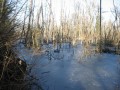
A national nature reserve, the Petite Camargue Alsacienne now covers 904 hectares, including nearly 200 hectares of water. Originally, in 1982, it covered 120 hectares around the buildings of the Imperial Fish Farm (1852). It is here, in the wild heart of the Au wetland plain, that you can walk along some of its most beautiful paths and discover the exceptional flora and fauna of this marshland landscape, thanks to the groundwater.
Circular route in the southern Hardt Forest
 3.83 mi
+30 ft
-30 ft
1h 45
Easy
Departure from Kembs (Haut-Rhin)
3.83 mi
+30 ft
-30 ft
1h 45
Easy
Departure from Kembs (Haut-Rhin)
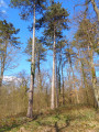
A short family walk through a pleasant woodland setting, in stark contrast to the neighbouring urban development. In fine weather, a playground and a picnic area will make for an enjoyable day out.
In wet seasons, the paths are often muddy or overgrown with vegetation, whilst others are rutted due to forestry work.
Sundgau circuit in Leymen
 4.14 mi
+673 ft
-686 ft
2h 30
Easy
Departure from Leymen (Haut-Rhin)
4.14 mi
+673 ft
-686 ft
2h 30
Easy
Departure from Leymen (Haut-Rhin)
Landskrön, a castle that was feared until 1814 and is now lovingly maintained by a Franco-Swiss association, and Mariastein, where crowds of pilgrims come to pray every year, are the highlights of this superb walk, which offers beautiful views on both sides of the border.
The Nieder Weiher pond in Obermorschwiller
 4.36 mi
+171 ft
-157 ft
2h 10
Easy
Departure from Obermorschwiller (Haut-Rhin)
4.36 mi
+171 ft
-157 ft
2h 10
Easy
Departure from Obermorschwiller (Haut-Rhin)
On this route through the fields, you will take a small section of the Circuit de la Mémoire (Memorial Trail) with signs recounting the military exploits of the First World War. You will also have the opportunity to walk around the lake, which is impressive in size and pleasant in all seasons, with numerous benches dotted along the route.
La Petite Camargue by Rosenau
 3.98 mi
+13 ft
-13 ft
1h 50
Easy
Departure from Haut-Rhin
3.98 mi
+13 ft
-13 ft
1h 50
Easy
Departure from Haut-Rhin
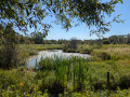
Do you live in the urban area of the three borders and want to get away from it all without travelling dozens of kilometres? Come and discover the Petite Camargue to get some fresh air and observe many species of birds and plants in a well-preserved area. Leaving from the pretty village of Rosenau, you'll find it hard to believe that you're only 4 kilometres away from the airport as the crow flies.
Walk along the old bed of the Rhine: along the Au
 3.86 mi
+69 ft
-39 ft
1h 50
Easy
Departure from Kembs (Haut-Rhin)
3.86 mi
+69 ft
-39 ft
1h 50
Easy
Departure from Kembs (Haut-Rhin)
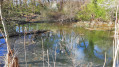
In the heart of the Au, the alluvial terrace of the Rhine between Huningue and Kembs, the history of Rosenau is closely linked to that of the Rhine. Throughout this route, between the Grand Canal d’Alsace and the Huningue Canal, by a pond or a lock, on the banks of canals or streams, water is ever-present.
Along the canals south of Kembs
 5.48 mi
+13 ft
-13 ft
2h 30
Easy
Departure from Kembs (Haut-Rhin)
5.48 mi
+13 ft
-13 ft
2h 30
Easy
Departure from Kembs (Haut-Rhin)
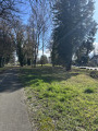
Walk from the car park near the turbine roundabout in Kembs, towards Rosenau Sud along the Rosenau Stream, through Rosenau to the Huningue Canal, then back to the starting point along the towpath.
Walk along the old bed of the Rhine: from the Huningue Canal to the Old Rhine
 6.31 mi
+253 ft
-256 ft
3h 05
Easy
Departure from Kembs (Haut-Rhin)
6.31 mi
+253 ft
-256 ft
3h 05
Easy
Departure from Kembs (Haut-Rhin)
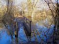
Two centuries ago, the Rhine flowed in a network of meandering channels. From 1842, with the construction of dykes by Tulla, and then around 1930 with the construction of the Grand Canal, the river was channelled into a single course and the Rhine’s ecosystem was profoundly altered.Today, there is a stark contrast between nature, which is becoming overgrown again as it adapts to the drying conditions with diverse and unique flora and fauna, and the intense industrial activity centred on shipping and hydroelectric power.
In the heart of the Au plain, Rosenau, daughter of the Rhine
 8.42 mi
+98 ft
-98 ft
3h 55
Moderate
Departure from Kembs (Haut-Rhin)
8.42 mi
+98 ft
-98 ft
3h 55
Moderate
Departure from Kembs (Haut-Rhin)
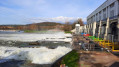
The Plaine de l’Au is this wetland region on the Rhine’s floodplain in the Land of the Three Borders, where the river, before its course was straightened by dykes (19th century) and then channelled (early 20th century), spread out into multiple branches.Between the Kembs hydroelectric power station to the north and the Grand Marais trail to the south, water accompanies us throughout this route, where biodiversity and human activities strive to coexist harmoniously.The time given does not include stops at the five observation points and other points of interest along the route.
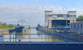
Kembs lock between the Grand Canal d'Alsace and the Old Rhine
 3.26 mi
+52 ft
-52 ft
1h 35
Easy
Departure from Haut-Rhin
3.26 mi
+52 ft
-52 ft
1h 35
Easy
Departure from Haut-Rhin
A short walk between the wild Old Rhine and the tamed canal, with its array of industrial installations: the locks, the German motorway which you cannot see but can hear, the high-voltage power lines you pass under at the start of the route, as well as its natural beauty: the winding, sand-filled Rhine, exposed at the Barre d’Istein. To make the most of the views of the Rhine, the route is best enjoyed in winter when the trees are still bare.
The 3 Castles Trail
49.77 mi
+7,972 ft
-7,946 ft
4 days
 Difficult
Departure from Leymen (Haut-Rhin)
Difficult
Departure from Leymen (Haut-Rhin)
A marked route of around 80 km (4 days / 3 nights) that crosses the Sundgau region of the Jura, passing by its three main castles: Leymen, Ferrette and Morimont.Four days of walking, far from the hustle and bustle of the cities, offering the perfect opportunity to fully recharge your batteries.The Sundgau Jura, despite its relatively low altitude, offers plenty of points of interest and beautiful views; it awaits you.Accommodation is available in each town/stage.
The Big Oak Tree via the Raedersdorf Discovery Trail
 3.77 mi
+499 ft
-472 ft
2h 10
Easy
Departure from Raedersdorf (Haut-Rhin)
3.77 mi
+499 ft
-472 ft
2h 10
Easy
Departure from Raedersdorf (Haut-Rhin)
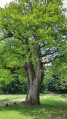
This family hike takes you to the majestic Gros Chêne de Sondersdorf. Entirely in the forest, it passes through the Raedersdorf Discovery Trail, decorated with around fifty (or more) wooden sculptures and dotted with educational panels that are sure to interest children. Best done in dry weather in any season.If you only want to do the discovery trail and see the sculptures, see Practical Information.
Cambete route
 Tourist office
 5.48 mi
+49 ft
-46 ft
2h 35
Easy
Departure from Kembs (Haut-Rhin)
5.48 mi
+49 ft
-46 ft
2h 35
Easy
Departure from Kembs (Haut-Rhin)
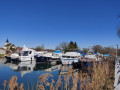
A circular route that mainly follows cycle paths. The route, running alongside the water, allows you to discover the local flora, fauna, history and industry between Kembs-Loechlé and Kembs
The Île du Rhin to the north of the Kembs bottleneck
 9.10 mi
+66 ft
-69 ft
4h 15
Moderate
Departure from Kembs (Haut-Rhin)
9.10 mi
+66 ft
-69 ft
4h 15
Moderate
Departure from Kembs (Haut-Rhin)
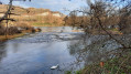
The Île du Rhin is a narrow strip of land stretching over 50 km between the Grand Canal d’Alsace and the Vieux Rhin, shared by the neighbouring municipalities.Less well-known and less frequented than its southern neighbour – which has been renaturalised, is fed by the Petit Rhin and has been developed for walking and birdwatching – the northern section within the municipality of Kembs is nevertheless well worth a visit for walkers, especially when the vegetation is not too dense, allowing visitors to observe the birds of the wetlands near the Old Rhine.
The Dwarves' Cave
 5.37 mi
+1,220 ft
-1,211 ft
3h 30
Moderate
Departure from Ferrette (Haut-Rhin)
5.37 mi
+1,220 ft
-1,211 ft
3h 30
Moderate
Departure from Ferrette (Haut-Rhin)
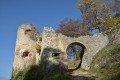
A beautiful hike to discover Ferrette, a beautiful medieval town with its castle and the Grotte des Nains (Dwarves' Cave) with its famous legend known to everyone in Alsace.
Sundgau pedestrian route: Ferrette
 4.87 mi
+1,270 ft
-1,286 ft
3h 20
Moderate
Departure from Ferrette (Haut-Rhin)
4.87 mi
+1,270 ft
-1,286 ft
3h 20
Moderate
Departure from Ferrette (Haut-Rhin)
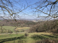
This is an opportunity to visit the ruined castle and the town of the powerful Counts of Ferrette. Narrow, romantic paths lead to stunning limestone promontories and the mysterious Grotte des Nains (Dwarves' Cave), which is the subject of a famous legend.
Ferrette, the Grotte des Nains, the Rossberg and the Kastelberg
 13.98 mi
+2,776 ft
-2,769 ft
8h 50
Difficult
Departure from Ferrette (Haut-Rhin)
13.98 mi
+2,776 ft
-2,769 ft
8h 50
Difficult
Departure from Ferrette (Haut-Rhin)
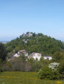
Ferrette is a medieval town situated in southern Alsace, in the Sundgau region at the gateway to the Jura. There are many places to see around the town, including the castle, the Loechlenfelsen, the Grotte des Nains, the Rossberg and the ruins on the Kastelberg. This walk forms a double circular route. You can therefore split the route into two sections. There are numerous viewpoints along this circular route, particularly in the first section, but most of the route runs through woodland.
Isteiner Klotz, Huttingen and Römerstrasse through the vineyards
 3.77 mi
+486 ft
-492 ft
2h 10
Easy
Departure from Efringen-Kirchen (Regierungsbezirk Freiburg)
3.77 mi
+486 ft
-492 ft
2h 10
Easy
Departure from Efringen-Kirchen (Regierungsbezirk Freiburg)
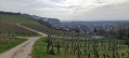
The route is mainly open, winding through the vineyards. There are stunning views throughout the route of the villages in the Rhine Valley, the Jura, the Vosges and Istein. There are numerous benches and picnic tables along the route. Information boards (in German) on wine, history and geology are dotted along the route. From the car park, information boards and the Saint-Vit Chapel opposite, set in the rock, herald the richness of the route, which is “to be savoured”.
More walks in Ranspach-le-Haut
Select a point of interest below: