The Île du Rhin to the north of the Kembs bottleneck

The Île du Rhin is a narrow strip of land stretching over 50 km between the Grand Canal d’Alsace and the Vieux Rhin, shared by the neighbouring municipalities.
Less well-known and less frequented than its southern neighbour – which has been renaturalised, is fed by the Petit Rhin and has been developed for walking and birdwatching – the northern section within the municipality of Kembs is nevertheless well worth a visit for walkers, especially when the vegetation is not too dense, allowing visitors to observe the birds of the wetlands near the Old Rhine.

Details

7438208
Creation:
Last update:
Last review:
  • Walking
    Activity: Walking
  • ↔
    Distance: 9.10 mi
  • ◔
    Average duration: 4h 15 
  • ▲
    Difficulty: Moderate

  • ⚐
    Back to start: Yes
  • ↗
    Ascent: + 66 ft
  • ↘
    Descent: - 69 ft

  • ▲
    Highest point: 778 ft
  • ▼
    Lowest point: 728 ft
  • ⚐ Country: France
  • ⚐ City: Kembs (68680)
  • ⚑
    Start/End: N 47.660559° / E 7.522019°
  • ❏
    IGN map(s): Ref. 3720ET, 3721ET
  • Hour-by-hour weather

Photos

Description of the walk

To reach Le Bouchon, after passing the hydroelectric power station, cross the canal in front of the large locks and then head downhill to the left (the surface is in poor condition for the last 300 metres).
See Practical Information.

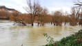
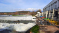
(S/E) From the car park, head towards the Old Rhine by going down the few steps leading to the riverbank. Enjoy the view of the islets and the Rocher d’Istein.
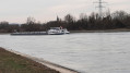
Head back up towards the car park and follow the track that runs alongside the Grand Canal.

(1) After about 200 m, leave the turn-off to the Old Rhine bank on your right and continue along the canal until you reach thefirst cross-path.

(2) Turn right to reach the bank of the Old Rhine and the old towpath.

(3) Head straight north, enjoying the vegetation and spotting waterbirds. See practical information. After about 2.5 km, you’ll reach thesecond cross-path.

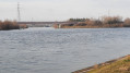
(4) Turn left to reach the bank of the Grand Canal d’Alsace at its junction with the Rhône–Rhine Canal. Continue north on the right for about 300 m, then take the path branching off to the right.

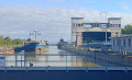
(5) Enjoy the view of the junction of the canals. See practical information.
Ignore the path on the right (dead end) and continue along the canal to thethird crossroads.

(6) Turn right to rejoin the Old Rhine near the small German town of Rheinweiler. Turn right towards the technical installations of the old cable ferry, which still appear to be in perfect condition.

(7) Continue along the riverbank. The path enters the ‘Petite Camargue Alsacienne’ nature reserve and joins thesecond cross-channel.

(4) Turn right onto the Grand Canal and follow its bank due south. The path splits; take the left-hand branch near the forest so as not to miss the small track leading to the birdwatching station hidden amongst the trees; it is located near a jetty visible on the opposite bank.

(8) The birdwatching chalet looks a bit neglected and the wooden shelter to its right is in poor condition, but it’s good enough for shelter or a picnic break.
Head back south along the path. You can make out the town of Kembs on your right.

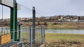
(2) At the junction with thefirst side road, turn left towards the Old Rhine. At the barrier, turn right, heading due south. After passing two more barriers, you’ll reach the Grand Canal and then the ‘Bouchon de Kembs’ (S/E).
Waypoints

  1. S/E : mi 0 - alt. 778 ft - Car park at the “Bouchon de Kembs”
  2. 1 : mi 0.33 - alt. 771 ft - Grand canal d'Alsace
  3. 2 : mi 1.42 - alt. 761 ft - 1st cross-channel
  4. 3 : mi 1.63 - alt. 764 ft - Former towpath
  5. 4 : mi 3.21 - alt. 758 ft - 2nd cross-channel
  6. 5 : mi 3.48 - alt. 761 ft - Grand Canal Junction - Canal du Rhône au Rhin
  7. 6 : mi 4.35 - alt. 761 ft - 3rd cross-canal
  8. 7 : mi 4.75 - alt. 745 ft - Former Niffer–Rheinweiler cable ferry
  9. 8 : mi 6.92 - alt. 758 ft - Birdwatching chalet
  10. S/E : mi 9.1 - alt. 778 ft - Traffic jam - Le Vieux Rhin

Notes

This walk is best undertaken in dry weather between November and May, when the foliage is not too dense.
There are two other car parks available on either side of the locks, about 1 km from the start.

(S/E) There’s no risk of getting lost; there are only two paths running north-south – one along the bank of the Grand Canal and the other along the bank of the Old Rhine – with a few rare cross-paths to move from one to the other or provide a shortcut.

(3) To the east, the German motorway runs between 200 and 1,000 metres from the banks of the Rhine; if the wind is blowing from the east, you’ll have to put up with some unpleasant background noise, though this is fortunately offset by the beauty of the landscape and the chance to spot waterbirds.
Every winter, the Rhine welcomes large numbers of birds from Scandinavia or Eastern Europe, which find refuge on the Île du Rhin.

(5) Under the bridges linking Kembs to Niffer, just above the junction, you can see the small-vessel lock designed by Le Corbusier, which provides access to the marina and the Huningue Canal; and further to the right, the large-vessel lock for passage to the Rhine–Rhône Canal.

Worth a visit

The Heritage Centre: Wednesdays 2 pm to 6 pm and the first Sunday of the month from 10 am to 12 noon.
It provides information on the history of Kembs, which is closely linked to that of the Rhine, and offers a wealth of details on the construction of the Grand Canal d’Alsace, the development of hydroelectric power, as well as the flora and fauna of the Petite Camargue Alsacienne.

Reviews and comments

4.7 / 5
Based on 1 review

Reliability of the description
5 / 5
Ease of following the route
5 / 5
Route interest
4 / 5
FJ6888
FJ6888 ★

Thank you for your comment

Kind regards

Machine-translated

Joris Hanser
Joris Hanser

Overall rating : 4.7 / 5

Date of your route : Feb 26, 2024
Reliability of the description : ★★★★★ Very good
Ease of following the route : ★★★★★ Very good
Route interest : ★★★★☆ Good
Very busy route : No

A pleasant little walk surrounded by the Old Rhine and the Grand Canal d’Alsace; it’s not at all difficult.

Machine-translated

Other walks in the area

For more walks, use our search engine .

The GPS track and description are the property of this route's author. Please do not copy them without permission.