Refine your search for walks in Pont-de-Buis-lès-Quimerch
Pont-de-Buis-lès-Quimerch walks


 Circuit du nouveau bourg de Quimerc'h vers Kostalan
 Visorando Member
 4.52 mi
 +554 ft
 -571 ft
 2h 35
2h 35
 Moderate
 Departure from Pont-de-Buis-lès-Quimerch (Finistère)
Découvrez la campagne de Quimerc'h à partir du nouveau bourg jusqu'au village typique de Kostalan. Cette promenade offre de beaux points de vues sur le Menez Hom, Rumengol et la rade de Brest. Itinéraire équilibré entre chemins creux, chemins d'exploitation et petites routes tranquilles.
Discover forestry in the Cranou Forest
 10.57 mi
+1,165 ft
-1,161 ft
5h 50
Moderate
Departure from Le Faou (Finistère)
10.57 mi
+1,165 ft
-1,161 ft
5h 50
Moderate
Departure from Le Faou (Finistère)
This walk has been organised by three Forestry Management students
We invite you to discover the profession of a forester by following a slide show along a route whose stops will help you understand forest management.
Walk around the Cranou Forest
8.60 mi
+912 ft
-899 ft
4h 45
Moderate
Departure from Le Faou (Finistère)
Situated in the Armorique Regional Park, this is the largest state-owned forest in Finistère. Hilly, with its beech trees and ancient oaks, and crossed by theGR®37and the Way of St James, it is a favourite spot for walkers.
Circular Rumengol towards Le Cranou
6.38 mi
+568 ft
-574 ft
3h 25
Moderate
Departure from Le Faou (Finistère)
Discover sunken paths, recharge your batteries in the forest, and visit the village of Rumengol and its place of pilgrimage.
Route of the old paths in Lopérec
 Local authority
 7.26 mi
+896 ft
-869 ft
4h 05
Moderate
Departure from Lopérec (Finistère)
7.26 mi
+896 ft
-869 ft
4h 05
Moderate
Departure from Lopérec (Finistère)
The municipality of Lopérec is set amidst a varied, undulating landscape of hedgerows, featuring woods, moorland and farmland criss-crossed by numerous watercourses.
In 1830, a traveller described Lopérec as follows: “Everywhere, water, foliage, majestic trees, numerous villages, surrounded by lush orchards where apple and cherry trees display their dazzling blossoms in shades of purple and white...”°°
The Leopards’ Route in Le Faou
2.36 mi
+30 ft
-30 ft
1h 05
 Easy
Departure from Le Faou (Finistère)
Easy
Departure from Le Faou (Finistère)
Set off to explore this ‘Petite Cité de Caractère’ with this urban walking route known as the ‘Léopards’!On foot, by bike, on a scooter, or with a pushchair!The route is marked with bronze nails bearing the town’s coat of arms (the leopard) and additional blue signposts.
Rosconnec marsh route via the Sant-Dispar Chapel
 5.92 mi
+830 ft
-830 ft
3h 25
Moderate
Departure from Dinéault (Finistère)
5.92 mi
+830 ft
-830 ft
3h 25
Moderate
Departure from Dinéault (Finistère)
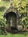
From the beautiful green setting where the Sant-Dispar Chapel nestles, flanked by its calvary and fountain, make your way through the woodland to the protected Rosconnec marshes at the confluence of the Aulne and its tributary, the Douffine.These meadows, which flood at spring tides, are protected areas for the aquatic reed warbler, a small passerine measuring 12 to 13 cm in length and weighing 10 to 14 g. This species is one of the birds protected by the European Commission.
Saint-Sébastien route
 6.21 mi
+295 ft
-285 ft
3h 05
Easy
Departure from Port-Launay (Finistère)
6.21 mi
+295 ft
-285 ft
3h 05
Easy
Departure from Port-Launay (Finistère)
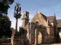
A route through the countryside and along the banks of the Aulne, the final section of the Nantes–Brest Canal which runs through a channel.Discover Saint-Sébastien Chapel.
Circular between the Aulne and the Faou river
 10.11 mi
+1,335 ft
-1,342 ft
5h 50
Moderate
Departure from Rosnoën (Finistère)
10.11 mi
+1,335 ft
-1,342 ft
5h 50
Moderate
Departure from Rosnoën (Finistère)
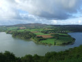
A circular loop between the Aulne in its final meanders before its estuary in the Brest harbour and its last tributary, the Faou river.
Several viewpoints on the left bank of the Aulne with Ménez-Hom, the new Térénez bridge, Landévennec and its abbey.
Shellfish farming on the Faou river is currently limited to the cultivation of Pacific oysters.
Trinité Chapel and the Douffine Valley in Pleyben
 5.81 mi
+574 ft
-577 ft
3h 10
Moderate
Departure from Pleyben (Finistère)
5.81 mi
+574 ft
-577 ft
3h 10
Moderate
Departure from Pleyben (Finistère)
Hills and valleys, with a river running beneath, are what give this route along the banks of the Douffine its charm: a wild route, largely through woodland, ideal for summer days but not recommended in winter.This route is recommended for those who appreciate peace and quiet in a less-frequented area.There is a beautiful chapel at the start, set within its own enclosure, featuring a calvary with a fine Pietà.
Aulne towpath and Notre-Dame de Kerluan Chapel
 7.05 mi
+243 ft
-243 ft
3h 25
Moderate
Departure from Châteaulin (Finistère)
7.05 mi
+243 ft
-243 ft
3h 25
Moderate
Departure from Châteaulin (Finistère)
Let's take a leisurely stroll along the canalised Aulne for about 6 km, passing three locks. Then let's head back up small roads towards the Notre-Dame de Kerluan Chapel. Let's climb a little further to finally descend back down to the banks of the Aulne.
Following the canalised River Aulne
 6.79 mi
+154 ft
-154 ft
3h 15
Easy
Departure from Châteaulin (Finistère)
6.79 mi
+154 ft
-154 ft
3h 15
Easy
Departure from Châteaulin (Finistère)
The route is largely a return walk, following a section of the channelled River Aulne. Peace and quiet, with the murmur of the water as you approach the two locks. You’ll regularly spot pairs of mallards and, occasionally, herons and great cormorants.
Along the route, you’ll pass a memorial stone commemorating a terrible shipwreck on this river in 1693 (in which 77 people, including many children, drowned).
From the Chapel of Guénily along the banks of the Aulne and through the countryside
 6.71 mi
+499 ft
-472 ft
3h 30
Moderate
Departure from Pleyben (Finistère)
6.71 mi
+499 ft
-472 ft
3h 30
Moderate
Departure from Pleyben (Finistère)
Starting from the little chapel at Guénily, a peaceful route between the banks of the channelled Aulne (Nantes-Brest Canal) and the countryside.Sweeping views over the Montagnes Noires.
Roc'h an Daol route
 3.67 mi
+384 ft
-400 ft
2h 00
Moderate
Departure from Saint-Eloy (Finistère)
3.67 mi
+384 ft
-400 ft
2h 00
Moderate
Departure from Saint-Eloy (Finistère)
A short walk with beautiful panoramic views of the peaks in the municipality of Saint-Eloy.
Along the Aulne in Châteaulin
 6.72 mi
+318 ft
-299 ft
3h 20
Moderate
Departure from Châteaulin (Finistère)
6.72 mi
+318 ft
-299 ft
3h 20
Moderate
Departure from Châteaulin (Finistère)
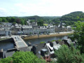
With the River Aulne, in its final stretch before the sea, as our guide, let’s set off to explore Port-Launay, a former river port. Let’s follow the towpath and then climb up to the Notre-Dame Chapel, which offers a view of Châteaulin, before returning to the river.
Canal route departing from the former station
 6.09 mi
+272 ft
-253 ft
3h 00
Easy
Departure from Châteaulin (Finistère)
6.09 mi
+272 ft
-253 ft
3h 00
Easy
Departure from Châteaulin (Finistère)
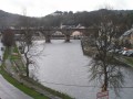
Set off on foot along the former Châteaulin-Carhaix railway line, overlooking the still-canalised Aulne river, continue along an old Roman road, then follow the towpath of the Nantes-Brest Canal to discover the heart of Châteaulin at the end of the route.
Châteaulin right-bank route
 3.60 mi
+223 ft
-223 ft
1h 50
Easy
Departure from Châteaulin (Finistère)
3.60 mi
+223 ft
-223 ft
1h 50
Easy
Departure from Châteaulin (Finistère)
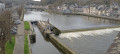
Starting from the old Châteaulin station, this walk combines town streets and dirt tracks, ending on the old railway line with views of the town’s bridges.
Saint-Rivoal countryside and Monts d'Arrée ridges
10.74 mi
+1,175 ft
-1,175 ft
6h 00
Moderate
Departure from Saint-Rivoal (Finistère)
Hiking in wild areas, mostly unmarked. Woods, rivers, moors, views of several peaks of the Monts d'Arrée, Lake Brennilis, Saint-Michel Chapel.
Tro Sant Riwal circuit
 9.75 mi
+781 ft
-794 ft
5h 10
Moderate
Departure from Saint-Rivoal (Finistère)
9.75 mi
+781 ft
-794 ft
5h 10
Moderate
Departure from Saint-Rivoal (Finistère)
Nestled beautifully in a lush green valley, this village has all the charm of a mountainous countryside, with its sunken lanes, hedgerows, streams and rugged terrain.The village’s name derives from the parish’s patron saint, Saint Rivoal (formerly Riwall), the name of a prominent family among the Bretons who emigrated to Great Britain in the 5th and 6th centuries.
Saint-Rivoal has been awarded the ‘Communes du Patrimoine Rural de Bretagne’ designation.