Canal route departing from the former station

Set off on foot along the former Châteaulin-Carhaix railway line, overlooking the still-canalised Aulne river, continue along an old Roman road, then follow the towpath of the Nantes-Brest Canal to discover the heart of Châteaulin at the end of the route.

Details

590325
Creation:
Last update:
Last review:
  • Walking
    Activity: Walking
  • ↔
    Distance: 6.09 mi
  • ◔
    Average duration: 3h 00 
  • ▲
    Difficulty: Easy

  • ⚐
    Back to start: Yes
  • ↗
    Ascent: + 272 ft
  • ↘
    Descent: - 253 ft

  • ▲
    Highest point: 279 ft
  • ▼
    Lowest point: 16 ft
  • ⚐ Country: France
  • ⚐ City: Châteaulin (29150)
  • ⚑
    Start/End: N 48.197648° / W 4.087185°
  • ❏
    IGN map(s): Ref. 0517OT, 0518OT, 0618OT
  • Hour-by-hour weather

Photos

Description of the walk

Car park at the former station near the Marie Curie School.

YellowPR® markings

(S/E) With your back to the old station building, take the path that runs alongside a playground with picnic tables and sports facilities. Follow this long path. Pass the old stands of the Aulne cycling route (metal safety barriers) on your left. Follow this long, straight, wooded path overlooking the river. This is the foundation of the Châteaulin-Carhaix railway line, which operated until the 1970s. Continue along a dirt track.

(1) Join a small road at the Résidence Roz Lezabannec and cross this group of houses. At the signpost, near an old abandoned tennis court, climb up to the right onto a small path that leads to a small road. Follow this road to the right, cross the Lezabannec farm and continue along a wide stony path between meadows. This is an old Roman road. Walk along the long wall of a beautiful property on your right and a Peugeot dealership on your left to reach the D887.

(2) Cross it and continue straight ahead along the path between the fields and meadows until you reach the entrance to a housing estate.

(3) Continue straight ahead, then turn right at the road towards a large school. Stay on the pedestrian strip on the right.

(4) Opposite the entrance to the Collège et Lycée Saint-Louis, cross at the pedestrian crossing and take the path that runs alongside a shop called "Malice". Cross the street and continue straight ahead.
Turn left onto a steep sunken path (marked on a tree). Cross the street you crossed earlier and continue straight downhill. Cross the old farm with its renovated buildings and a new road.

(5) First turn right then left to enter the alleyway that runs alongside the fire station and leads to the towpath.

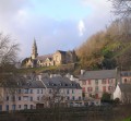
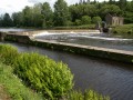
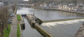
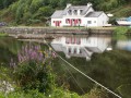
(6) Facing the canal, ignore the yellow arrow indicating a left turn and turn right. Follow this towpath and pass the drinking water treatment plant. Look for a stone marker at the side of the path indicating that you are 358 km from Stream via the canal. Pass the Coatigrac'h lock. A sign tells you that thanks to this micro power station, Châteaulin was, in 1887, the third town in France to have electric street lighting. Continue along the canal, pass the campsite and, in the last bend, look out for the Notre-Dame Chapel on the hill.

Off the beaten track

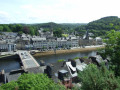
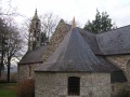
(7) At the modern footbridge, turn left to cross the river: view of the two other bridges, the main road bridge and the old railway bridge, which is now also used by road traffic. On Quai Carnot, turn right and continue to the bridge: view of the town hall with its belfry-shaped tower. Cross the bridge and follow Quai Jean Moulin to the right. Turn left into the street between the town hall and the post office. Take the first left, then turn right twice to go around Saint-Idunet Church. Walk past the war memorial on your right and turn into Rue de l'Église, passing by the market halls. On your left, you will see the old corn exchange building.

YellowPR® markings

(8) Go up the right-hand side of Grand Rue, pass the clinic on your right and ignore the next street on your right.

(9) Facing a large cement cross, turn left into an alleyway, leaving the street behind you, and follow it to the end. Cross a street and then the car park near the Marie Curie School to return to the starting car park (S/E).

Waypoints

  1. S/E : mi 0 - alt. 52 ft - Car park at the former station
  2. 1 : mi 1.52 - alt. 164 ft - Small road at the Résidence de Roz Lezabannec
  3. 2 : mi 2.34 - alt. 226 ft - Crossing the D887
  4. 3 : mi 2.83 - alt. 174 ft - Crossing the housing estate
  5. 4 : mi 3.15 - alt. 135 ft - Entrance to the secondary school
  6. 5 : mi 3.67 - alt. 66 ft - Alleyway leading to the canal
  7. 6 : mi 3.84 - alt. 26 ft - Right at the canal
  8. 7 : mi 5.28 - alt. 23 ft - Footbridge
  9. 8 : mi 5.77 - alt. 26 ft - Main Street
  10. 9 : mi 5.91 - alt. 72 ft - Alleyway on the left
  11. S/E : mi 6.09 - alt. 52 ft - Car park at the former station

Notes

Toilets at departure

Worth a visit

Always be cautious and plan ahead when you're outdoors. Visorando and the author of this route cannot be held responsible for any accidents occurring on this route.

The GR® and PR® markings are the intellectual property of the Fédération Française de Randonnée Pédestre.

Reviews and comments

4.9 / 5
Based on 7 reviews

Reliability of the description
5 / 5
Ease of following the route
4.9 / 5
Route interest
4.7 / 5
FabH
FabH

Overall rating : 5 / 5

Date of your route : Dec 08, 2025
Reliability of the description : ★★★★★ Very good
Ease of following the route : ★★★★★ Very good
Route interest : ★★★★★ Very good
Very busy route : No

Lovely walk along the canal, which is also very nice.

Machine-translated

Les pommiers
Les pommiers

Overall rating : 5 / 5

Date of your route : Feb 02, 2025
Reliability of the description : ★★★★★ Very good
Ease of following the route : ★★★★★ Very good
Route interest : ★★★★★ Very good
Very busy route : Yes

A very good route, mostly in the countryside.

Machine-translated

Laita
Laita
• Edited:

Overall rating : 4.3 / 5

Date of your route : Jul 17, 2023
Reliability of the description : ★★★★★ Very good
Ease of following the route : ★★★★☆ Good
Route interest : ★★★★☆ Good
Very busy route : Yes

A very pleasant walk with views of the Chateaulin hills – definitely worth repeating.

Machine-translated

Ninja
Ninja

Overall rating : 5 / 5

Date of your route : Jul 27, 2022
Reliability of the description : ★★★★★ Very good
Ease of following the route : ★★★★★ Very good
Route interest : ★★★★★ Very good
Very busy route : No

A rural route, with very little urban development, ending in the town of Chateaulin, which is very nice.

Machine-translated

EBELLANGER
EBELLANGER

Overall rating : 4.7 / 5

Date of your route : Jul 15, 2022
Reliability of the description : ★★★★★ Very good
Ease of following the route : ★★★★★ Very good
Route interest : ★★★★☆ Good
Very busy route : Yes

A lovely walk on Friday 15 July in glorious sunshine, along the banks of the River Aulne, with a few shaded sections.

Machine-translated

passiorando
passiorando

Overall rating : 5 / 5

Date of your route : Mar 16, 2021
Reliability of the description : ★★★★★ Very good
Ease of following the route : ★★★★★ Very good
Route interest : ★★★★★ Very good
Very busy route : No

Largely wooded area. Beautiful route along the quays.
If you're feeling brave, go and see Notre Dame Chapel, which can be seen on the hills at the end of the route!

Machine-translated

jlucquimper
jlucquimper

Overall rating : 5 / 5

Date of your route : Sep 30, 2019
Reliability of the description : ★★★★★ Very good
Ease of following the route : ★★★★★ Very good
Route interest : ★★★★★ Very good

Very nice walk: countryside, riverside and town!

Machine-translated

Other walks in the area

For more walks, use our search engine .

The GPS track and description are the property of this route's author. Please do not copy them without permission.