Tour of Ménez Hom from the Sainte-Marie Chapel

Ménez Hom is the highest hill in the western Montagnes Noires. Its two main peaks, Yelc'h (or Hielc'h according to the IGN map) and Yed, overlook Douarnenez Bay and Brest Harbour.
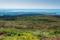
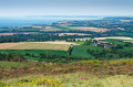
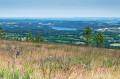
This route goes around them, along paths that are sometimes very discreet on its slopes and summits, and offers a vast panorama between the Aulne Valley and the Iroise Marine Natural Park.

Details

58955375
Creation:
Last update:
Last review:
  • Walking
    Activity: Walking
  • ↔
    Distance: 7.17 mi
  • ◔
    Average duration: 4h 00 
  • ▲
    Difficulty: Moderate

  • ⚐
    Back to start: Yes
  • ↗
    Ascent: + 850 ft
  • ↘
    Descent: - 869 ft

  • ▲
    Highest point: 1,079 ft
  • ▼
    Lowest point: 499 ft
  • ⚐ Country: France
  • ⚐ City: Plomodiern (29550)
  • ⚑
    Start/End: N 48.201877° / W 4.23395°
  • ❏
    IGN map(s): Ref. 0517OT, 0518OT
  • Hour-by-hour weather

Photos

Description of the walk

Departure from the car park at the Sainte-Marie-du-Ménez-Hom chapel.

No signposts

(S/E) From the car park, cross the D887 with caution and take the D47, leaving the Sainte-Marie-du-Ménez-Hom chapel on your left. Follow the D47 for about 700 m, ignoring a wide lane on the left (which will be the return route), until you reach an intersection.

GRP® markings (yellow and red)

(1) Join theGRP® of the Crozon Peninsula by turning left onto a small road towards Kergaoc. Follow it for about 200 metres, then turn left onto a driveway that climbs steadily up the eastern flank of Ménez Hom. Continue on theGRP®, ignoring the paths that branch off to the left and right. The lane becomes a narrower, steeper path, leading to a T-junction at the top of a small pass.

No markings

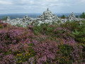
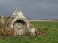
(2) Leave theGRP® by turning right to reach a cairn which, according to legend, houses the tomb of King Marc'h (on the way, there are beautiful views of the Aulne valley and the Térénez suspension bridge). Pass the cairn and continue along a rocky path that descends, narrows and becomes steeper (take care) until you reach another T-junction.

(3) Turn left onto a lane at the edge of the Trégarvan Communal Forest (beautiful views of the main peak of Ménez Hom). Follow it to another trail intersection.

(4) Turn right and then immediately left onto a wide uphill lane. Continue, ignoring the paths on the right, until you reach an intersection and cross theGRP® of the Crozon Peninsula again.

GRP® markings (yellow and red)

(5) Turn left to join theGRP® which climbs steadily up the western flank of Ménez Hom. Ignore the paths branching off to the left and right and continue on theGRP® until you reach another intersection.

No markings

(6) Leave theGRP® and continue straight ahead on a path towards Yelc'h, the second peak of Ménez Hom. Turn right at the next trail junction, climb a steep slope, pass a post with an anemometer and solar panel to reach a viewpoint (beautiful views of Douarnenez Bay, from Pointe du Raz to Cap de la Chèvre).

(7) Ignore a path descending to the right and turn left onto a grassy lane that goes around Yelc'h to the east. Turn right at the next intersection, then left and cross a road. Continue left on this road, pass a car park and reach theGRP® for the third time, at an orientation table.

GRP® markings (yellow and red)

(8) Continue on theGRP® which goes around the orientation table on the right, then a geodetic marker indicating the main summit. Leave a group of Second World War blockhouses on your right, largely hidden by vegetation. Continue downhill to the start of a path on the right.

PR® (Yellow) markings are very discreet

(9) Turn onto this path down the eastern flank of Ménez Hom, climb a short steep section, then descend to a path junction.

No markings

(10) Take a narrow path slightly to the left, which descends, is rutted in places and quite steep (caution), to reach a wide lane that leads to a small road (D47).
Follow it to the right, turn right again to enter the grounds of the Chapelle Sainte-Marie and take the opportunity to visit it if it is open. Leave the grounds and cross (with caution) the D887 to reach the car park (S/E).


Waypoints

  1. S/E : mi 0 - alt. 640 ft - Car park at the Sainte-Marie-du-Ménez-Hom Chapel
  2. 1 : mi 0.58 - alt. 509 ft - GRP® of the Crozon Peninsula
  3. 2 : mi 1.97 - alt. 883 ft - T-junction on a pass
  4. 3 : mi 2.42 - alt. 659 ft - T-junction after a beautiful descent.
  5. 4 : mi 2.82 - alt. 633 ft - Trail intersection
  6. 5 : mi 3.55 - alt. 709 ft - GRP® of the Crozon Peninsula
  7. 6 : mi 3.91 - alt. 830 ft - Path to Yelc'h
  8. 7 : mi 4.56 - alt. 965 ft - Viewpoint above Douarnenez Bay.
  9. 8 : mi 5.38 - alt. 1,070 ft - GRP® of the Crozon Peninsula
  10. 9 : mi 5.68 - alt. 1,024 ft - Start of a path on the right
  11. 10 : mi 6.27 - alt. 896 ft - Trail intersection
  12. S/E : mi 7.17 - alt. 640 ft - Car park at the Sainte-Marie-du-Ménez-Hom Chapel

Notes

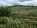
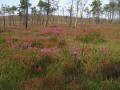
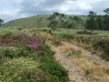
Between early July and late August, the moorland is magnificent, carpeted with heather and dwarf gorse flowers.

Numerous paths intersect and criss-cross on the Yed at the point (8). Don't hesitate to explore them to enjoy the scenery before descending to the Sainte-Marie Chapel.

Shortly after the point (10), the downhill trail can be very muddy, even impassable, in winter or after heavy rain.

There is no shade on this route through open moorland. A hat, sunglasses and sun cream are essential when the sky is clear.

Some sections follow narrow, rocky, steep paths lined with thorny bushes. Hiking boots and trousers are strongly recommended.

Le Yed, the main peak of Ménez Hom, can be visited in summer as there is a car park nearby. The rest of the route is much quieter, even deserted.

There is a little tarmac at the start, but the roads are very quiet and quickly forgotten.
Toilets are available at the car park at the start of the route.
Alternative car park at the main summit of Ménez Hom.

Worth a visit

Always be cautious and plan ahead when you're outdoors. Visorando and the author of this route cannot be held responsible for any accidents occurring on this route.

The GR® and PR® markings are the intellectual property of the Fédération Française de Randonnée Pédestre.

Reviews and comments

4.7 / 5
Based on 6 reviews

Reliability of the description
4.8 / 5
Ease of following the route
4.7 / 5
Route interest
4.7 / 5
Pescadito
Pescadito

Overall rating : 4.7 / 5

Date of your route : Aug 22, 2025
Reliability of the description : ★★★★★ Very good
Ease of following the route : ★★★★☆ Good
Route interest : ★★★★★ Very good
Very busy route : Yes

We took this tour with our four grandchildren. We really wanted to show them "the roof of Brittany". We were spoiled by beautiful weather and were able to enjoy the promised "stunning unobstructed views of the bays of Douarnenez and Brest".

Machine-translated

Michel TRN
Michel TRN

Overall rating : 4.3 / 5

Date of your route : Aug 06, 2025
Reliability of the description : ★★★★☆ Good
Ease of following the route : ★★★★☆ Good
Route interest : ★★★★★ Very good
Very busy route : No

There are several possible routes for Ménez-Hom (from Dinéault, Trégarvan, St-Nic or Plomodiern). The one that starts at St-Marie chapel is very good, but it is best to do it clockwise. The end of the Visorando route is TOO STEEP for a group of hikers; it is better to do it going uphill.
When I did it on 6 August, the weather was fine. This makes all the difference to the view.
There were quite a few people (about twenty) but no groups on the trail.
Best regards, Michel from Quimper.

Machine-translated

Durand-Omarjee
Durand-Omarjee

Overall rating : 4.7 / 5

Date of your route : Jun 28, 2025
Reliability of the description : ★★★★★ Very good
Ease of following the route : ★★★★★ Very good
Route interest : ★★★★☆ Good
Very busy route : No

We didn't go to point 7, which isn't very interesting: nice panoramic view when you go around the Ménez Hom. A slightly rocky descent.

Machine-translated

TAMALOUX 2019
TAMALOUX 2019

Overall rating : 4.7 / 5

Date of your route : Jun 16, 2025
Reliability of the description : ★★★★★ Very good
Ease of following the route : ★★★★★ Very good
Route interest : ★★★★☆ Good
Very busy route : No

I deducted one star from "interest of the circuit" because of the monotonous track between 3 and 5. According to the map, it is possible, from 4, to take a random route leading between 5 and 6, to be confirmed...

Machine-translated

Youend
Youend

Overall rating : 5 / 5

Date of your route : Dec 29, 2024
Reliability of the description : ★★★★★ Very good
Ease of following the route : ★★★★★ Very good
Route interest : ★★★★★ Very good
Very busy route : No

A very beautiful hike! It also took 3 hours (with regular photo breaks). I was a little apprehensive about doing it at this time of year, but I really enjoyed it (and I would do it again in sunnier weather). Most of the paths are forest trails, so they are wide and dry with a gravel surface. When there are sections with water, you can always walk around them, but make sure you wear waterproof hiking boots! I didn't see a single person on the trail! There were only people at the summit, with a car park nearby. The Sainte Marie Chapel was open and is magnificent! There is mobile phone coverage, which is good for finding your way with the app, especially so you don't miss any junctions and even to check from time to time that you are still on the right path 😊 Storm Ciaran left a lot of damage in its wake, and major work has been carried out to remove fallen trees. The arrival at the summit from this side is truly magnificent. You feel like you're at the end of the world/alone in the world!

Machine-translated

Le Carrer Sylvie
Le Carrer Sylvie

Overall rating : 5 / 5

Date of your route : Aug 11, 2024
Reliability of the description : ★★★★★ Very good
Ease of following the route : ★★★★★ Very good
Route interest : ★★★★★ Very good
Very busy route : No

A beautiful hike in the Landes region offering stunning views of Douarnenez Bay. Part of the trail is quite technical, so take care on the descents (numbers 3 and 9 in the hike description).

Machine-translated

Other walks in the area

For more walks, use our search engine .

The GPS track and description are the property of this route's author. Please do not copy them without permission.