


Refine your search for walks in Orus
Orus walks


 Orus Viewpoint via Donseille
 Visorando Member
 1.97 mi
 +1,375 ft
 -1,375 ft
 2h 05
 Moderate
 Departure from Orus (Ariège)
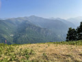
A fairly easy walk from Orus, a charming village with cobbled streets and picture-postcard scenery. The path winds through the undergrowth and ferns, past numerous low walls and abandoned shelters, bearing witness to the agricultural and pastoral activity of days gone by. The route ends at a paragliding launch site. Superb views across all the mountain ranges to the south of the Vicdessos Valley, with the Pique d’Endron in the centre and Montcalm to the right. Not to be missed!
La Soulane de Vicdessos
7.99 mi
+1,457 ft
-1,447 ft
4h 55
Moderate
Departure from Vicdessos (Ariège)
As its name suggests, the hike takes place on the southern slope and on the heights of Vicdessos. You will take an old, entirely paved road to reach the village of Illier with its interesting narrow streets, then follow a balcony path through a forest of boxwood, cherry, oak, acacia and hazelnut trees to the village of Orus. From there, the landscape opens up onto a safe path built on the mountainside, offering beautiful views as you reach the village of Sentenac, from where you will return partly via the D18. All these roads and paths are built on foundations that bear witness to civil engineering skills in terms of their volume and position.
The Mine Trail
 Tourist office
 3.71 mi
+1,122 ft
-1,138 ft
2h 40
Moderate
Departure from Vicdessos (Ariège)
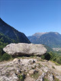
The mining trail winds its way through the woods around the delightful Sem valley. Follow in the footsteps of the former miners of Rancié and discover the past.
Circular Bège ridges from Vicdessos
 6.81 mi
+1,811 ft
-1,801 ft
4h 45
 Difficult
Departure from Vicdessos (Ariège)
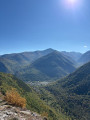
This hike is for experienced hikers who are comfortable using the app, as it takes place on unmarked roads and trails until the junction with the GR® Tour des Trois Seigneurs at the highest point of the Crêtes de Bège. The trails are old but still easily identifiable and easy to follow. However, you will need to be in good physical condition as there is a significant elevation gain over a relatively short distance. You will also need to be able to identify the best routes when you reach the rocky part of the ridge. From there, you will discover exceptional 360° panoramic views. The return journey, which is not particularly difficult, follows the GR® trail.
Col de Risoul and Rancié Mines circular.
 5.66 mi
+1,680 ft
-1,667 ft
4h 05
Moderate
Departure from Sem (Ariège)
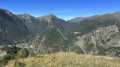
A beautiful route alternating between beech forests, stunning views of the Os Valley and old iron mines, starting from the small village of Sem, above Vicdessos. Best done in dry, clear weather.
The Chemin du Minier in Sem
 6.17 mi
+1,749 ft
-1,749 ft
4h 20
Moderate
Departure from Sem (Ariège)
A magnificent circular route through the forest with numerous information panels along the route, offering welcome breaks during the tough climb and breathtaking panoramic views. With two must-see sights, the Refuge de Grail (closed) and the Col de Grisoul!
This short but steep hike in the Vicdessos valley reveals an important part of the mining history of the Ariège. Here, in the heart of the mountains, the Mines du Rancié began with modern open-pit iron ore extraction at an altitude of over 1,500 metres, before more and more tunnels were dug, descending ever deeper! Connected to each other, they saved many lives during the frequent rockfalls that led to their permanent closure in 1931, despite the fact that the deposit was far from exhausted.
Crête d’Esplas – Crête de la Calvière from Goulier
8.83 mi
+2,822 ft
-2,828 ft
6h 30
Difficult
Departure from Goulier (Ariège)
This hike is suitable for walkers who know how to use the app and are observant of their surroundings. Most of the route follows paths marked on the map, but these are often difficult to spot. There are no signposts from the Col de Grail onwards; however, some sections remain clearly visible and provide reassurance regarding the route. Do not attempt this hike if there is a risk of fog or after rain, as the descent into the gispet could prove very difficult. Otherwise, there are remarkable views of the Pique d’Endron, Vicdessos, the Pic des Trois Seigneur, Montcalm and others...
From Goulier to the resort via the ridges and woods
 9.06 mi
+2,667 ft
-2,657 ft
6h 30
Difficult
Departure from Goulier (Ariège)
A lovely circular walk starting from Goulier, passing through the ski resort and following theGR®10.
The Pic du Sarrasi and Pic du Garbié – Col de Grailet and Col de Risoul from Goulier
 9.25 mi
+3,885 ft
-3,862 ft
7h 40
Difficult
Departure from Goulier (Ariège)
Second day of a three-day trip (August 2023) starting from Vicdessos (Val de Sos).
A challenging hike at the start.
From (2) to (8), gradient 30%, distance 3 km, elevation gain 1000 m.
After (6), the stunning scenery makes the effort required to reach the Crête du Sarrasi (8) well worth it.
From this high vantage point, a lovely descent follows, with stunning views throughout.
From the Col de Grail (13), the return journey via theGR®10is much more comfortable.
Please note: the section from (6) to (12) is exposed.
Pique d'Endron
 5.00 mi
+3,238 ft
-3,238 ft
5h 05
Difficult
Departure from Goulier (Ariège)
The Pique d'Endron, which can be seen majestically from Goulier, is located on a ridge separating the Siguer and Vicdessos valleys. Magnificent viewpoint with a 360° panorama of all the great peaks around, and below, the Étangs d'Izourt and Gnioure lakes.
La Pique d'Endron
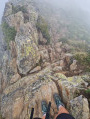 5.67 mi
+3,245 ft
-3,235 ft
5h 25
Difficult
Departure from Goulier (Ariège)
The Pique d’Endron is a central vantage point in the Haute-Ariège. From here, you can see the Montcalm massif and the Bassiès massif with its terraced lakes up close, and look out over two large lakes: Gnioure, with its small island, and Izourt. The view to the north stretches for miles. The hike is relatively short but quite challenging, with a 1,000-metre elevation gain, dizzying views and a short section where you’ll need to ‘get your hands dirty’.
The Étangs de Bassiès from Massada
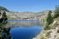 9.11 mi
+3,212 ft
-3,202 ft
7h 00
Difficult
Departure from Auzat (Ariège)
First day of a three-day trip (August 2023) starting from Vicdessos (Val de Sos).Please note: the suggested route, which is in excellent condition, is only sparsely signposted, except for the section of theGR®®10.This hike is classified as difficult due to the need for a good sense of direction, the poor condition of theGR®®10, the numerous steps to negotiate, the duration, etc.If it is simply a return trip to the refuge via theGR®®10, then the walk can be classified as moderate.=> August 2026: access to the lakes and the refuge may be affected by this => GR®10 in Ariège: Temporary closure of the Marc > Port de Saleix section (diversion)It should be possible to do a return trip to the lakes and the refuge via the power station (6) without returning via the GR®10!
Bassiès Lakes
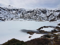 7.45 mi
+2,940 ft
-2,943 ft
6h 00
Difficult
Departure from Auzat (Ariège)
The granite cirque of Bassiès, near the Montcalm massif, is impressive for its size and its lakes. It is accessed from the right bank of the steeply-sided Bassiès stream via a comfortable but steep path that passes through a beautiful forest before coming out onto a rocky outcrop that marks the first lake. The descent is on the other bank, which is just as steep, following a well-maintained stony mule track.
Pic de Bassibié via Étang d'Artax
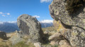 9.37 mi
+4,144 ft
-4,114 ft
7h 55
Difficult
Departure from Gourbit (Ariège)
A magnificent hike with no major difficulties. A majestic lake and wonderful views of the Ariège Pyrenees and Andorra from Pic de Bassibié.
Artax pond loop
 7.27 mi
+3,186 ft
-3,186 ft
6h 05
Moderate
Departure from Gourbit (Ariège)
A beautiful loop starting from the village of Gourbit.Passing by the Étang d'Artax (Artats), the Roc de Querquéou and the Col de Lastris.The viewpoint, at an altitude of almost 1,900 metres, is a feast for the eyes.
L'Étang Bleu
 6.02 mi
+2,625 ft
-2,598 ft
5h 05
Difficult
Departure from Rabat-les-Trois-Seigneurs (Ariège)
This high-altitude hike gives you an exact view of the high mountains of the Ariège and their perched ponds. This small pond in a peaceful setting has an immediate charm.
Moderator's warning as of 22/03/2021: Caution! in snowy conditions, very tricky passage; see reviews
Pic des Trois Seigneurs ridge via the Rabat slope
 8.72 mi
+4,065 ft
-4,055 ft
7h 35
Difficult
Departure from Rabat-les-Trois-Seigneurs (Ariège)
This peak at the gateway to the Pyrenees, 1 hour from Toulouse, offers a magnificent panorama of the 3000-metre peaks (Montcalm, Pic d'Estats). The hike is a little challenging, but the varied landscapes (streams, ponds, meadows, peaks) more than make up for the effort. There are no real technical difficulties, apart from the need to use your hands occasionally on certain sections of the ascent or descent.
Étang de Peyregrand
 9.13 mi
+3,232 ft
-3,219 ft
7h 00
Moderate
Departure from Siguer (Ariège)
This hike in the Siguer valley is very varied. The climb along the Brouquenat stream is bucolic and feels easy despite the length and elevation gain.
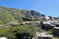
The first Neych pond from Bouychet
 7.01 mi
+3,465 ft
-3,468 ft
6h 15
Difficult
Departure from Siguer (Ariège)
Third day of a three-day trip (August 2023) starting from Vicdessos (Val de Sos).
A (very) difficult round-trip hike: 1,200 m elevation gain and an average gradient of 21 per cent.
A magnificent path all the way to the Pont de le Peyre over the Ruisseau de Brouquenat. Then a narrow path until you cross the Ruisseau d’Auruzan.
Next, a steep path leads to the first Neych lake.
After the second footbridge, the landscape opens up. From the Pont de la Peyre, there are stunning views over various valleys and the Ariège mountain ranges as far as the lake.
Very old yellow signposting.
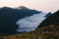
Two-day circular walk taking in the lakes of Gnioure, Rouch, Llassiès and Peyregrand
 17.00 mi
+6,398 ft
-6,388 ft
2 days
 Very difficult
Departure from Siguer (Ariège)
A magnificent but very demanding circular route with highly varied landscapes and terrain:Numerous waterfalls during the ascent, which is at times steep and very stony, up to the Peyre bridge.A short, slightly vertiginous ledge section to reach the vast Gnioure pond.A long path running alongside the lake, then the stream, and winding its way into the valley.A hillside climb that starts off fairly gentle but ends up quite steep, leading to the Étang du Rouch.Cross the pass and enjoy a gentle descent towards the very pretty Llassiès lakes.A challenging descent via a chimney (which can be bypassed via a hairpin bend) into the valley.A long and gentle descent (very long) via the Peyregrand and Brouquenat lakes from above.A gruelling descent along stony paths back to the car park.
The route follows the streams of Escalès, Auruzan and Gnioure on the ascent, then those of Llassiès, Peyregrand and Brouquenat on the descent.
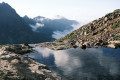
Étang du Rouch via Étang de Gnioure
 8.63 mi
+6,322 ft
-1,004 ft
10 hrs
Very difficult
Departure from Siguer (Ariège)
Climb the ridge marking the border with Andorra to the beautiful Étang du Rouch, which seems to sit at the foot of the Pic de Font Blanca, passing by the majestic Étang de Gnioure and its lovely, long valley:
- numerous waterfalls during the fairly steep and very stony climb up to the Peyre bridge;
- a short, slightly vertiginous ledge section to reach the immense Étang de Gnioure;
- a long path running alongside the lake, then the stream, and winding its way into the valley;
- a hillside climb that starts off fairly gentle but ends up quite steep, leading up to the Étang du Rouch.
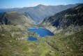
Pic de Cabanatous via the Bassiès lakes
 9.71 mi
+3,871 ft
-3,862 ft
7 hrs
Very difficult
Departure from Auzat (Ariège)
A difficult but exceptional hike offering panoramic views of the Ariège Pyrenees.
After a steep climb to the Bassiès lakes, you will walk along them before gaining height and reaching the Pic de Cabanatous, a viewpoint offering a 360° view from Tarbésou to Mont Vallier.
Blaou Pond and Port de Siguer
 13.69 mi
+5,115 ft
-5,115 ft
10h 45
Difficult
Departure from Siguer (Ariège)
This is a fairly long route, taking around 6 hours to climb up to Étang Blaou. The route is easy up to Cabane de Peyregrand, where you simply follow the yellow markings. In the plain around the hut, the markings are more or less faded and it is easy to lose track of them. They reappear at the start of the final climb, where the cairns and yellow markings are fairly easy to see.
It's a real treat once you reach the lake, where there is no one else around and the landscape is magnificent.
Le Roc du Querquéou via the three passes
 9.31 mi
+3,291 ft
-3,320 ft
7h 10
Difficult
Departure from Génat (Ariège)
Despite its modest altitude (1,840 m), Roc de Querquéou offers a superb view of the many peaks of the Haute Ariège. After the beautiful climb through the woods to Col du Pla de Faradu and then Col de Lastris, you will need to redouble your efforts to climb the extremely steep ridge that leads to the summit. The return journey takes you via the Col de la Bène and the pretty pastoral site of La Grangette d'en Bas before returning to Génat.
Circular Artax via the Étang Bleu de la Courbière
 12.95 mi
+5,157 ft
-5,131 ft
10h 25
Difficult
Departure from Gourbit (Ariège)
A beautiful circular starting from the small village of Gourbit. You will pass through Artax, then Pic de Bassibié and Pic de Pioulou, before descending to the Étangs Bleus de la Courbière via the Col de la Couillate. Finally, the hike ends at the Cirque d'Embans, the Cabane d'Embanels and then a climb back up to the village of Gourbit.
 Circular route between Quié and Génat
 9.10 mi
+1,864 ft
-1,850 ft
2 hrs
Moderate
Departure from Génat (Ariège)
A challenging descent from the Col du Trou to Quié, followed by a ride along the mountainside before climbing back up to the Génat plateau.
The Génat Plateau
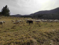 3.35 mi
+472 ft
-456 ft
1h 55
 Easy
Departure from Génat (Ariège)
A lovely viewpoint, a dolmen and a rural plateau.
Col de Campels via Chemin de la Teillette
3.44 mi
+741 ft
-725 ft
2h 15
Easy
Departure from Génat (Ariège)
A lovely off-trail walk through the forest and boxwood trees.
Génat Forest - Route No. 2
 4.06 mi
+961 ft
-961 ft
2h 40
Easy
Departure from Génat (Ariège)
A pleasant family walk in a beech forest, interesting in all seasons, including for snowshoeing.
The Étang d’Izourt circular route from Pradières d’en haut
5.67 mi
+2,156 ft
-2,156 ft
4h 30
Moderate
Departure from Auzat (Ariège)
Hiking up to the Étang d’Izourt along the Ruisseau d’Artiès offers a chance to enjoy a mountain walk. Doing so by ascending the eastern slope of the valley, starting from Pradières d’en haut, allows you to gain altitude quickly, enjoy the marvellous panoramic views of the surrounding ridges and peaks, and reach Étang d’Izourt from above. But to do this, you need to be able to manage a one-and-a-half-hour climb up a steep and demanding path. But it’s well worth the effort.
Pradières d’en haut car park – Étang d’Izourt – Refuge du Fourcat
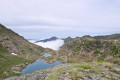 4.80 mi
+4,298 ft
-75 ft
5h 55
Difficult
Departure from Auzat (Ariège)
First stage of the journey through the Haute-Ariège.
A beautiful, steady climb takes you to the Étang d’Izourt, steeped in human history.
This is followed by a gruelling climb up to the Orri de la Caudière.
Once you’ve crossed the rustic footbridge, there’s another very steep climb up to the small Étang du Fourcat.
The rest of the route to the Étang du Fourcat refuge is more gentle.
A very steep climb to the Fourcat refuge with an average gradient of 17 per cent.
Please note: from the Étang d’Izourt to the refuge, the gradient is 24 per cent.
Ascent to the Étangs du Fourcat via the Étang d'Izourt
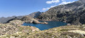 10.09 mi
+4,642 ft
-4,616 ft
8h 40
Difficult
Departure from Auzat (Ariège)
A beautiful hike that will take you to one of the most beautiful lakes in the Vicdessos valley.
The times indicated are for a trained walker. Allow at least 5 hours to reach the refuge.
The Izourt Pond
 4.18 mi
+1,768 ft
-1,788 ft
3h 30
Moderate
Departure from Auzat (Ariège)
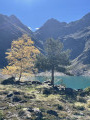
A beautiful hike ending at the Étang d'Izourt with a stunning view. The Étang d'Izourt is a dam lake with a tragic history (read about it on the commemorative plaque).
There are two paths you can take to get to the Étang d'Izourt: the left bank or the right bank of the stream. The outward journey is on the right bank of the Arties stream and the return journey is on the left bank.
Bassiès-Port de Lers mountain hut via the Étang d’Alate and Mont Ceint
 3.97 mi
+1,883 ft
-2,313 ft
3h 30
Difficult
Departure from Auzat (Ariège)
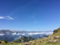
Before heading back, there is the option of a return trip to the Étang de Bassiès from the refuge, leaving some of your luggage at the refuge.A fairly short second stage, with two steep ascents (19% to 38%): one from the Refuge de Bassiès to the Port de Bassiès, and the even more challenging one from the Port de Saleix to the Pic de Girantès or Mont Ceint. In fact, it is a rather gruelling, up-and-down stage, classified as difficult. The ascents and descents are on challenging trails (pebbles, rocks, scree). The whole day is spent in open country with stunning panoramic views. The route passes the beautiful Étang d’Alate.The relative altitude, between 1,520 m and 2,100 m, means this day’s walk is feasible even in the height of summer.
Circular via Port de Lers, Port de Bassiès and Pas de la Portère
 7.04 mi
+3,540 ft
-3,507 ft
6h 20
Difficult
Departure from Suc-et-Sentenac (Ariège)
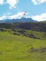
A beautiful circular starting from Port de Lers, passing by Pic de Girantes (or Mont Ceint) with magnificent 360° views, then descending to Port de Saleix and climbing back up to Port de Bassiès with superb views of the refuge and the Bassiès lakes. Return via Pas de la Portère via a difficult climb.
Two-day route via the Bassiès Refuge
11.43 mi
+4,810 ft
-4,806 ft
2 days
Difficult
Departure from Suc-et-Sentenac (Ariège)
Do not underestimate these two days, which pack in significant gradients over a relatively short distance.The first day is interesting for the discoveries it offers and a section with virtually no signposting. The arrival at the refuge is magnificent.Spending the night at the Refuge de Bassiès allows you to look forward to the return journey on the second day with greater peace of mind.A visit to the Étangs de Bassiès can be planned for the second day from the refuge, leaving some of your kit there. You can then collect all your kit for the challenging return walk to the Port de Lers car park.
Port de Lers–Bassiès Refuge via Pas du Roc, Étang de Labant, Col Fouzès
 7.46 mi
+2,927 ft
-2,493 ft
6h 00
Difficult
Departure from Suc-et-Sentenac (Ariège)
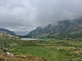
The first day takes you to the Refuge de Bassiès, passing huts, a valley, mountain passes, an old mine, a pond, and various cols and mountain passes. The stretch from the Col de las Fouzès to the Port de Bassiès is particularly beautiful.The route follows paths and tracks that are difficult due to their terrain (rock, scree, unmarked).See practical information * From (3) to (6) an unmarked path with gradients of 15% and 25%, with the presence of Patou dogs from (4). From (12) to (18) a marked path with gradients of 16% to 30%.The GPX track is necessary in places to avoid any confusion, as the route does not necessarily follow GR®, GRP® or PR® trails.Allow around 6 hours for the walk.
The Pic des Trois Seigneurs loop
 6.33 mi
+2,746 ft
-2,726 ft
5h 20
Difficult
Departure from Suc-et-Sentenac (Ariège)
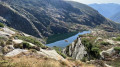
A circular walk in a magnificent landscape bathed in a calm and soothing atmosphere. This loop will delight lovers of peace and quiet as well as those wishing to reconnect with nature.
Marc Aqueduct Circular Loop
 5.80 mi
+1,302 ft
-1,293 ft
3h 50
Moderate
Departure from Auzat (Ariège)
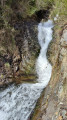
This is an idyllic circular route in the Vicdessos Stream valley, starting from the hamlet of Marc, with a steep climb right from the start, followed by a good descent halfway through. The route follows dirt tracks or concrete paths.
Tour of the Giants of the Three Nations
43.58 mi
+19,429 ft
-19,419 ft
6 days
Very difficult
Departure from Auzat (Ariège)
A beautiful cross-border high mountain loop between France, Spain and Andorra, which takes you through the highest peaks of Ariège and Andorra, as well as other iconic peaks in the region. It also allows you to discover numerous lakes and ponds, as well as a multitude of different landscapes (forests, summer pastures, scree slopes, etc.) to delight all hikers. This itinerary takes us through three natural parks: the Ariège Pyrenees Regional Nature Park, the Alt Pirineu Natural Park and the Coma Pedrosa Valley Nature Park.
Marc's Lodge - Refuge du Pinet
4.31 mi
+4,012 ft
-36 ft
5h 30
Difficult
Departure from Auzat (Ariège)
The first stage of the journey, the shortest and easiest, to warm up your legs, passing through the Bois de Fontanal and the Étang Sourd to the Refuge du Pinet. The elevation gain is still significant.
Gourbit circular starting from Rabat-les-Trois-Seigneurs
 4.82 mi
+1,089 ft
-1,066 ft
3h 10
Moderate
Departure from Rabat-les-Trois-Seigneurs (Ariège)
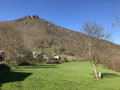
A family hike accessible to all, including children, in an area rich in pastoral history.
This hike gives pride of place to wooded trails and highlights the waters of the Torrent de la Courbière.
Beautiful mountain views and magnificent undergrowth.
"Le Monolithe" and the summit of Roche Ronde from Rabat
 Association / Club / Walk leader
 3.72 mi
+1,155 ft
-1,165 ft
2h 45
Moderate
Departure from Rabat-les-Trois-Seigneurs (Ariège)
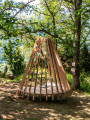
Starting from the Contrac car park in Rabat-les-Trois-Seigneurs, this is an accessible circular route with beautiful sights along the way.After the first climb, you will reach the architectural structure "Le Monolithe", created by students from the Toulouse School of Architecture: an unusual seat with a view over the valley. Then enjoy the panorama from the ruins of the ancient Cathar castle of La Roche Ronde, before finally descending past the Calamès Cave and its climbing site.
La Roche Ronde between Rabat-les-Trois-Seigneurs and Bédeilhac
 5.16 mi
+1,516 ft
-1,529 ft
3h 40
Moderate
Departure from Rabat-les-Trois-Seigneurs (Ariège)
An easy hike between Rabat-les-Trois-Seigneurs and Bédeilhac offering a beautiful view of the valley from the Roche Ronde.
Circular route around the Tignalbu reed beds from Mounicou
7.53 mi
+2,264 ft
-2,274 ft
5h 25
Moderate
Departure from Auzat (Ariège)
A pleasant walk through forests of beech, hazel and pine trees along well-marked trails to the drystone shelters and orris of Tignalbu. Views of the Montcalm massif and the Pique Rouge de Bassiès. You can also catch a glimpse of the Étang de Soulcem, the Pic de la Madelon and other landmarks. The return journey along a pleasant track offers a chance to see the flora regenerating after a fire. Don’t set off too quickly – the first hour is quite tough. The final stretch is lulled by the sound of the torrent, with a few small pools along the way.
Étang Sourd circular loop, returning via the Waterfall d’Artigue
 6.78 mi
+2,815 ft
-2,789 ft
5h 35
Difficult
Departure from Auzat (Ariège)
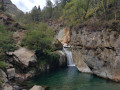
A hike suitable for people in good physical condition, for which a navigation app may be useful. The first section follows good paths which are actually shortcuts, so it’s short but steep as it climbs through the Montcalm State Forest. After a very scenic traverse through the forest, we rejoin the GR®T60 and begin the ascent along a path in poor condition. The Orri de Pla de Nouzère is of no particular interest. It’s better to take the path leading uphill to the left, which is rocky and easier (marked in yellow). The Étang Sourd, set in its picturesque surroundings, makes the effort well worth it. The return journey follows the GR®T60 for part of the way; this section is tough and you’ll sometimes need to use your hands. The Artigue Waterfall is well worth a look.
The summit of Mentiès
 6.04 mi
+3,068 ft
-3,068 ft
5h 25
Difficult
Departure from Saurat (Ariège)
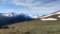
This gentle peak is not notable for its modest altitude but nevertheless offers a superb vantage point over the Trois Seigneurs massif, the Montagne de Tabe and far beyond. After an initial section through a beautiful beech forest, the long climb up the broad grassy ridge allows you to fully enjoy the scenery. However, you’ll need patience and perseverance, as the slope is steep from start to finish with very little respite, except at the Col de Carlong.
From Tarascon-sur-Ariège to Junac and back
 7.60 mi
+912 ft
-935 ft
4h 15
Moderate
Departure from Tarascon-sur-Ariège (Ariège)
A walk starting from Tarascon-sur-Ariège that will take you to Junac, passing through the small village of Alliat and overlooking the village of Niaux.
Étang and Refuge du Pinet circular
 5.66 mi
+3,484 ft
-3,497 ft
5h 40
Difficult
Departure from Auzat (Ariège)
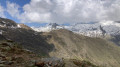
A very beautiful hike, but one that has to be earned. There is a 1,000-metre elevation gain over a short distance. The variety of paths taken, including rivers, forests, mountainsides and lakes, will make you forget the difficulty. The view of the Bassiès massif on the way up and down is truly magnificent. The bonus: the welcome at the refuge is very warm. From the refuge, you can continue on to several other lakes, or enjoy the beautiful view of all the 3,000-metre peaks around Montcalm.
Aire d'Artigue - Étang Sourd - Refuge du Pinet
 5.74 mi
+3,514 ft
-3,514 ft
5h 40
Difficult
Departure from Auzat (Ariège)
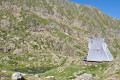
Fourth stage of the journey in Haute-Ariège.Leave very early as it gets very busy in summer.Drive to the Aire d'Artigue.A very beautiful mountain hike, but difficult due to the steep incline.Pass by Étang Sourd before arriving at the original Refuge de l'Étang du Pinet.Return via the GRT60.Circular route in the opposite direction from Étang and Refuge du Pinet in a taboulechat circular route.
Ascent of Montcalm on snowshoes
9.78 mi
+6,243 ft
-6,224 ft
9h 55
Very difficult
Departure from Auzat (Ariège)
This is a high-mountain route, to be undertaken in good weather conditions and when the snowpack is stable. The route remains fairly busy, even in winter. The trail is therefore usually well trodden, making it easier to find your way.Above the refuge, there is a long traverse on steep slopes which is not technically difficult if the snow is not too hard, but can be daunting. This section is prone to avalanches and should only be attempted when the snow cover is perfectly stable (crampons and ice axe recommended). Beware of strong winds on the ridges.
The Artigue waterfalls
 1.82 mi
+427 ft
-436 ft
1h 10
Easy
Departure from Auzat (Ariège)
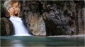
A gentle walk to the Artigue waterfalls.
Pique d'Estats and Montcalm
 10.30 mi
+7,080 ft
-7,057 ft
12 hrs
Very difficult
Departure from Auzat (Ariège)
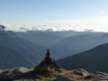
This high-mountain hike takes you to the two iconic peaks of the Vicdessos valley in Ariège: Pique d'Estats and Montcalm!Montcalm (3,077 m) is the first "3,000" peak in the Pyrenees coming from the Mediterranean, and Pique d'Estats (3,143 m) is the highest peak in Catalonia, which explains their symbolic nature. Please note that some hikers have described the descent as dangerous. See the reviews and please keep us informed, but remain cautious.
Artigue Waterfall Loop
 3.73 mi
+1,060 ft
-1,047 ft
2h 40
Moderate
Departure from Auzat (Ariège)
A lovely loop around the Ruisseau de l'Artigue and Estats.
This loop allows you to avoid the crowds that can gather in summer due to the easy access to the waterfall and the canyoning activity.
Summit of Mont and Roche Ronde from Saurat
 8.17 mi
+2,375 ft
-2,395 ft
5h 50
Moderate
Departure from Saurat (Ariège)
This hike will allow you to discover two remarkable sites, the Sommet du Mont and the Roche Ronde,
for the views they offer over the Tarascon valley and some of the peaks of the Pyrenees: Saint-Barthélémy and Pic des Trois Seigneurs.
The Goutets irises
 5.96 mi
+1,749 ft
-1,729 ft
4h 15
Moderate
Departure from Le Port (Ariège)
This circuit provides access to the dry stone hamlet of Les Orris. It is a magnificent pastoral village, used for summer grazing, set in lush green surroundings opposite the Pic des Trois Seigneurs. The hamlet of Les Goutets was used from the 1800s until around 1950.
Refuge du Pinet - Montcalm/Estats/Verdaguer Peaks - Refuge Vallferrera
7.84 mi
+3,786 ft
-4,790 ft
6h 55
Very difficult
Departure from Auzat (Ariège)
The second day is a high-mountain stage passing through the highest point of this itinerary: Pic d'Estats, as well as two other peaks over 3,000 m nearby, Pic du Montcalm and Pic de Verdaguer. The route is largely over scree and rocky terrain, which will greatly appeal to mineral enthusiasts. The trail largely follows the Porta del Cel hike and the GR®T61. Although not particularly technical, this stage should not be taken lightly due to its altitude (three peaks over 3,000 metres), its length, its elevation gain and its trails composed of loose stones that can make progress difficult.