Country:

 City:
City:



To reach the start: from Tarascon-sur-Ariège, follow signs for Vicdessos (D8) to the right at the chapel, pass through Niaux, Capoulet and Junac, then turn left towards Siguer just as you enter Laramade (D24). In the village, follow the signs for Bouychet, turn right in the centre to avoid the no-entry sign opposite, and, at the bottom facing the river, turn left (D224). Continue to the Bouychet car park (end of the road).
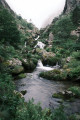
(S) Enter the forest at the hiking signposts opposite the car park entrance. Follow the dirt track (GR® T65), which soon becomes stony and runs alongside the Ruisseau d’Escalès. Walk along the shaded right bank of the stream on the rocky and often paved path to the first footbridge, admiring the numerous waterfalls along the way.
(1) Cross the footbridge and continue along the left bank of the stream until you reach the second footbridge.
(2) Cross again to return to the right bank, then follow the path to the very pretty Pont de la Peyre.
(3) Cross the bridge and carry on straight ahead (GR® T64). The path does not appear to be signposted but is fairly obvious as you can see the trail continuing diagonally uphill to the right.
Follow the path to the unmanned Auruzan hut (alt. 1,620 m).
(4) Just past the hut, head down to cross the Ruisseau d’Auruzan and turn immediately left to follow the left bank of the stream. Continue to a junction at the 1,697-metre mark.
(5) Turn right (the two paths run parallel to each other a few metres apart for a while) and follow the stream, which eventually veers off to the left, until you reach another junction at the 1,838-metre mark.
(6) Turn right again towards the pass. Continue along the much steeper path and reach the pass at elevation 1998.
At the pass, descend slightly to the left until you reach a vertiginous section with a sheer drop to the right.
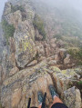
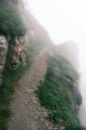
(7) Follow the very exposed ledge path. There is a significant drop-off to the right, but the path is relatively wide and the section is equipped with a handrail (steel cable).
Warning: when I passed through on 13 July 2023, the final section of the handrail was unusable because the end of the cable had come loose from a rock and was lying in the middle of the path. Under no circumstances should you attempt to hold on to this section, as doing so could result in a fatal fall! (See photo)
Continue along the path to the ruins of some old barracks, passing a small building on the right a little earlier which houses a spring marked on the IGN map.
Head down a little to the right, but keep to the left of the ruins to find the Gnioure communal shelter.
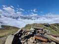
Note: this is an ideal spot for a picnic as the terrace is equipped with a large table and pallets to sit on, and offers shelter from the rain in case of bad weather.
(Note: if you cross through the ruins or head right after the communal shelter, there is a path leading to the dam, but I didn’t spot it because of the clouds. It isn’t very clearly marked on the IGN map either, for that matter).
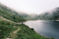
(8) To set off again from the shelter, head slightly uphill to the left to rejoin the path. Then follow this path which runs along the right bank of the Étang de Gnioure until you reach further ruins and a footbridge at elevation 1876.
(9) Cross the footbridge and continue along the path (still theGR® T64).
(10) On the right, there is a pretty metal cross on a concrete plinth, which makes for a lovely viewpoint.
Continue along the path, skirting the pond.
(11) After the pond, start heading uphill, following the stream along its right bank. A very long and pretty, easy walk, marked in yellow; not always easy to follow but you can always get back on track easily.
(12) Here, there are two options:
- stay on the right bank of the stream and continue along theGR® T64 to reach the Étang de Rouch junction;
- cross the stream instead of staying on the right bank (recorded route), continue a short way before crossing back over to reach the Étang de Rouch junction (marked route).
(On the ground, theGR® T64 route does not appear to be marked and is far less natural than the more passable left-bank route. Moreover, on other base maps such as OpenTopo, OpenStreet or mapy.cz, the route runs exclusively along the left bank and theGT® T route does not exist...).
(13) Take care: there is a faint yellow marker on a large rock indicating the junction towards the Étang du Rouch. Head down to the left towards the stream. Look for another yellow marker on a small rock to cross. Then head north-east, cross a dry stream bed and continue on to reach a small clearing with a small pool on the right.
(14) At the orri, continue up an increasingly steep slope, following the cairns – which you may sometimes have to search for; the GPX track can serve as a guide but isn’t perfect. Begin a bend to the right leading into a scree slope and head south-south-east. Continue on to reach the edge of a chimney, which you must not enter.
(15) Stay on the left-hand side of the chimney (the right bank if you consider it to be the source of a stream) and continue in the same direction, passing over the chimney and then through a large scree slope that shifts a great deal, with sections of loose earth and rolling stones. Again, look carefully for the cairns to ensure you do not stray off course.
You’ll emerge at the Étang du Rouch (E).
Return via the same route or continue on to the second part of the Gnioure–Rouch–Llassiès–Peyregrand circular route.
In either case, a bivouac is a welcome option to give your knees a rest.

 Visorando Member
 Difficult
 Moderate