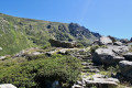
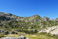
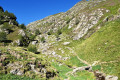
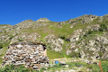
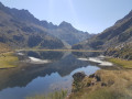
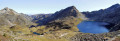
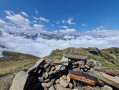
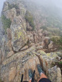
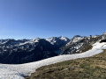
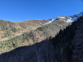
The first Neych pond from Bouychet

Third day of a three-day trip (August 2023) starting from Vicdessos (Val de Sos).
A (very) difficult round-trip hike: 1,200 m elevation gain and an average gradient of 21 per cent.
A magnificent path all the way to the Pont de le Peyre over the Ruisseau de Brouquenat. Then a narrow path until you cross the Ruisseau d’Auruzan.
Next, a steep path leads to the first Neych lake.
After the second footbridge, the landscape opens up. From the Pont de la Peyre, there are stunning views over various valleys and the Ariège mountain ranges as far as the lake.
Very old yellow signposting.

This walk is part of a multi-day hike: Séjour de trois jours en Val de Sos

Details

38061090
Creation:
Last update:
Last review:
  • Walking
    Activity: Walking
  • ↔
    Distance: 7.01 mi
  • ◔
    Average duration: 6h 15 
  • ▲
    Difficulty: Difficult

  • ⚐
    Back to start: Yes
  • ↗
    Ascent: + 3,465 ft
  • ↘
    Descent: - 3,468 ft

  • ▲
    Highest point: 6,522 ft
  • ▼
    Lowest point: 3,054 ft
  • ⚐ Country: France
  • ⚐
    Area: Pyrenees
  • ⚐ City: Siguer (09220)
  • ⚑
    Start/End: N 42.730299° / E 1.549439°
  • ❏
    IGN map(s): Ref. 2148OT, 2148OTR
  • Hour-by-hour weather

Photos

Description of the walk

From Tarascon-sur-Ariège, take the D8 towards Vicdessos (Val de Sos). Pass through Capoulet-et-Junac and, 2 km further on, turn left towards Siguer via the D24. Drive past Siguer and continue towards Bouychet via the D224. Drive to the end of the road at the large car park in Bouychet.

Old, very sparseyellow markings.

(S/E) Please note: the IGN base map is inaccurate => there is noGR® T65 route, nor any red and white markings.
With your back to the access road, head towards the forest and the wooden signposts. Climb quite steeply towards Peyregrand until you reach the first footbridge over the Ruisseau d’Esacales at an elevation of 1290.

(1) From here, a magnificent, entirely stoned path begins.
How many people and how much time were needed to build these retaining walls and this stony path?
You’ll reach a second footbridge at an elevation of 1,401 metres.

(2) Climb steeply up the right bank of the Ruisseau de Brouquenat. The stony path then becomes less steep and leads into a large mountain pasture. Magnificent views of the valley floor. You’ll reach a rock marked with a yellow left turn and a yellow right turn. To the left, a barely visible path leads to the Pic de Siguer.

(3) Head right, cross the Pont de la Peyre at elevation 1492. You’ll reach another unmarked junction. Take care. There are no directional signs. NoGR® T65, noPR®! The path along the stream leads to the Étang de Peyregrand.
With your back to the stream, climb straight up the slope, heading south-west for about a hundred metres, until you find a good path. Then turn right, heading due north-west, and climb steeply. Beautiful scenery.
You’ll reach a small flat area; go down a magnificent flight of wide stone steps, then head back up towards an Ariège-style stone hut with a tent attached *. Altitude 1,620 m.

(4) Cross a footbridge and climb steeply to the left along the Ruisseau d’Auruzan. Pass a rock shelter at around the 1,697-metre mark. Take care: you will need to cross the stream.

No signposting. Cairns

(5) Look out for cairns on the large boulders. Descend towards the stream and cross it. Head right, behind the boulder, for about twenty metres. Then climb up to the left.
Do not venture onto the scree slope. Above this, you’ll find a good path.
Head north-east up a very steep slope. The gradient is steep. Keep following the cairn-marked path. Then turn generally south and arrive at a flat area at a barely marked fork (alt. 1,975 m).

(6) Turn off to the right towards the south-west, on almost level ground, and come within sight of one of the Étangs de Neych. This one is reserved for the residents of Siguer! Head down to it.

(7) A vast and beautiful spot for a restorative break. *
For the return journey, simply follow the route in the opposite direction to the outward journey and head back to the Bouychet car park (S/E).

Waypoints

  1. S/E : mi 0 - alt. 3,058 ft - Bouychet car park
  2. 1 : mi 1.11 - alt. 4,288 ft - Footbridge - Ruisseau d'Escalès (rivière) - Affluent du Siguer
  3. 2 : mi 1.38 - alt. 4,580 ft - Footbridge - Ruisseau d'Escalès (rivière) - Affluent du Siguer
  4. 3 : mi 1.91 - alt. 4,915 ft - Pont de la Peyre. Brouquenat stream
  5. 4 : mi 2.55 - alt. 5,312 ft - Cabane d'Auruzan (1620m)
  6. 5 : mi 2.91 - alt. 5,709 ft - Crossing the Ruisseau d’Auruzan
  7. 6 : mi 3.33 - alt. 6,473 ft - Flat section. Fork in the path
  8. 7 : mi 3.52 - alt. 6,496 ft - One of the - Étangs de Neych
  9. S/E : mi 7.01 - alt. 3,054 ft - Bouychet car park

Notes

  • Most of the huts are used by shepherds and are reserved for them from mid-June to mid-September.

Water in the streams (torrents) must be filtered or disinfected.
No springs or water sources along the route. Except for the Source de la Coume du Four after the (5), continuing a short way along the GT64.

This is a mountainous area: bring rainwear, water, a packed lunch, a GPX track, route description, map, GPS or the Visorando app, a camera, good walking boots and walking poles.

The route is largely exposed => set off early during hot weather. The weather can change quickly.

Worth a visit

  • (7) Option to continue southwards towards the second pond (elevation 1986). At the fork (elevation 2012), turn right heading due west. Walk past two further Étangs de Neych and the hillock on the right. Then turn sharply right heading due north and join the well-marked path after the spring. Descend to the right and rejoin the (5).

Val de Sos
Siguer Town Hall

Always be cautious and plan ahead when you're outdoors. Visorando and the author of this route cannot be held responsible for any accidents occurring on this route.

The GR® and PR® markings are the intellectual property of the Fédération Française de Randonnée Pédestre.

Reviews and comments

5 / 5
Based on 2 reviews

Reliability of the description
5 / 5
Ease of following the route
5 / 5
Route interest
5 / 5
Ibanez-Ramon Marie-Christine

Overall rating : 5 / 5

Date of your route : Jul 28, 2025
Reliability of the description : ★★★★★ Very good
Ease of following the route : ★★★★★ Very good
Route interest : ★★★★★ Very good
Very busy route : No

We made snowshoes and climbed up the route indicated, but on the way back we went around all the Neych ponds, passing through the pass. This is what was indicated in note no. 7. It was a little longer than going there and back, but more enjoyable. On the way down, we came across the spring and then a little further on, the yellow marked trail. We climbed 1,100 metres instead of the 1,000 metres planned. We are used to climbing.
It was a very beautiful hike with stunning scenery after the forest.

Machine-translated

tegon
tegon

Overall rating : 5 / 5

Date of your route : Jul 17, 2025
Reliability of the description : ★★★★★ Very good
Ease of following the route : ★★★★★ Very good
Route interest : ★★★★★ Very good
Very busy route : No

A lovely walk, with stunning scenery towards Peyregrand Lake, starting from the Peyre Bridge and then following the ridges at the bottom of the valley of the Auruzen stream.
I chose to do a circular route around the Neych lakes via the Pourtaneille de Gnioure (an old pass leading to the Gnioure lake). I didn’t see the source of the Coume du Four.
This route is quite busy, particularly along the main section up to the Peyre Bridge.

Machine-translated

Other walks in the area

For more walks, use our search engine .

The GPS track and description are the property of this route's author. Please do not copy them without permission.