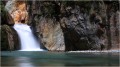
Circular route around the Tignalbu reed beds from Mounicou

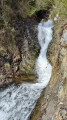
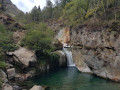
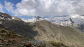
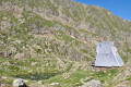
A pleasant walk through forests of beech, hazel and pine trees along well-marked trails to the drystone shelters and orris of Tignalbu. Views of the Montcalm massif and the Pique Rouge de Bassiès. You can also catch a glimpse of the Étang de Soulcem, the Pic de la Madelon and other landmarks. The return journey along a pleasant track offers a chance to see the flora regenerating after a fire. Don’t set off too quickly – the first hour is quite tough. The final stretch is lulled by the sound of the torrent, with a few small pools along the way.

Details

102948830
Creation:
Last update:
Last review:
  • Walking
    Activity: Walking
  • ↔
    Distance: 7.53 mi
  • ◔
    Average duration: 5h 25 
  • ▲
    Difficulty: Moderate

  • ⚐
    Back to start: Yes
  • ↗
    Ascent: + 2,264 ft
  • ↘
    Descent: - 2,274 ft

  • ▲
    Highest point: 5,866 ft
  • ▼
    Lowest point: 3,573 ft
  • ⚐ Country: France
  • ⚐
    Area: Pyrenees
  • ⚐ City: Auzat (09220)
  • ⚑
    Start/End: N 42.707778° / E 1.450815°
  • ❏
    IGN map(s): Ref. 2148OT, 2148OTR
  • Hour-by-hour weather

Description of the walk

Coming from Auzat towards Soulcem via the D8, pass through the pretty village of Marc and reach the hamlet of Mounicou via the D8; cross the bridge and park 50 metres further on, on the left (note: very few spaces available).

(S/E) Continue along the D8 for about fifty metres and head up the GR® 10 on the left towards Artigues. You’ll come to a fork in the road.

(1) Leave the GR® 10 and head up a path on the right. You’ll come to a track.

(2) Follow it to the left for about 100 metres and turn right onto the track. You’ll reach a bend in the track.

(3) Continue up the track opposite and reach Les Orris de Tignalbu at an altitude of 1,790. High point and end of the walk. Stunning view from the hut. Fountain.

(4) Turn back and return to the bend in the track.

(3) No signposting. Head down to the left along this winding track. You’ll eventually reach the D8 and the GR® T62.

(5) Follow the road to the right up to the 1145-metre mark and a footbridge on the left.

(6) Cross the footbridge over the Ruisseau de Vicdessos (or Ruisseau de Mounicou) and head down to the right along the left bank, still following the GR® T62.

(7) At the entrance to Mounicou, cross the Vicdessos stream again and turn left to reach the Mounicou car park (S/E).


Waypoints

  1. S/E : mi 0 - alt. 3,602 ft - Car park – Mounicou
  2. 1 : mi 0.9 - alt. 4,603 ft - GR trail
  3. 2 : mi 1.95 - alt. 5,417 ft - Track
  4. 3 : mi 2.15 - alt. 5,518 ft - Bend in the track – Common junction for out-and-back route
  5. 4 : mi 2.71 - alt. 5,863 ft - Les Orris de Tignalbu – Fontaine
  6. 5 : mi 5.84 - alt. 4,236 ft - Road
  7. 6 : mi 6.9 - alt. 3,766 ft - Footbridge over the - Vicdessos (rivière) - Affluent de l'Ariège
  8. 7 : mi 7.47 - alt. 3,573 ft - Footbridge over the - Vicdessos (rivière) - Affluent de l'Ariège
  9. S/E : mi 7.53 - alt. 3,606 ft - Car park – Mounicou

Notes

No water sources, herds of horses, the hut is closed.

Worth a visit

Do not hesitate to head up to the Étang de Soulcem, the starting point for many hikes.

Always be cautious and plan ahead when you're outdoors. Visorando and the author of this route cannot be held responsible for any accidents occurring on this route.

The GR® and PR® markings are the intellectual property of the Fédération Française de Randonnée Pédestre.

Other walks in the area

For more walks, use our search engine .

The GPS track and description are the property of this route's author. Please do not copy them without permission.