Country:

 City:
City:


Car park on the right-hand side of the D8 when approaching Marc from the north, just before the Church of Saint-Antoine du Montcalm.
(S/E) Walk south along the road, turn right at the church onto the GR®10, cross the Ruisseau de Mounicou and then, at the bend in the road to the left, turn right to cross the Ruisseau de l’Artigue and head up into the village via the narrow streets or the main road. At the top, you’ll reach a terrace and continue the climb up a narrow street.
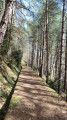
(1) The start of the steep climb. At the junction, keep left, cross a road, then turn right at the next junction and join a road. Follow it to the right, ignoring the road branching off to the left, and walk about a hundred metres towards Les Toutous d’en Bas, then follow the path branching off to the right. A very pleasant wooded path; the terrain is flat as you are walking along the aqueduct.
(2) Cross the Ruisseau d’Argansou at a bend to the right of the path, which continues along the aqueduct.
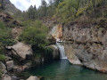
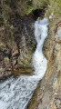
(3) Leave the GR®10. Go straight on at the junction of the paths. You’ll reach the waterfall on the Ruisseau de Bassiès (swimming prohibited).
(4) Continue along the path, which becomes tarmac, then bends to the right and begins a steep descent.
(5) At the junction with a dirt track, follow it to the left, continuing the descent via a series of hairpin bends. Ignore the paths branching off to the left. You’ll reach the Pont de Gers bridge over the Ruisseau de Vicdessos.
(6) Leave this bridge on your left. Continue straight ahead along the track on the same left bank. Further on, pass a footbridge on your left at the hamlet of Ensem, then another bridge at the hamlet of Le Hourré. 300 metres further on, you’ll reach a footbridge over the Vicdessos at elevation 985.
(7) Cross it, then follow the D8 to the right with care (a quiet but narrow road) until you reach the car park (S/E).



 Visorando Member
 Difficult
 Very difficult