The summit of Mentiès

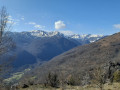
This gentle peak is not notable for its modest altitude but nevertheless offers a superb vantage point over the Trois Seigneurs massif, the Montagne de Tabe and far beyond. After an initial section through a beautiful beech forest, the long climb up the broad grassy ridge allows you to fully enjoy the scenery. However, you’ll need patience and perseverance, as the slope is steep from start to finish with very little respite, except at the Col de Carlong.

Details

4630535
Creation:
Last update:
Last review:
  • Walking
    Activity: Walking
  • ↔
    Distance: 6.04 mi
  • ◔
    Average duration: 5h 25 
  • ▲
    Difficulty: Difficult

  • ⚐
    Back to start: Yes
  • ↗
    Ascent: + 3,068 ft
  • ↘
    Descent: - 3,068 ft

  • ▲
    Highest point: 5,554 ft
  • ▼
    Lowest point: 2,720 ft

Photos

Description of the walk

Note to moderators: I have amended this route by changing the starting point (S/E) following a complaint from a local resident at the original starting point.

On arriving in Saurat via the D618, follow signs for ‘centre ville’ and walk right through the village. Once you reach the end of the road, which is blocked by large boulders, turn left onto a very narrow track: ‘there are no signposts at this point’. Continue to a four-way junction where there is a road sign indicating ‘Carli’. Turn left, following this direction, and continue along the track until you reach the small car park at Carli.

YellowPR® markings

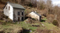
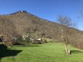
Leave the car park and turn immediately right onto a sunken path which may be very muddy depending on the season. Stay on the main path, which climbs steeply, ignoring the various offshoots to the left. After a challenging stretch, you’ll reach Carlong, where the two beautifully restored barns make for a very pretty spot.

Turn right, following the yellow markings, pass between the two buildings, then turn left onto the path that winds its way through the boxwoods and holly bushes.

(1) Look out for the path on the right which you’ll use on the descent, and head straight on, due south, to quickly reach the vast meadows heralding the Col de Carlong. Head straight ahead, aiming for the wooden post bearing the signposts. Once you reach it, follow a very clear track to the right for just a few metres.

No signposting

(2) A tricky junction: there is nothing here to indicate the start of the ascent, so I have placed a long dead conifer trunk on the ground to mark it.

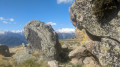
Take the path on the left up a steep slope through sparse shrubbery. Make sure to keep heading south-west. You’ll soon reach a clear, grassy area; continue straight ahead, doing your best to follow the faint track that winds its way through the ferns. Head for the Roc de Peyrenègre, a large, isolated boulder that’s easy to spot and marks the top of the first climb.

(3) Once at the rock, keep heading west, leaving it on your left. After a welcome slight levelling off, the climb becomes very steep again up to the Roc de Trabinet, a small secondary summit made up of scattered boulders.

(4) The slope levels out and is followed by a gentle descent to the Col des Cramades, which is barely marked, then the final ascent leading to the Sommet de Mentiès.

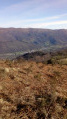
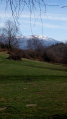
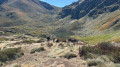
(5) An exceptional 360° view, dominated by the Pic des Trois Seigneurs to the south-west and the Tabe Massif to the south-east, where the lofty silhouette of Saint-Barthélémy stands out.

Begin the descent by following the reverse route of the ascent to reach the Col de Carlong.

YellowPR® markings

(2) Follow the markings towards the barns at Carlong.

(1) At a yellow marker on a tree, take a sharp left-hand bend despite the Yellow Cross that seems to be trying to dissuade you, and set off along a path carpeted with leaves that descends gently. About 200 metres further on, go round a large uprooted tree lying across the path on the right (as of February 2021) and continue the descent through a beautiful beech forest. You’ll reach Les Planels des Miechs, where the two restored barns and the murmur of the little stream you have to cross create a timeless, bucolic setting.

(6) Join the track you took by car to reach the start.

(7) Follow it to the right and head back up to the car park at Carli (S/E).

Waypoints

  1. S/E : mi 0 - alt. 2,733 ft - Crossroads, ‘Carli’ sign
  2. 1 : mi 0.78 - alt. 3,579 ft - Junction: A/ straight on – R/ left
  3. 2 : mi 1.09 - alt. 3,862 ft - Wooden post - Col de Carlong
  4. 3 : mi 1.48 - alt. 4,544 ft - Roc de Peyrenègre
  5. 4 : mi 2.18 - alt. 5,446 ft - Roc de Trabinet
  6. 5 : mi 2.78 - alt. 5,554 ft - Sommet de Mentiès
  7. 6 : mi 5.36 - alt. 3,104 ft - Planels des Miechs
  8. 7 : mi 5.69 - alt. 2,723 ft - Vehicle track, on the right
  9. S/E : mi 6.04 - alt. 2,733 ft - Crossroads, ‘Carli’ sign

Notes

The walk certainly deserves its ‘Difficult’ rating: the slope is very steep from start to finish and you’ll need to tackle it sensibly to conserve your breath over the course of the hike. It is therefore suitable for walkers in good physical condition.

(2) Col de Carlong: it is important to spot the start on the left clearly, without continuing to follow the very distinct but tempting trail. If you miss this junction, don’t panic; you can turn left about a hundred metres further on and rejoin the GPX track, but the vegetation, although sparse, makes it difficult to find your bearings.

Shelter is available at the Col de Carlong hut, situated on the left (west) as you reach the meadow. It is, however, quite difficult to spot amongst the trees.

There’s a water source at the Col de Carlong, to the left of the signpost, following the clear track heading south. An unattractive tub, used as a drinking trough, collects water from the spring (not tested by the author).

This hike is also a classic Ariège route for snowshoeing.

Always be cautious and plan ahead when you're outdoors. Visorando and the author of this route cannot be held responsible for any accidents occurring on this route.

The GR® and PR® markings are the intellectual property of the Fédération Française de Randonnée Pédestre.

Reviews and comments

4.3 / 5
Based on 3 reviews

Reliability of the description
4.7 / 5
Ease of following the route
4 / 5
Route interest
4.3 / 5
Fargote
Fargote

Overall rating : 3.3 / 5

Date of your route : May 09, 2026
Reliability of the description : ★★★★☆ Good
Ease of following the route : ★★★☆☆ Average
Route interest : ★★★☆☆ Average
Very busy route : No

Hello, I can confirm that the hike is difficult at point number 2 – it’s not easy to find the path; to put it simply, you just have to head straight up;
It’s not a hike I’d do in summer because of the tall grass and ferns
Good luck to everyone

Machine-translated

Rémy 09
Rémy 09

Overall rating : 5 / 5

Date of your route : Apr 19, 2023
Reliability of the description : ★★★★★ Very good
Ease of following the route : ★★★★★ Very good
Route interest : ★★★★★ Very good
Very busy route : No

A pleasant walk; the first section gives you a chance to warm up before the steep climb.
At the Col de Carlong, you need to continue the climb, keeping to the left and heading towards a huge rock.
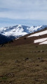
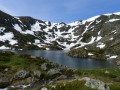
The ridge is wide throughout the climb towards Mentiès and offers views of the snowfields on either side.
It is possible to continue on to other peaks.
There is an alternative starting point where you can park near the hamlet of Escales, past Rabat-les-Trois-Seigneurs, whilst of course being considerate of local residents and farmers.

Machine-translated

Olivierbarbara
Olivierbarbara

Overall rating : 4.7 / 5

Date of your route : Jul 25, 2021
Reliability of the description : ★★★★★ Very good
Ease of following the route : ★★★★☆ Good
Route interest : ★★★★★ Very good
Very busy route : No

The difficulty of the hike lies in its significant elevation gain over a short distance, as well as the lack of a defined path in the upper section (you’ll be crossing an area of tall ferns and tall grass as you reach the summit)..
The view from the summit is brilliant!
Be careful, however, of snakes in the rocky outcrops (I nearly stepped on one) and of ticks (I removed two in the shower).
This hike therefore requires a good level of fitness as well as suitable clothing.

Machine-translated

Other walks in the area

For more walks, use our search engine .

The GPS track and description are the property of this route's author. Please do not copy them without permission.