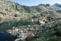
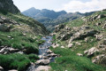
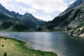
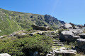
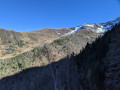
Two-day circular walk taking in the lakes of Gnioure, Rouch, Llassiès and Peyregrand

A magnificent but very demanding circular route with highly varied landscapes and terrain:

  • Numerous waterfalls during the ascent, which is at times steep and very stony, up to the Peyre bridge.
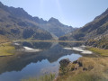
  • A short, slightly vertiginous ledge section to reach the vast Gnioure pond.
  • A long path running alongside the lake, then the stream, and winding its way into the valley.
  • A hillside climb that starts off fairly gentle but ends up quite steep, leading to the Étang du Rouch.
  • Cross the pass and enjoy a gentle descent towards the very pretty Llassiès lakes.
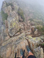
  • A challenging descent via a chimney (which can be bypassed via a hairpin bend) into the valley.
  • A long and gentle descent (very long) via the Peyregrand and Brouquenat lakes from above.
  • A gruelling descent along stony paths back to the car park.

The route follows the streams of Escalès, Auruzan and Gnioure on the ascent, then those of Llassiès, Peyregrand and Brouquenat on the descent.

Details

36460389
Creation:
Last update:
Last review:
  • Walking
    Activity: Walking
  • ↔
    Distance: 17.00 mi
  • ◔
    Average duration: 2 days 
  • ▲
    Difficulty: Very difficult

  • ⚐
    Back to start: Yes
  • ↗
    Ascent: + 6,398 ft
  • ↘
    Descent: - 6,388 ft

  • ▲
    Highest point: 8,471 ft
  • ▼
    Lowest point: 3,061 ft

Photos

Stages of the route

This route needs several days, find the details below:

  1. S
  2. E

Notes

Rated ‘very difficult’ due to the length, the steep and challenging sections (though not overly technical), the occasionally confusing route, and the fact of having to carry a heavy rucksack (14 kg in this case) for bivouacking.
Strictly speaking, I would have rated it ‘difficult’ due to the fairly steep ascent to the Étang du Rouch and the steep descent to the Jasse de Belesta.

No specific kit is required, but I’d recommend good high-top boots for ankle support, and walking poles to protect your knees on the ascents and descents in the steep sections, particularly when carrying a heavy rucksack.

Running water everywhere (mid-July 2023), so you can travel light with a filter or water purification tablets.

Shelters encountered:

  • The open hut at Auruzan (occupied by a shepherd in summer).
  • Communal shelter at the Gnioure dam (sleeps 8).
  • The open hut at Les Llassiès (occupied by a shepherd in summer).
  • Peyregrand open hut.
  • Brouquenat d’en Haut open hut.

Always be cautious and plan ahead when you're outdoors. Visorando and the author of this route cannot be held responsible for any accidents occurring on this route.

Reviews and comments

3.5 / 5
Based on 4 reviews

Reliability of the description
3.5 / 5
Ease of following the route
2 / 5
Route interest
5 / 5
User 28956035

Overall rating : 3.7 / 5

Date of your route : Jun 29, 2026
Reliability of the description : ★★★★☆ Good
Ease of following the route : ★★☆☆☆ Disappointing
Route interest : ★★★★★ Very good
Very busy route : No

Hello,
We did this hike on the first weekend of June 2026 and there was still plenty of snow between 2,000m and 2,500m in altitude; the path on the final ascent is very poorly signposted, often hidden in the snowfields, and very steep. We advise anyone planning to do this hike (outside the summer months) to come properly equipped, as the two people we met at the top had a right scare after sliding several metres down a very steep slope. The second section, which was just as snow-covered, left us with few options at times and forced us to take a few risks. Make sure you have a map, as the GPX track for the hike takes unnecessary detours and isn’t very clear.
That said, it’s a lovely route, and our bivouac by the (frozen) Rouch pond treated us to a magnificent sunset.

Machine-translated

Antoine Escudero
Antoine Escudero

Overall rating : 4.3 / 5

Date of your route : Oct 04, 2025
Reliability of the description : ★★★★★ Very good
Ease of following the route : ★★★☆☆ Average
Route interest : ★★★★★ Very good
Very busy route : No

Hike done this weekend, in conditions that weren't exactly ideal (rain, frost and light snow) but without any particular problems!

The scenery is stunning at this time of year, with very bright colours and beautiful shades of yellow and orange all along the route. It's a really interesting route, very calm and fairly uniform (especially the descent), which makes it very enjoyable!
As for the route itself, it's pretty good, but difficult to follow at times, especially on the last climb before reaching the Rouch pond, which is quite steep. In addition, the paths are not always easy to follow (no markings and a lack of cairns in places), which slightly lengthens the hike.

In terms of time, the first stage took me 7 hours, including breaks, with sunny weather and a dry path. The second stage, following overnight rain, frost and snowflakes in the morning, was quite tricky, and it took me about 6 hours (again including breaks) to reach the car park. I should point out that I was carrying a fairly heavy rucksack (20kg), so the route can be completed in less time in better conditions and with a more reasonable load.
I would advise against doing the route in the opposite direction, as the final climb up to the Rouch pond (in the original direction) seems too dangerous to descend, especially in the morning with dew and potentially frost.

Thank you for the route, it was a very good weekend in a peaceful and sublime setting!

Machine-translated

User 16692626

Overall rating : 3.3 / 5

Date of your route : Aug 10, 2025
Reliability of the description : ★★★☆☆ Average
Ease of following the route : ★★☆☆☆ Disappointing
Route interest : ★★★★★ Very good
Very busy route : No

Hike completed on 30 and 31 July 2025.
From the Bouychet car park to the communal shelter at the Gniour pond; a beautiful climb but not too difficult.
First night spent at the communal shelter at the Gniour pond. I met Marcel and the shepherd there. A very pleasant encounter. The shelter is great, with mattresses and blankets available.
The next day, nothing special to report until point 14, where the route became increasingly difficult to follow. Do not follow the GPX route at this point, as I did and found myself in great difficulty on the last 300-400 metres of the climb (dangerous aerial passages...). Follow the cairns and head south-south-east.
Magnificent Étang de Rouch.
Easy descent to point 5, very difficult descent in the rocky ridge to the Jasse de Bélesta. Be extra vigilant at this point.
From the Cabane de Peyregrand, the trail disappears a bit and is difficult to follow, so keeping an eye on the GPX route can help.
Second night spent in the Cabane de Brouquenat, which is very well maintained. Mattresses were available, which was great.
Overall, a very beautiful hike but very difficult, especially during the final ascent and at certain points during the descent.
Walking time (including breaks): 15 hours.
Departure on Wednesday 30 July at 5pm, arrival on Friday 1 August at 8.30am.

Machine-translated

Oliver34
Oliver34

Overall rating : 2.7 / 5

Date of your route : Jul 17, 2025
Reliability of the description : ★★☆☆☆ Disappointing
Ease of following the route : ★☆☆☆☆ Very disappointing
Route interest : ★★★★★ Very good
Very busy route : No

Please note: this is a very beautiful hike, but after the Gniour pond, which is empty when you start the climb, there are no landmarks, so you have to find your way using cairns
Very steep climbs with very difficult sections
Please note that the 6 hours and 37 minutes to descend from the Étang de Rouch to the car park is impossible if you are not an expert
It took us 8½ hours without stopping, partly due to poor signposting
However, it is a very beautiful hike

Machine-translated

Other walks in the area

For more walks, use our search engine .

The GPS track and description are the property of this route's author. Please do not copy them without permission.