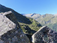
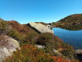
Two-day route via the Bassiès Refuge

Do not underestimate these two days, which pack in significant gradients over a relatively short distance.
The first day is interesting for the discoveries it offers and a section with virtually no signposting. The arrival at the refuge is magnificent.
Spending the night at the Refuge de Bassiès allows you to look forward to the return journey on the second day with greater peace of mind.
A visit to the Étangs de Bassiès can be planned for the second day from the refuge, leaving some of your kit there. You can then collect all your kit for the challenging return walk to the Port de Lers car park.

Details

101915027
Creation:
Last update:
Last review:
  • Walking
    Activity: Walking
  • ↔
    Distance: 11.43 mi
  • ◔
    Average duration: 2 days 
  • ▲
    Difficulty: Difficult

  • ⚐
    Back to start: Yes
  • ↗
    Ascent: + 4,810 ft
  • ↘
    Descent: - 4,806 ft

  • ▲
    Highest point: 6,831 ft
  • ▼
    Lowest point: 4,649 ft

Photos

Stages of the route

This route needs several days, find the details below:

  1. S
  2. E

Notes

Étangs de Bassiès Mountain Hut

Essential kit for an overnight stay in a refuge: sheet, toiletries, first-aid kit, a change of clothes, food, water and all the compulsory and necessary equipment for a two-day hike.
The GPX track is necessary in places to avoid any confusion, as the route does not necessarily follow GR®, GRP® or PR® trails.

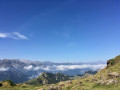
Take careful note of the sawtooth-shaped elevation profile, featuring a long, steep climb to the Port de Bassiès on the first day. Then there are two further steep climbs on the second day. The landscapes and panoramic views you’ll encounter are well worth the effort.

Worth a visit

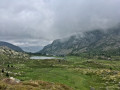
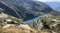
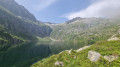
The Étang de Bassiès seen from the refuge on the outward and return journeys.

Always be cautious and plan ahead when you're outdoors. Visorando and the author of this route cannot be held responsible for any accidents occurring on this route.

The GR® and PR® markings are the intellectual property of the Fédération Française de Randonnée Pédestre.

Reviews and comments

4.3 / 5
Based on 1 review

Reliability of the description
5 / 5
Ease of following the route
3 / 5
Route interest
5 / 5
lemarcheur65
lemarcheur65 ★

Hello

It clearly states:
Practical information
Étangs de Bassiès Mountain Hut

Essential kit for an overnight stay at the refuge...
The GPX track is required in some places to avoid any confusion, as the route does not necessarily follow GR®, GRP® or PR® trails.

So!

Machine-translated

marc24
marc24

Overall rating : 4.3 / 5

Date of your route : Aug 09, 2026
Reliability of the description : ★★★★★ Very good
Ease of following the route : ★★★☆☆ Average
Route interest : ★★★★★ Very good
Very busy route : No

I can confirm… there’s a section where, if you don’t have GPS guidance – like this app or a smartwatch – it’s incredibly easy to get lost and end up going round in circles… I had both, and even so I struggled a bit on the section from route 3 to 6… After that, it’s no problem… On the way back, make sure you take plenty of water, especially if it’s hot, as there’s no water between the pond and the car park… The mountain hut is superb, as is their local beer
You can camp behind the hut without any issues, but remember to follow the ‘Leave No Trace’ principle when you leave.

Machine-translated

Other walks in the area

For more walks, use our search engine .

The GPS track and description are the property of this route's author. Please do not copy them without permission.