Country:

 City:
City:


Go past the hamlet of Artès. The route starts from the car park in the hamlet of Pradières d’en haut, just before the power station of the same name.
(S/E) From the car park, head down towards the hamlet of Pradières d’en bas.
(1) A path, the GR®10 variant, starts between the houses on the right-hand side of the track. Take this path to begin the steep ascent up a wooded valley filled with magnificent beech trees. During the climb, the trail is barely marked; the red and white markings are very sparse and not maintained.
(2) At an altitude of 1,435 metres, pass the ruins of several barns – the first, a solitary one, on the right, then a few others on the left a little further up. As you emerge from the woods, join the GR®10, which cuts across the hillside at the same level.
(3) Take this opportunity to catch your breath. Follow the GR® 10 to the right. Whilst the rest of the route is less hilly, the path is by no means a motorway. This is all the more true as it appears to have regularly deviated from its original route, which is, however, clearly marked in other sections. You’ll reach a valley floor. Take care.
(4) Change of direction at this point: the path is cut off by a rocky outcrop, which you’ll need to climb to continue. Some ingenious trail-markers had the good sense to cut into the rock with a power saw to make the passage easier. We owe them our thanks. Further on, you’ll pass over one of the upstream water collection pipes that supply the Pradières power station.
(5) At the point with an altitude of 1776 – the only real junction of paths encountered on this slope – take the path that descends to the right. It quickly leads to the outlet of the underground drainage channel from the Étang de Gnioure, which is situated in the neighbouring valley.
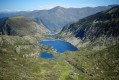
(6) Pass the structure and descend towards the Étang d’Izourt, which you overlook until you reach it.
(7) From the small pass where the old barracks for the workers who built the dam once stood – and at the foot of which the current mountain refuge is situated – continue walking beyond the dam to take in the full view of the lake.
(8) Then return to the fork in the path near the mountain hut.
(7) Begin the descent, which takes you beneath the EDF cable car and along the GR®10 near the Ruisseau d’Artiès, which you can hear. The path alternates between gentle and steep sections until it reaches an intermediate plateau where the Orri de la Coume is situated – a small stone shepherd’s hut, set slightly apart from the path on the left.
(9) Once past this section, the path becomes more wooded, crosses several streams, and eventually leads to the end of the track leading to the power station.
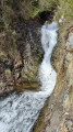
(10) Take the track to the left, then cross the footbridge over the stream. Complete the descent on the left bank, following the path alongside the torrent. Further on, cross the torrent to return to the car park where you started (S/E).
 Visorando Member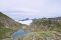
 Difficult

 Very difficult