Country:

 City:
City:


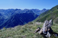
From Vicdessos (09) (Val de Sos), head up towards Goulier Neige. Walk through the village of Goulier and park in the second car park on the way out of the village. There is a fountain and a cup-marked menhir opposite the car park.
(S/E) Continue uphill along the road until you reach the first sharp bend to the left.
(1) Leave the road, turn right, heading due south. Cross an electric fence and continue along the left bank of the Ruisseau de Goulier. Climb up into the mountain pasture, following a low-voltage power line. Follow a path lined with trees and, at the end of this row, look out for a path on the right (alt. 1200 m).
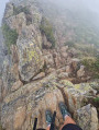
(2) Turn slightly to the right, heading due south. Cross the Ruisseau de la Prade. From this point onwards, the path climbs very steeply all the way to the summit. You’ll reach a cross-country track (alt. 1325 m).
(3) Cross this track, which forms part of theGR®10B(not shown on the base maps). Continue climbing steeply straight ahead until you reach a track heading south-east (alt. 1,450 m).
Maintain this general direction, along the ridge, until you reach the highest point on the Crête du Sarrasi.
(4) Follow it uphill until you reach a four-way junction, at a sharp bend in another track (alt. 1510 m).
(5) Leave both the track you have been following and this new track, and climb up the steep path opposite. Then continue in the same south-easterly direction (alt. 1,610 m). Join a faintly marked cross-country path.
(6) Continue climbing, now in open terrain. Join a path coming from the left from the Goulier Neige car park (alt. 1,975 m).
Old, very sparseyellow markings.
(7) Continue south-east up the steep climb. Just below the pass, climb one final hairpin bend and reach the Crête du Sarrasi and its eponymous summit (elevation 2213).
Old yellow markings, very sparse.
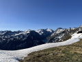
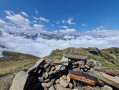
(8) From the Pic du Sarrasi: sweeping 360° views, looking due south towards the Étang de Gnioure and north-east towards the Étangs de Basiès.
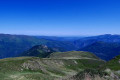
After a restorative break, set off along the north-eastern ridge, taking in all the small peaks, including the Pic du Garbié de Brésoul. Here too, there are sweeping views of the many deep valleys in this part of the Ariège.
(9) Now continue downhill along a barely visible, grass-covered track. Simply head for the Cabane du Garbié, which is no longer on the plateau (alt. 1,930 m).
(10) “Very nicely fitted out in a cubic ‘Algéco’ unit. The key is hanging by the window. It’s clearly a place lived in by a shepherd and his family. Two beds, a gas cooker, some provisions – very clean.
Please respect this place, which is freely accessible. Thank you to those who look after such places.”
Continue the descent along the stony track. Take your time; this isn’t the most interesting part. But it’s true that the landscape and the numerous vultures make the descent more enjoyable.
You’ll arrive, much further down, at another hut with a very steep corrugated iron roof at elevation 1578.
(11) A simple, clean shelter hut with no special facilities, useful in case of trouble or rain.
Continue the descent northwards. This is followed by a bend to the right and then another to the left.
Take care: cross two wooden cross-trails (water drainage channels) across the track and arrive at a Y-junction. Look out for a cairn on the left.
(12) No signposts. Do not continue downhill.
Turn left, due west, onto a grassy track through the woodland. Follow this pleasant track, which climbs only slightly. You’ll reach a tapped spring and, a little further on, a large, open crossroads of tracks (elevation 1485).
At this Col de Grail, there is a ‘Retrouvance’ lodge run by the ONF.
Red and white markings forthe GR®10
(13) Set off to the left along theGR®10. Cross a valley floor and, after 300 m, keep an eye on the left-hand side of the track. Do not continue downhill. NoGR®10markings. IGN base map is accurate.
(14) Head uphill to the left to follow theGR®10. You will then join a wide path through the forest. Various signposts and directional signs.
(15) Turn sharply right onto a path that runs alongside a track below on the left. Further on, join this track at the Col de Risoul. Take care: there are no signposts.
Turn right onto this track and follow it for about thirty metres.
Note: look out for a handmade totem pole with signposts on the left.
(16) Turn sharply left and descend rapidly along theGR®10. Much further down, you’ll reach the access road to the car park.
(17) Turn left onto this road and head for the second car park on the outskirts of the village (S/E).

 Visorando Member
 Average
  Tourist office