Country:

 City:
City:


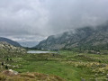
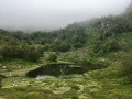
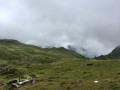
From Tarascon-sur-Ariège via the N20, heading towards Andorra; at the second roundabout, turn right onto the D8. Pass through Niaux (caves) and Capoulet. On reaching Vicdessos, continue right onto the D18 towards Port de Lers. The road is not very wide. Continue to Port de Lers.
(S/E) Two options:
- From the memorial stone, follow the route, heading south-west then west along a path that is barely visible at first, and join the road at the large shepherd’s hut at an elevation of 1,461 metres on the other side of the road. Then continue along the D18 to the left until you reach the right-hand bend.
- From the car park, with the marker stone on your left, continue along the D18 due west until you reach the right-hand bend.
See practical information *
(1) Head left up a small grassy track leading towards the Orri-Cabane (Courtal de Lers) with a tin roof. Go round it on the left and follow the yellow markings. A little further down, you’ll come to a wooden gate in a fence.
Purple markings on a white background screwed onto numerous rocks
(2) Take care. There are two markers pointing in different directions. Keep to the left as you climb up a very pretty forest path. Unfortunately, it’s not very comfortable, with small rocks to climb over or avoid. On the other hand, the path winds through some very green and pretty little valleys. Leave the forest and reach a vast, undulating mountain pasture . Follow the very prominent markings carefully. You’ll notice a brand-new shepherd’s hut on the slope to the right.
Very old, sparse yellow markings
(3) Take care. At an altitude of around 1,450 m, leave the marked path, which turns north-east. Head up to the left onto a west-facing path, then quickly due south into the Combe de Bispou. After about 400 m (alt. 1,470 m), the path turns south-east into another valley. The old markings occasionally confirm you’re on the right track. The slope becomes steeper and the valley widens at an altitude of around 1,620 m.
(4) The route suggested here is the one I took to avoid some Patou dogs and a flock of sheep (mid-July 2026).
So head up to the right, heading south-west, through the old mountain pastures overgrown with low vegetation (and therefore free of sheep), aiming for the east-west-running ridge (alt. 1,700 m).
Alternatively, if there are no mountain wolves, continue along the valley and turn right, heading south, to the unnamed pass, then follow the suggested route.
(5) Caution. Do not approach the ridge with its low vegetation: risk of falling and it is impossible to descend on the other side.
Find a path very clearly marked on the ground by animals and head due east towards the Tuc des Paloumères. The unnamed pass will soon come into view. Descend along a path towards a clearly visible track further down the unnamed pass (alt. 1,675 m).
Yellow markings are fairly frequent
(6) Descend very steeply due south along this difficult path (pebbles, rocks, steps) until you reach a crossroads and a signpost with multiple directions on old wooden signs. A very beautiful spot.
(7) Take care. Follow the signs for Pas du Roc. Turn right, westwards, onto a good, level path, following the yellow markings. After 200 m, turn left, 90°. Pass through a wet area (marsh), heading south-west. Further on, you’ll come to a round black plastic water container.
(8) Descend into the forest and cross the Pas du Roc. The descent through the forest is not easy. You’ll reach a small summer pasture. Cross it, continuing straight ahead, find a track and follow it down to the D8f road.
(9) Follow it to the left along the wide left-hand slope, facing the oncoming traffic, and reach a right-hand bend on this road.
(10) Just after the road bridge over the Ruisseau Mérigue, head up to the left for a few metres through the forest and emerge into a mountain pasture. Turn right at the edge of the forest and rejoin a stony track that forms part of the GR®10.
Red and white GR®10markings
(11) Follow it to the left and, further on, you’ll reach a wetland area (watering hole, spring). Directional signpost.
(12) Follow the sign for Étang de Labant to the right. Climb steeply to the right along a worn path. You’ll reach an area of rubble from the former Argentières Mine. Continue a little further and you’ll come to a fork in the path. The signposts are dilapidated.
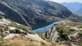
(13) Turn right towards Étang de Labant and reach it at an elevation of 1597. A very beautiful spot.
(14) Continue climbing more steeply through the forest, still on a difficult path, and emerge into a clear area at the edge of the forest at an elevation of 1,648 metres. Note the large sign explaining the presence of the Patou dogs, along with their names!
(15) Take care. Do not head towards this sign. Turn sharply left, 90°, towards the south-east, and climb again along a challenging but almost level balcony path. Stunning scenery.
(16) At an altitude of around 1,750 m, the path turns due east and the gradient becomes very steep (26%). After a 200-metre climb, you’ll reach the Col de las Fouzès at an elevation of 1,944 metres. A very beautiful spot with a 360° panorama.
(17) Continue to the left. A beautifully restored ‘orri’ provides shelter from the wind for a well-deserved break. Follow the yellow markings carefully , keeping to the right after 100 metres, still on a challenging path. A stunning view of the Refuge de Bassiès and its ponds below on the right. This brings you to the junction at Port de Saleix and the GR®10 at an altitude of 1,935 metres. This is another lovely spot with beautiful views.
White and red markings of the GR®10
(18) Turn right onto the GR®10. The descent is very steep along a stony, winding path with natural steps.
(19) Take care when the GR®10 reaches a flat area. There are no signposts at the fork. Turn right towards the refuge, cross a wooden footbridge, and follow the fence around the bivouac area (this is compulsory at this exact spot). Observe the guidelines: Biological Reserve. You will arrive at the Refuge de Bassiès (E).
 Visorando Member
 Moderate