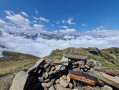
From Goulier to the resort via the ridges and woods

A lovely circular walk starting from Goulier, passing through the ski resort and following theGR®10.

Details

3020117
Creation:
Last update:
Last review:
  • Walking
    Activity: Walking
  • ↔
    Distance: 9.06 mi
  • ◔
    Average duration: 6h 30 
  • ▲
    Difficulty: Difficult

  • ⚐
    Back to start: Yes
  • ↗
    Ascent: + 2,667 ft
  • ↘
    Descent: - 2,657 ft

  • ▲
    Highest point: 5,833 ft
  • ▼
    Lowest point: 3,642 ft
  • ⚐ Country: France
  • ⚐
    Area: Pyrenees
  • ⚐ City: Goulier (09220)
  • ⚑
    Start/End: N 42.754688° / E 1.504713°
  • ❏
    IGN map(s): Ref. 2047ET, 2148OT, 2148OTR
  • Hour-by-hour weather

Photos

Description of the walk

Start from the car park on the road running alongside the town, the ski resort road.

(S/E) Head north to join theGR®10and begin the ascent.

(1) On reaching the Col de Risoul, turn right onto the forest track,the GR®10, which runs alongside the forest road. The track is flat.

(2) Continue straight ahead on theGR®10B, heading south-west.

(3) Join the D 208 local road, continuing along theGR®10B.

(4) Before reaching the resort car park (elevation 1,463), take a path on the far left to climb towards the Pic du Besset.

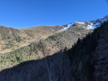
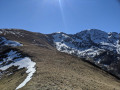
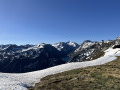
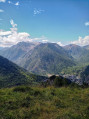
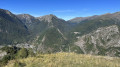
(5) Enjoy the 360° view. Follow the ridge.

(6) Turn right onto a path leading down towards the top of the ski run.

(7) Walk down the piste to return to the foot of the resort, keeping the Nam ski lift on your left.

(8) Continue left along theGR®10Bthrough the forest. Cross the Ruisseau de Goulier.

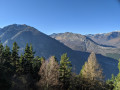
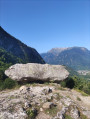
(9) Take a moment to admire the view at the boundary marker, before turning right onto theGR®10to return to the car park (S/E).


Waypoints

  1. S/E : mi 0 - alt. 3,661 ft - Goulier car park. Road to the ski resort
  2. 1 : mi 0.72 - alt. 4,344 ft - To the right. GR10 - Col de Risoul (1320m)
  3. 2 : mi 1.56 - alt. 4,646 ft - Junction: GR10 – GR10B – PR – Ski run
  4. 3 : mi 2.16 - alt. 4,636 ft - D 208. GR10B
  5. 4 : mi 2.5 - alt. 4,770 ft - Turn left. Leave the GR10B
  6. 5 : mi 3.26 - alt. 5,656 ft - Viewpoint. Ridge
  7. 6 : mi 3.52 - alt. 5,735 ft - Turn right towards the top of the ski run
  8. 7 : mi 4.04 - alt. 5,778 ft - Keep right, with the Nam ski lift on your left
  9. 8 : mi 4.73 - alt. 4,852 ft - Left. GR10B
  10. 9 : mi 7.42 - alt. 4,619 ft - Junction. Turn right. GR10
  11. S/E : mi 9.06 - alt. 3,652 ft - Goulier car park. Road to the ski resort

Always be cautious and plan ahead when you're outdoors. Visorando and the author of this route cannot be held responsible for any accidents occurring on this route.

The GR® and PR® markings are the intellectual property of the Fédération Française de Randonnée Pédestre.

Reviews and comments

4.1 / 5
Based on 3 reviews

Reliability of the description
4.3 / 5
Ease of following the route
4 / 5
Route interest
4 / 5
marc1234
marc1234

Overall rating : 3 / 5

Date of your route : Jun 24, 2024
Reliability of the description : ★★★★☆ Good
Ease of following the route : ★★★☆☆ Average
Route interest : ★★☆☆☆ Disappointing
Very busy route : No

Between points 4 and 5, I found this walk not difficult but DANGEROUS:

- at this point, the path winds its way up a slope with a gradient of approximately 45° to 50° and a height of 200 to 250 metres
- this slope is entirely covered in long grass and low-growing bushes
=> In my opinion, there is a high risk that if you slip, you will not come to a halt until you reach the line of trees at the very bottom of the slope… especially as this vegetation retains moisture very well, which ‘enhances’ the sliding

Furthermore:
- this path has probably not been maintained for years. The vegetation, on both the mountain side and the ravine side, has reduced the usable width to the width of a shoe…
- the edge of the path on the ravine side is not visible, as it is obscured by vegetation. But if you step onto this vegetation, you’ll quickly realise that there is, underneath it, … nothing

I should point out that we sometimes walk along paths that run alongside cliffs…
This particular path isn’t any more dangerous than that.
The point I wanted to make is that this path is TRICKY!!!

Apart from that:
- the view from the top is superb
- we didn’t see a single tick, but we were bitten by horseflies on the way down (to the point where we had to speed up considerably to get rid of them)

All in all:
- we certainly won’t be doing this walk again, because of the danger
- I strongly advise against it! If you want to enjoy the view, start the walk in the other direction and retrace your steps without going through sections 4–5!

Machine-translated

gazok54
gazok54 ★

Thank you, yannevelynesjgccav.
Not even a few words about this walk?

Machine-translated

yannevelynesjgccav
yannevelynesjgccav

Overall rating : 5 / 5

Date of your route : Sep 18, 2020
Reliability of the description : ★★★★★ Very good
Ease of following the route : ★★★★★ Very good
Route interest : ★★★★★ Very good
Very busy route : Yes

Xxxx

Machine-translated

entropiek
entropiek

Overall rating : 4.3 / 5

Date of your route : May 25, 2020
Reliability of the description : ★★★★☆ Good
Ease of following the route : ★★★★☆ Good
Route interest : ★★★★★ Very good
Very busy route : No

A really lovely walk; the whole GR section through the woods (i.e. the bit below the ski resort) is magnificent. Only the climb from the ski resort was a bit of a nuisance between 1,400 and 1,600 metres; we picked up lots of ticks of all sizes in the grass, so you need to check your legs very regularly to remove them before they latch on.

Machine-translated

Other walks in the area

For more walks, use our search engine .

The GPS track and description are the property of this route's author. Please do not copy them without permission.