Étang Sourd circular loop, returning via the Waterfall d’Artigue

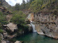
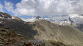
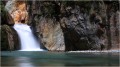
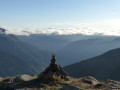
A hike suitable for people in good physical condition, for which a navigation app may be useful. The first section follows good paths which are actually shortcuts, so it’s short but steep as it climbs through the Montcalm State Forest. After a very scenic traverse through the forest, we rejoin the GR®T60 and begin the ascent along a path in poor condition. The Orri de Pla de Nouzère is of no particular interest. It’s better to take the path leading uphill to the left, which is rocky and easier (marked in yellow). The Étang Sourd, set in its picturesque surroundings, makes the effort well worth it. The return journey follows the GR®T60 for part of the way; this section is tough and you’ll sometimes need to use your hands. The Artigue Waterfall is well worth a look.

Details

103752545
Creation:
Last update:
Last review:
  • Walking
    Activity: Walking
  • ↔
    Distance: 6.78 mi
  • ◔
    Average duration: 5h 35 
  • ▲
    Difficulty: Difficult

  • ⚐
    Back to start: Yes
  • ↗
    Ascent: + 2,815 ft
  • ↘
    Descent: - 2,789 ft

  • ▲
    Highest point: 6,385 ft
  • ▼
    Lowest point: 3,658 ft

Description of the walk

From Auzat, pass through the hamlet of Marc and take the first road on the right towards l’Artigue. Park in the first car park and picnic area just before a bridge over the Ruisseau de l’Artigue.

(S/E) Cross the road and take the forest track on the left until you reach the first hairpin bend.

(1) Follow the path to the right, which is difficult to spot at first: look for a cairn. Further up, rejoin the track you left earlier; follow it to the right until the next hairpin bend, then turn right onto the path. This path rejoins the track; follow it to the right for a few dozen metres before taking the path to the left (cairn). Once back on the track, head uphill to the right and walk for about a hundred metres.

(2) Join the path on the left (cairn). Head diagonally uphill through the forest, cross the track again, rejoin it and turn right for about 100 metres.

(3) Join the path on the left, continue climbing to rejoin the track one last time. Cross the track, continue straight ahead on the path which crosses the Coume de Subra and then follows a very scenic horizontal traverse to the junction with the GR®T60.

(4) Keep to the left to climb steeply and reach the Orri de Pla de Nouzère. Go past it to reach a junction marked by a large cairn.

(5) Take the path on the left, marked in yellow. Make one final steep ascent to reach the Étang Sourd, which marks the highest point of the walk.

(6) Head slightly uphill to the right and look for a faint track heading west which follows a ridge line. The route is safe all the way back to the GR®T60.

(7) Follow it down to the right and rejoin the Orri de Pla de Nouzère junction.

(5) Head straight on to retrace the route you took on the way up, back to the junction you passed on the way there.

(4) Keep left onto the GR®T60 and you’ll soon reach another path junction.

(8) Leave the GR®T60 and turn left towards Artigue, following the signpost. Cross along the hillside, taking care not to miss the hard-to-spot cairn marking the start of a path on the right before the Ruisseau d’Estats.

(9) Carefully descend to the right along the path leading to the Artigue Waterfall.

(10) Continue downwards, rejoin the GRT60 and follow it in the same direction.

(11) Leave the GR® which branches off to the left towards Port de l’Artigue; continue straight on to join the D66 at the Soulcem hydroelectric power station. Then follow the road back directly to the car park (S/E).


Waypoints

  1. S/E : mi 0 - alt. 3,658 ft - Car park – Picnic area - Ruisseau de l'Artigue (ruisseau) - Affluent du Vicdessos
  2. 1 : mi 0.13 - alt. 3,698 ft - Peg, cairn
  3. 2 : mi 0.58 - alt. 4,163 ft - Path to the left, cairn
  4. 3 : mi 0.95 - alt. 4,744 ft - Path to the left, cairn
  5. 4 : mi 2.04 - alt. 4,829 ft - Junction with the circular waterfall loop
  6. 5 : mi 2.42 - alt. 5,502 ft - Junction with the circular lake loop - Orri de Pla de Nouzère
  7. 6 : mi 2.88 - alt. 6,362 ft - Étang Sourd (Forêt Domaniale du Montcalm)
  8. 7 : mi 3.54 - alt. 6,122 ft - Junction with the GR T60, turn right
  9. 8 : mi 4.59 - alt. 4,754 ft - Leave the GR T60, turning left
  10. 9 : mi 4.96 - alt. 4,554 ft - Cairn, path to the right
  11. 10 : mi 5.3 - alt. 4,163 ft - Cascade de l’Artigue
  12. 11 : mi 5.96 - alt. 3,891 ft - Leave the GR T60, go straight on - Ruisseau de l'Artigue (ruisseau) - Affluent du Vicdessos
  13. S/E : mi 6.78 - alt. 3,658 ft - Car park – Picnic area - Ruisseau de l'Artigue (ruisseau) - Affluent du Vicdessos

Notes

There is no signposting: keep a close eye out for cairns along the tracks or paths.

=> 19 August 2026. Municipal by-law of the commune of Auzat, prohibiting swimming in mountain lakes for everyone andrequiring dogs to be kept on a lead.

Montcalm State Forest

Worth a visit

Visit to the village of Marc. Soulcem hydroelectric power station.

The stunning ridge line stretching from the Pic de Sauve to the Pique Rouge de Bassiès. The Pointe des Trois Comte and others...

Always be cautious and plan ahead when you're outdoors. Visorando and the author of this route cannot be held responsible for any accidents occurring on this route.

The GR® and PR® markings are the intellectual property of the Fédération Française de Randonnée Pédestre.

Other walks in the area

For more walks, use our search engine .

The GPS track and description are the property of this route's author. Please do not copy them without permission.