


Refine your search for walks in les Llosses
les Llosses walks
 The Gorgs de la Cabana
 Visorando Member
 4.98 mi
 +656 ft
 -676 ft
 2h 50
2h 50
 Easy
Easy
 Departure from Campdevànol (Girona)
A spectacular hike in Southern Catalonia, along the Cabana stream, where seven magnificent waterfalls follow one another, forming seven natural pools of crystal-clear water… an irresistible invitation to take a dip.
Paid parking (€10)
Cabana Gorges circular loop starting from Pla de Niubo
6.42 mi
+873 ft
-886 ft
3h 45
 Moderate
Departure from Campdevànol (Girona)
Moderate
Departure from Campdevànol (Girona)
Here is an alternative route for exploring the Cabana Gorges if the official car park is full (especially in high season). The route climbs up the slope of the Torrent de Gausacs valley before descending into the Torrent de la Cabana valley, leading directly to the highest waterfall of the 7 Gorges of Campdevanol. Much of the outward journey takes place through pleasant, quiet woodland. The return journey allows you to enjoy the other waterfalls in the valley. There are no major difficulties, but some sections are narrow paths. Unlike the return journey, the ascent is barely signposted, but there is little risk of getting lost.
Short circular loop at Le Taga
4.65 mi
+2,306 ft
-2,306 ft
2h 10
Moderate
Departure from Ogassa (Girona)
A circular hike in Catalonia with an elevation gain of around 700 metres. The climb is steady from the start at the chapel to the summit of Taga. The distance is short, but the elevation gain and the steep gradient at the start make for a challenging hike. You need to set off very early in the morning between June and September, which allows me to be back by around 1 pm and means I don’t need to take a packed lunch. A small snack at the summit is enough.
Gorg Negre de Santa Cecilia de Voltregà
5.53 mi
+814 ft
-814 ft
3h 15
Moderate
Departure from Santa Cecília de Voltregà (Barcelona)
This route is accessible to everyone. There are a few slightly steep sections that require some caution, but overall it is an easy hike. Keep in mind that you will cross the river about four times per trip. It takes about an hour to reach Gorge Negre.
The Puigmal d'Err
4.92 mi
+2,999 ft
-2,999 ft
4h 50
 Difficult
Departure from Err (Pyrénées-Orientales)
Difficult
Departure from Err (Pyrénées-Orientales)
A formidable and challenging climb, but still accessible despite the altitude of the summit. Thesecond highest peak in the Eastern Pyrenees offers an exceptional 360° panorama that is well worth the effort!
Puigmal d’Err – de Petit Sègre – de Llo – de Coma Dolça – Les Planes Mountain Hut
 10.13 mi
+3,839 ft
-3,848 ft
8h 00
Difficult
Departure from Err (Pyrénées-Orientales)
10.13 mi
+3,839 ft
-3,848 ft
8h 00
Difficult
Departure from Err (Pyrénées-Orientales)
A difficult and long mountain hike with no fewer than four peaks along the France-Spain border ridge. Passes by a charming hut and, after a very beautiful balcony path, leads to the pastoral refuge.
The section along the border ridge is absolutely stunning.
A GPX track on the app or a GPS is absolutely essential.
A hike best undertaken from late May until the first snows.
Part of the route is shared with one of my other hikes
Puigmal d'Err via Petit Puigmal de Segre
 6.05 mi
+3,136 ft
-3,110 ft
5h 30
Difficult
Departure from Err (Pyrénées-Orientales)
6.05 mi
+3,136 ft
-3,110 ft
5h 30
Difficult
Departure from Err (Pyrénées-Orientales)
A very tough climb to Petit Puigmal de Segre, then a steep final ascent to Puigmal d'Err via a ridge path. The descent after the summit is very challenging
There is a good path along the entire route. The border ridge crossing is beautiful.
I recommend having the GPX track on the app or on a GPS device. Fog and clouds on the day of the reconnaissance.This hike is best attempted from late May until the first snowfall.
Jaça de Palau from Palau-de-Cerdagne
5.86 mi
+1,877 ft
-1,857 ft
4h 20
Moderate
Departure from Palau-de-Cerdagne (Pyrénées-Orientales)
A 15% incline for the first two kilometres. The climb is through pine trees. There is a lack of views, but you will be rewarded when you reach the refuge and the Palau sheepfold, which offer beautiful views of Dorres, Angoustrine, Llivia and Font-Romeu. The descent along a pretty stream is pleasant.
The Nahuja Pastoral Refuge
 8.63 mi
+1,624 ft
-1,617 ft
5h 25
Moderate
Departure from Nahuja (Pyrénées-Orientales)
8.63 mi
+1,624 ft
-1,617 ft
5h 25
Moderate
Departure from Nahuja (Pyrénées-Orientales)
This route will take you deep into the heart of the forests of Nahuja and Osseja, with the Nahuja Pastoral Refuge as your destination.
You will walk approximately 14 km over a duration of 4 hours, with an elevation gain of 500 m. You will encounter three trail markings: the yellowPR®, the red and whiteGR®36, and the red and yellowGRP® Tour de Cerdagne.
From Err to Núria via the Col des Finestrelles
 9.35 mi
+4,177 ft
-2,356 ft
7h 55
Difficult
Departure from Err (Pyrénées-Orientales)
9.35 mi
+4,177 ft
-2,356 ft
7h 55
Difficult
Departure from Err (Pyrénées-Orientales)
A superb hike that takes you from the French Cerdagne to the splendid Sanctuary of Nuria in Spain, via the Col de Ségalère and the Col des Finestrelles. Once you arrive in Nuria, you can spend the night at the Xanascat hostel if you’ve booked in advance and enjoy the area, which is the starting point for numerous walks; or you can return to France by train: Ribes de Freser, then on to Puigcerdà and finally the Yellow Train to Err, or the LiO buses.
The Cami de Nuria Refuge
 6.91 mi
+1,637 ft
-1,637 ft
4h 35
Moderate
Departure from Err (Pyrénées-Orientales)
6.91 mi
+1,637 ft
-1,637 ft
4h 35
Moderate
Departure from Err (Pyrénées-Orientales)
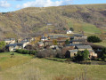
A beautiful excursion in the hills above the village of Err in Cerdagne, taking the Nuria trail with the Cami de Nuria refuge as your destination.
Discover five villages starting from Bourg-Madame
 6.17 mi
+374 ft
-384 ft
3h 10
Easy
Departure from Bourg-Madame (Pyrénées-Orientales)
6.17 mi
+374 ft
-384 ft
3h 10
Easy
Departure from Bourg-Madame (Pyrénées-Orientales)
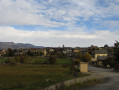
This cross-border route starting from the hamlet of Hix near Bourg Madame allows you to discover Bourg Madame, Osséja, Palau de Cerdagne and two villages in Puigcerda, Spain: Vilallobent and Age. You may even see the Yellow Train, part of the industrial heritage of the Pyrénées Orientales, during this trip.
From Plat d'Hospitalet to the Mariailles Refuge
 13.33 mi
+2,041 ft
-3,025 ft
7h 55
Difficult
Departure from Setcases (Girona)
13.33 mi
+2,041 ft
-3,025 ft
7h 55
Difficult
Departure from Setcases (Girona)
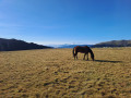
A beautiful hike between Spain and France from Plat d'Hospitalet to the Mariailles Refuge at the foot of Canigou. The route is varied with splendid views when crossing the mountain passes.
Llo Lion Circular Route
4.81 mi
+1,555 ft
-1,539 ft
3h 35
Moderate
Departure from Llo (Pyrénées-Orientales)
Apart from an interest in a play on words, we found no trace of the feline along this pretty route, which quickly rises above the village of Llo and allows you to visit Sant Féliu in its chapel. The view over Cerdanya is breathtaking and remains so all the way to the Pla plateau. A forest track on a balcony ensures the return to Port de Llo, from where it is easy to reach the narrow streets of the old village.
Sègre Gorges
 3.80 mi
+853 ft
-853 ft
2h 30
Easy
Departure from Llo (Pyrénées-Orientales)
3.80 mi
+853 ft
-853 ft
2h 30
Easy
Departure from Llo (Pyrénées-Orientales)
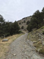
This route will take you deep into the Segre Gorges (a paradise for Via Ferrata climbers) andtake you to the ridges of the Sant Feliu Chapel with its breathtaking views, and, as the icing on the cake, the hot springs at the end of the route.
Water path in Bolvir
 Association / Club / Walk leader
 3.22 mi
+240 ft
-246 ft
1h 40
Easy
Departure from Bolvir (Girona)
3.22 mi
+240 ft
-246 ft
1h 40
Easy
Departure from Bolvir (Girona)
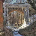
Classic walking roundtrip through the sorroundings of Bolvir, a village in Baixa Cerdanya, Catalonia.
Around Saillagouse
 6.94 mi
+797 ft
-794 ft
3h 55
Moderate
Departure from Saillagouse (Pyrénées-Orientales)
6.94 mi
+797 ft
-794 ft
3h 55
Moderate
Departure from Saillagouse (Pyrénées-Orientales)
A route allowing you to explore the surroundings of Saillagouse (villages, hamlets, the enclave of Llivia) with a high chance of encountering the Yellow Train.
Refuge de la Carença - Mantet
7.47 mi
+2,881 ft
-3,720 ft
5h 55
Moderate
Departure from Fontpédrouse (Pyrénées-Orientales)
Deuxième étape du circuit catalan pour rejoindre le village de Mantet.
Around Ur
 5.87 mi
+381 ft
-404 ft
3h 00
Easy
Departure from Ur (Pyrénées-Orientales)
5.87 mi
+381 ft
-404 ft
3h 00
Easy
Departure from Ur (Pyrénées-Orientales)
This cross-border route will take you to Llivia. Take the opportunity to make a short detour to visit this Spanish enclave.
Hamlets of Enveitg
 6.30 mi
+1,115 ft
-1,112 ft
3h 50
Moderate
Departure from Enveitg (Pyrénées-Orientales)
6.30 mi
+1,115 ft
-1,112 ft
3h 50
Moderate
Departure from Enveitg (Pyrénées-Orientales)
A beautiful, unspoilt getaway that will allow you to discover three hamlets belonging to Enveitg.
Pic de Costabona via the Serra de l’Ullat from La Preste-les-Bains
 9.39 mi
+4,446 ft
-4,449 ft
7 hrs
9.39 mi
+4,446 ft
-4,449 ft
7 hrs
 Very difficult
Departure from Prats-de-Mollo-la-Preste (Pyrénées-Orientales)
Very difficult
Departure from Prats-de-Mollo-la-Preste (Pyrénées-Orientales)
Another way to climb this Catalan peak situated on the France–Spain border.
Please take the following points into careful consideration.
A challenging hike due to its significant elevation gain and steep ascents and descents.
This hike should not be attempted in fog or mist. (¹)
Turn back if the weather changes. This peak is notorious for this weather phenomenon.
Set off very early in summer. (²)
Loop of the Ullat huts and the Refuge des Conques from La Preste
 8.09 mi
+3,205 ft
-3,196 ft
6h 30
Moderate
Departure from Prats-de-Mollo-la-Preste (Pyrénées-Orientales)
8.09 mi
+3,205 ft
-3,196 ft
6h 30
Moderate
Departure from Prats-de-Mollo-la-Preste (Pyrénées-Orientales)
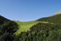
A very pretty circular path, well signposted and mostly shaded. Can be done in either direction. In the direction described, a lunch break can be planned at the Refuge des Conques. After the footbridge (2), the climb that follows is steady and continues through a magnificent beech forest. Water supply (7) at the edge of the forest, just before the huts. The Tech pass can be difficult, depending on the season. Then cross another beech forest, which is just as pretty. From Coll Baix (12), you can take the GRP® directly and reach the Roca Rodona fork. Shorter version of La Preste - Jasse de l'Ullat - Las Conques - Collada de la Solana
(!) Please note the GRP® detour. 25 July 2025. From(17) to (S/E). Detour (risk of falling rocks) La Preste
La Preste - Jasse de l'Ullat - Las Conques - Collada de la Solana
 8.98 mi
+2,713 ft
-2,713 ft
6h 30
Difficult
Departure from Prats-de-Mollo-la-Preste (Pyrénées-Orientales)
8.98 mi
+2,713 ft
-2,713 ft
6h 30
Difficult
Departure from Prats-de-Mollo-la-Preste (Pyrénées-Orientales)
A walk in the heart of the Prats-de-Mollo Nature Reserve – La Preste at the foot of Costabonne.The route follows connecting paths between the grazing areas on this mountain.Option to shorten the walk depending on the time available.
⚠️ Please note: GRP® diversion. 25 July 2025 => from(14) to (S/E). Temporary diversion via the Ronde du Canigou at ‘La Preste’
Loop of Coll de Siern and Cabane de l'Ullat from La Preste
 9.07 mi
+2,805 ft
-2,792 ft
6h 35
Moderate
Departure from Prats-de-Mollo-la-Preste (Pyrénées-Orientales)
9.07 mi
+2,805 ft
-2,792 ft
6h 35
Moderate
Departure from Prats-de-Mollo-la-Preste (Pyrénées-Orientales)
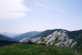
This hike requires a good sense of direction. There are numerous forks in the path and the markings are sparse or old. The route from (6) to (7) is not easy due to numerous fallen trees on the path. The GPX track is therefore necessary to confirm your position. Mostly shaded, this hike can be considered in summer, except in very hot weather.You can avoid following the trail between (6) and (7) by taking the track, then following the yellow and white markings on the left for 100 m until you reach (7).If necessary, two escape routes (7) and (10) allow you to quickly return to La Preste.
Elevation gain is close to 900 m. Allow 6 hours including breaks.
Coll de Pregon and Coll de Siern, Serra and Baraques de l'Ullat from La Preste
 9.37 mi
+2,917 ft
-2,904 ft
6h 50
Difficult
Departure from Prats-de-Mollo-la-Preste (Pyrénées-Orientales)
9.37 mi
+2,917 ft
-2,904 ft
6h 50
Difficult
Departure from Prats-de-Mollo-la-Preste (Pyrénées-Orientales)
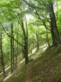
Very beautiful (difficult) climb through the forest from Veïnat de la Farga to the large Coll Pregon. This border grazing area is still in use. Then a beautiful ridge line with a few bumps towards Costabona. But you will need to turn off well before this into the forest at Coll de Siern. The passage through the grazing area of Cabanes de l'Ullat is very beautiful. The return is then through the forest.
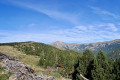
The former Costabonne garnet mines, viewed from La Preste-les-Bains
 10.42 mi
+3,501 ft
-3,484 ft
7h 50
Difficult
Departure from Prats-de-Mollo-la-Preste (Pyrénées-Orientales)
10.42 mi
+3,501 ft
-3,484 ft
7h 50
Difficult
Departure from Prats-de-Mollo-la-Preste (Pyrénées-Orientales)
A circular walk with no significant difficulties, apart from its length.
The climb up to the ridge from Coll Pregon, followed by the descent to the enclosure, offers superb views from east to west, from the Pic du Canigó to Mont Negre and, below, the Tech valley.
The Refuge and the Estany de Malniu
9.15 mi
+1,506 ft
-1,496 ft
5h 30
Moderate
Departure from Guils de Cerdanya (Girona)
A beautiful, unspoilt route across the border, starting from the Guils Fontanera Nordic ski resort in southern Catalonia, taking us to the Refuge and then on to the Estany de Malniu.
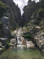
Pic de Costabonne via the Roc Colom
 11.96 mi
+3,888 ft
-3,888 ft
8h 55
Difficult
Departure from Prats-de-Mollo-la-Preste (Pyrénées-Orientales)
11.96 mi
+3,888 ft
-3,888 ft
8h 55
Difficult
Departure from Prats-de-Mollo-la-Preste (Pyrénées-Orientales)
A lovely walk offering views of Mont Canigou and the Catalan Pyrenees.
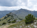
Collada del Vent – Puig de la Collade Verda – Collada de Roques Blanques
 10.45 mi
+3,140 ft
-3,143 ft
7h 30
Moderate
Departure from Prats-de-Mollo-la-Preste (Pyrénées-Orientales)
10.45 mi
+3,140 ft
-3,143 ft
7h 30
Moderate
Departure from Prats-de-Mollo-la-Preste (Pyrénées-Orientales)
From Las Conques, a lovely walk through pastures that are still well maintained.
Ridge walk (2,403 m). The route passes beneath the Esquerdes de Rotjà. Springs, shelters, shepherds’ huts and scenic viewpoints are all on the itinerary.
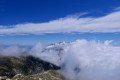
Costabona Peak from Las Conques
 9.74 mi
+3,419 ft
-3,425 ft
7h 25
Difficult
Departure from Prats-de-Mollo-la-Preste (Pyrénées-Orientales)
9.74 mi
+3,419 ft
-3,425 ft
7h 25
Difficult
Departure from Prats-de-Mollo-la-Preste (Pyrénées-Orientales)
The ascent to the Baraque de la Coma del Tech differs from the classic route. The climb up the famous Pic de Costabone passes by the well-known Cairn du Méridien de Paris. The descent to the Baraque de la Coma del Tech is also a more challenging alternative route.
Please note: crossing the Tech stream can prove tricky. You may need to take off your shoes.The descent from the summit can be considered very difficult. Alternative route details in the Practical Information section.
Warning: on 17 August 2026, a user reported:> the section through the forest between points ::2:: and ::3::. An impressive number of uprooted or broken trees, some of them very large.The Haut Vallespir suffered several storms in early 2026, causing extensive damage to all the forests.
Les Esquerdes de Rotjà from Les Conques via the source of the Tech
 10.23 mi
+3,051 ft
-3,038 ft
7h 20
Difficult
Departure from Prats-de-Mollo-la-Preste (Pyrénées-Orientales)
10.23 mi
+3,051 ft
-3,038 ft
7h 20
Difficult
Departure from Prats-de-Mollo-la-Preste (Pyrénées-Orientales)
A very lovely walk in Vallespir, on a signposted path, but one that is rarely used, allowing you to spot chamois and marmots.
See the ‘Practical Information’ section regarding the crossing of the Tech at the Ouillat huts ¹.
From the Refuge des Conques to the Refuge de Mariailles
 9.37 mi
+2,628 ft
-2,352 ft
6h 35
Difficult
Departure from Prats-de-Mollo-la-Preste (Pyrénées-Orientales)
9.37 mi
+2,628 ft
-2,352 ft
6h 35
Difficult
Departure from Prats-de-Mollo-la-Preste (Pyrénées-Orientales)
First stage of the: Loop from the Refuge des Conques to the Refuge de Mariailles
Mountain hike with beautiful scenery, particularly from Coll de Bise to Collada de la Roqueta.
Classified as difficult: exposed, steep slopes in places. See practical information.
Allow 6 hours of sustained walking.
Le Pla Guillem from the Cabane Pastorale des Forquets
 11.38 mi
+2,556 ft
-2,530 ft
7h 30
Difficult
Departure from Prats-de-Mollo-la-Preste (Pyrénées-Orientales)
11.38 mi
+2,556 ft
-2,530 ft
7h 30
Difficult
Departure from Prats-de-Mollo-la-Preste (Pyrénées-Orientales)
A fairly long hike, mostly on open terrain. Plenty of 360° views.Passes by watering holes, mountain passes, stone-paved paths, stone huts and a refuge.Trails at the start and finish of this beautiful hike.Please note: Nature Reserve. Specific regulations apply.Avoid this hike during heatwaves and when there is heavy snow.Classified as difficult as a basic sense of direction is required.Warning: the Pla Guillem area is very hazardous in foggy conditions and it is often very cold there. The GPX track is essential: the weather changes very quickly.Outside the summer season, when the barrier is raised at the Forquets car park: you can start at (1). This saves 3 km on the return journey.
The Col de Bise in the Vallespir
11.34 mi
+3,698 ft
-3,684 ft
7 hrs
Very difficult
Departure from Prats-de-Mollo-la-Preste (Pyrénées-Orientales)
A lovely circular route in Vallespir, partly on a very good path and partly off-trail, offering varied scenery.
Circular Pla Guillem via Coll des Basses – Cabane des Cums – Coll del vent
 10.31 mi
+2,589 ft
-2,589 ft
7h 00
Moderate
Departure from Prats-de-Mollo-la-Preste (Pyrénées-Orientales)
10.31 mi
+2,589 ft
-2,589 ft
7h 00
Moderate
Departure from Prats-de-Mollo-la-Preste (Pyrénées-Orientales)
A very pleasant circular route on well-marked paths. However, a good sense of direction is still required, as there are different markings to follow.Warning: the Pla Guillem area is very hazardous in foggy conditions and it is often very cold there. The GPX track is essential: the weather changes very quickly.*This hike can be classified as difficult. The 7-hour duration indicated by the software is fairly accurate. Not all the paths are easy to walk on.The scenery is very beautiful. The Cums hut and the Pla Guillem refuge offer places to rest.This hike should be avoided during heatwaves and in heavy snow.Please note the restricted access to the car park at La Togne towards Coll de les Basses: see practical information.
From Collada de Roques Blanques to Pla Guillem via the ridges
 10.51 mi
+3,228 ft
-3,268 ft
7h 40
Difficult
Departure from Prats-de-Mollo-la-Preste (Pyrénées-Orientales)
10.51 mi
+3,228 ft
-3,268 ft
7h 40
Difficult
Departure from Prats-de-Mollo-la-Preste (Pyrénées-Orientales)
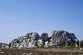
Most of the walk is out in the open, with some very beautiful scenery. First, a steep climb to Puig de Collada Verda (marker 2403) and a geodesic marker. This is followed by a route along the ridge and a passage to Collada del Vents. Then watch out for the rocky Cingle dels Pelegrins, where there is no fence or protection. Keep away from them by following the path marked on the ground. A large cairn marks the end of the ridge. A return trip to Pla Guillem (signpost) allows you to enjoy the scenery.
Classified as difficult due to the length and number of ascents and descents throughout the hike and a dangerous zone (15) at (17).
Les Queroses - Coll de Bise - La Parcigoule
 9.43 mi
+3,402 ft
-3,396 ft
7h 20
Difficult
Departure from Prats-de-Mollo-la-Preste (Pyrénées-Orientales)
9.43 mi
+3,402 ft
-3,396 ft
7h 20
Difficult
Departure from Prats-de-Mollo-la-Preste (Pyrénées-Orientales)
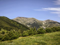
From Perpignan, head towards Le Boulou, Céret, Amèlies-les-Bains, Prats de Mollo via the D115. Then head towards La Preste via the D115a. Then turn right towards Parcigoule. Continue to the end of the tarmac road and park as soon as possible after the farm, without obstructing the passage. See practical information (¹).A sense of direction is necessary. The signposting is good in thefirst part.Plan for a simple return trip after heavy rain. See the practical information section (²).
The Campcardos circular route from the Malniu refuge
 6.89 mi
+3,005 ft
-2,989 ft
5h 45
Moderate
Departure from Meranges (Girona)
6.89 mi
+3,005 ft
-2,989 ft
5h 45
Moderate
Departure from Meranges (Girona)
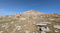
This hike, which starts in Spain, will take you to the summit of one of the three “2,900-metre peaks” in the Pyrénées-Orientales: Campcardos or Puig Pedros (2,915 m). It offers contrasting landscapes, ranging from high-altitude plateaus reminiscent of steppes to jagged ridges, ponds and balcony-like paths through beautiful forests of mountain pine. The border runs across the summit of Campcardos, making it the highest point in the province of Girona, ahead of Puigmal d’Err (2,910 m).
More walks in les Llosses
Select a point of interest below: