Water path in Bolvir

Classic walking roundtrip through the sorroundings of Bolvir, a village in Baixa Cerdanya, Catalonia.

Technical sheet

4100798
Creation:
Last update:
Last review:
  • Walking
    Activity: Walking
  • ↔
    Distance: 5.18 km
  • ◔
    Average duration: 1h 40 
  • ▲
    Difficulty: Easy

  • ⚐
    Return to departure point: Yes
  • ↗
    Vertical gain: + 73 m
  • ↘
    Vertical drop: - 75 m

  • ▲
    Highest point: 1,199 m
  • ▼
    Lowest point: 1,115 m

Photos

Description of the walk

(S/E) Start your walk by the Chapel of Remei following the path (to the north) till the very first crossing.

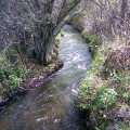
(1) At the crossing, follow the paved path to the left, close to the channel providing water to the village of Bolvir, crossing nice forests and having splendid views of the Cadí mountains.

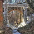
(2) Through the way, you will eventually see an old bridge hidden in the shadows. Keep following the path till next crossing

(3) At the crossing, turn left, entering the streets of Bolvir: Espiraltes St., then Urgell St. Once in Bolvir, you may eventually visit

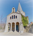
(4) Church of Saint Cecile and her sister, the Chapel of Esperança. Keep walking through Antoni Elies St. till The Chapel of Remei. This part of the track is a pleasant walk through the shadows.(S/E)

Waypoints

  1. S/E : km 0 - alt. 1,157 m - Chapel of Remei
  2. 1 : km 0.84 - alt. 1,196 m - Crossing
  3. 2 : km 2.69 - alt. 1,198 m - Bridge
  4. 3 : km 3.79 - alt. 1,182 m - Crossing
  5. 4 : km 4.12 - alt. 1,141 m - Church of Bolvir
  6. S/E : km 5.18 - alt. 1,155 m - Chapel of Remei

Practical information

In the nearby area

Chapel of Remei
(4) Church of Saint Cecile and Chapel of Esperança

Other walks in the area

For more walks, use our search engine .

The GPS track and description are the property of the author. Do not copy them without permission.