Country:

 City:
City:


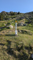
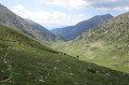
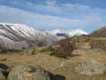
The start of the walk is at the Malniu Refuge at 2,128 m. From France, the refuge can be reached via Puigcerdà, Ger and Méranges. After Méranges and the hamlet of Girul, the road narrows but remains tarmacked for 6.5 km. It turns into a decent track after the last hairpin bend for the remaining 2 km.
(S/E) At the end of the car park, leave the refuge on your right and take a metal footbridge spanning a small lake. Walk alongside the campsite on your left and look out for the GR®11 signposts. Follow these for about 500 m and leave the GR® at a sign marked ‘Campcardos’. Turn right. From this point to the summit, the route is signposted with this type of sign or yellow posts. Begin the ascent first on a diagonal, then directly up the slope to a barely marked pass at an altitude of 2,480, the Coll de les Molleres.
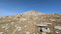
(1) From the Coll de les Molleres, you can already see the summit; head slightly north-east, again straight up the slope, without any difficulty. At an altitude of around 2,650 metres, the path approaches the edge of a rocky cirque on the left. You emerge onto the vast ‘Perdius Blanques’ plateau. Progress is quicker here. The faint path is of little use as you can now follow the terrain by sight. In foggy conditions, a few cairns may help. Campcardos has two peaks; maps indicate the northern peak as the highest. It is this peak that the marked path leads to.
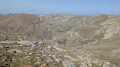
(2) The southern summit, reachable in 2 minutes, offers a slightly clearer view towards Cerdagne and the plateau you have just crossed. From the northern summit, you will now leave the markings behind. Look out for a line of cairns to the north-west. Follow it down a very gentle slope towards a small pass on the left. About 300 metres past the summit, you’ll join a path that is initially faint but becomes clearly visible and easy to follow as soon as the slope levels off. You’ll then have a bird’s-eye view of the Engorgs cirque and your next destination: the Portella Blanca de Meranges. The Engorgs mountain hut (Folch i Girona) is also clearly visible to the south-west during the descent and allows you to see the rest of the route.
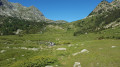
(3) At the pass, head down to the left. In summer, there is a striking contrast between the rocky, steep northern slope and the pastoral southern slope, which is gentler and dotted with small lakes. The route described here deliberately passes well to the left of the lake (Molleres d’Engorgs on the Spanish map) to avoid a wetland area. It descends gently across open meadows and reaches the refuge after crossing a stream.
(4) From here on, we’ll follow the GR®11 to the left for the remainder of this walk. We descend towards the stream and then climb back up the opposite side for about 250 metres. Be sure to keep to the right and look out for the slightly steep, scree-covered section that leads down into the gorges. We then follow the GR® along a fairly long, safe, ledge-like path, admiring some magnificent examples of mountain pines. As soon as we emerge from the forest, we can see the mountain hut, which we reach in 10–15 minutes (S/E).
 Visorando Member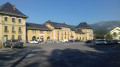
 Difficult
 Very difficult
 Association / Club / Walk leader
 Easy
Easy