Puigmal d’Err – de Petit Sègre – de Llo – de Coma Dolça – Les Planes Mountain Hut

A difficult and long mountain hike with no fewer than four peaks along the France-Spain border ridge. Passes by a charming hut and, after a very beautiful balcony path, leads to the pastoral refuge.
The section along the border ridge is absolutely stunning.

A GPX track on the app or a GPS is absolutely essential.
A hike best undertaken from late May until the first snows.

Part of the route is shared with one of my other hikes

Details

27727743
Creation:
Last update:
Last review:
  • Walking
    Activity: Walking
  • ↔
    Distance: 10.13 mi
  • ◔
    Average duration: 8h 00 
  • ▲
    Difficulty: Difficult

  • ⚐
    Back to start: Yes
  • ↗
    Ascent: + 3,839 ft
  • ↘
    Descent: - 3,848 ft

  • ▲
    Highest point: 9,544 ft
  • ▼
    Lowest point: 6,247 ft
  • ⚐ Country: France
  • ⚐
    Area: Pyrenees
  • ⚐ City: Err (66800)
  • ⚑
    Start/End: N 42.395421° / E 2.07771°
  • ❏
    IGN map(s): Ref. 2250ET, 2250ETR
  • Hour-by-hour weather

Photos

Description of the walk

Coming from Perpignan or Mont-Louis, continue along the N116 towards Bourg-Madame. Pass Err on your left and, before Sainte-Léocadie, turn left onto the D89 towards the Err-Puigmal ski resort until you reach a barrier. There is a large car park before this new barrier (2022). The old car park is off-limits. A cycle path (closed to all motorised vehicles) has been tarmacked as far as Jassa del Prat de Tossa.

Scatteredyellow markings and wooden trail posts indicating the elevation gain achieved.

(S/E) Go through the barrier and continue along the tarmac road, heading south-east. Once past the old car park, the road becomes a tarmac cycle path. Follow it to the sharp right-hand bend.

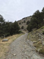
(1) At this bend, carry on straight ahead, leaving the drinking water building on your right. Follow the Ribera d’Err along a steep, non-vehicular track. Continue to the end of the track and join another track.

(2) Turn right onto this track and follow it for about a hundred metres, then look out for the start of a path on the left, marked with a yellow sign at elevation 2217.

(3) Head left up this very steep path, which turns due east. Given the very steep gradient, don’t hesitate to take breaks and enjoy the beautiful scenery. Pass the ruins of an old hut, then turn south-east and, much higher up, reach a very clearly marked fork at an elevation of 2637.

(4) Continue due east, climbing steeply over the rocky path. You’ll reach a sort of pass at the border ridge at around 2,850 m.

(5) Carry on to the left, heading north-east. Note, in the distance, the crosses marking the summit of Puigmal d’Err. Head towards the summit.

Helpful signposting: wooden trail posts.

(6) Take care: many paths lead off from this summit. Descend due north along one of the paths and continue down the border ridge along a very good path which leads to a rocky area and then to a sort of pass at an elevation of 2,809 metres. Magnificent scenery throughout the descent.

(7) Turn left, heading due west, through rocky terrain to reach the Col du Puigmal Petit de Segre at around 2,807 m.

(8) Ignore the descent to the left which leads back to the car park. This is an alternative route if necessary.
Continue due west, climbing up to the Puigmal de Petit de Segre at an elevation of 2,801 metres.

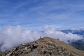
(9) Stunning panoramic views and a lovely spot for a lunch break.
Continue along the ridge, descending slightly towards Puigmal de Llo. Follow the well-marked path, which turns south-west at a faint fork in the path, up to an altitude of 2,705 m.

(10) Please note: change of direction.
Head due north-west; there is no clearly marked path on the ground. A wooden trail marker was still in place on 13 October 2022. Continue down the grassy, stony ridge and pass Puig de Coma Dolça at an elevation of 2,587 metres. Reach the junction of the grassy ridges at around 2,525 metres.

(11) Then veer slightly to the right, north-north-west, still following the descending ridge. Pass a large cairn and then, much lower down at around 2,310 m, join a good path that is very clearly marked on the ground; this is supposed to be the GRT73 but is not signposted.

(12) Follow this lovely Cami de Nuria to the left, marked as the GRT73 on the IGN map. Reach the Coll de Segalera at around 2,185 m.
Please note: change of direction. Head west, still following the clear path marked on the ground, and reach a clearly marked junction after turning due south.

No signposting. Traces of a blue mark on a stone at the start. End of the trail’s wooden posts.

(13) Leave the GRT73 on your right and continue due south along a very beautiful balcony path. Pass the Collet dels Vaquers, then finally cross the Rec de la Mata, turning due west for about 100 m.

(14) Please note: at around 2,030 m, there is a change of direction; the IGN route is inaccurate at this junction.
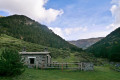
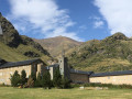
Head south-west, passing by a magnificent wooden hut. It is essential to follow the GPX track using a GPS device or the app. The numerous paths in the area can be confusing. Stay almost level throughout, heading generally south-south-east.

(15) At around 1,915 m, the path descends steeply and rapidly into a clearing and turns south. Head for the Refuge Pastoral des Planes.
Note: there are blue directional markers which we did not notice during the descent.

(16) Cross the wooden footbridge, continue along the north-west-bound track and reach the D89 road.

(17) Turn left onto this road and head for the car park at the foot of the chairlift (S/E).
Waypoints

  1. S/E : mi 0 - alt. 6,522 ft - Car park at the foot of the chairlift
  2. 1 : mi 0.79 - alt. 6,804 ft - Junction on the track
  3. 2 : mi 1.27 - alt. 7,264 ft - Junction
  4. 3 : mi 1.35 - alt. 7,280 ft - Junction
  5. 4 : mi 2 - alt. 8,652 ft - Junction
  6. 5 : mi 2.4 - alt. 9,354 ft - Junction
  7. 6 : mi 2.54 - alt. 9,544 ft - Puigmal d'Err
  8. 7 : mi 3.35 - alt. 9,206 ft - Small pass - Le Puigmal Petit de Segre
  9. 8 : mi 3.45 - alt. 9,035 ft - Fork in the path. Pass. Opposite
  10. 9 : mi 3.67 - alt. 9,150 ft - Puigmal de Llo
  11. 10 : mi 3.98 - alt. 8,878 ft - Junction. Turn right
  12. 11 : mi 4.7 - alt. 8,297 ft - Ridge junction
  13. 12 : mi 5.37 - alt. 7,589 ft - GRT73. Cami de Nuria
  14. 13 : mi 6.78 - alt. 6,781 ft - Junction. Turn left
  15. 14 : mi 7.98 - alt. 6,693 ft - Junction. Turn left. Hut
  16. 15 : mi 8.74 - alt. 6,713 ft - Descent
  17. 16 : mi 9.12 - alt. 6,276 ft - Pastoral Refuge of Les Planes
  18. 17 : mi 9.7 - alt. 6,352 ft - D89
  19. S/E : mi 10.13 - alt. 6,519 ft - Car park at the foot of the chairlift

Notes

Your sat-nav will no doubt suggest you go via Err to reach the resort. Having done this myself, I would advise against it: the cows block the narrow track when they are on summer pasture (mid-May to September).
From Perpignan, head towards Andorra via the N116. Then, 3.5 km after Saillagousee, turn left onto the D89, following the sign for ‘Station du Puigmal’.
Or take the N20 from Toulouse (Puymorens Tunnel). ‘Train Jaune’ station: Err.

This is a high-altitude mountain area (2,910 m): bring rainwear, water, a packed lunch, a GPX track, route description, map, GPS or the Visorando app, a camera, good walking boots and a walking stick.

Please note: I mention the wooden trail markers, but these are unreliable, prone to rotting and easily damaged and/or pulled up by grazing animals.

Water is available at the start of the walk (tapped spring).
Water must be filtered or disinfected at the Rec de la Mata (torrent) before the (14), and at the Ribera d’Err (16).
A hut at (14) and a refuge at (16).

Worth a visit

Latour-de-Carol – Enveigt: international station. From France, the SNCF operates the Train Jaune from Villefranche-de-Conflent, the TER Occitanie from Toulouse, and from Spain, RENFE operates a commuter-style R3 train from Ripoll; naturally, the three trains run on tracks with different gauges... Wikipedia

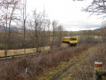
The Train Jaune.
Saillagouse.

Reviews and comments

4.2 / 5
Based on 3 reviews

Reliability of the description
4.5 / 5
Ease of following the route
3.5 / 5
Route interest
4.7 / 5
Betph01
Betph01

Overall rating : 3.7 / 5

Date of your route : Aug 11, 2025
Reliability of the description : ★★★★☆ Good
Ease of following the route : ★★★☆☆ Average
Route interest : ★★★★☆ Good
Very busy route : No

Between the Segalera Pass and the small pass called Collet dels Vaquers, there are practically no markings, the path is barely visible on the ground and the vegetation is dense! A GPX track is necessary to stay on the path.

Machine-translated

Christophe PO
Christophe PO

Overall rating : 4.7 / 5

Date of your route : Sep 16, 2024
Reliability of the description : ★★★★★ Very good
Ease of following the route : ★★★★☆ Good
Route interest : ★★★★★ Very good
Very busy route : Yes

A truly beautiful hike leading to one of the peaks of the Pyrénées-Orientales.

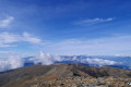
After a fairly long and rather challenging climb, reaching the summit of Puigmal rewards you with a breathtaking 360-degree view (we were lucky enough to do this hike on a completely cloudless day).

The descent is broadly divided into four stages:
- The ridge – magnificent!
- A vast area of mountain pastures, also very beautiful.
- A wooded area, very pleasant, where it’s easy to lose your way.
- A hillside section where you walk through broom before reaching a lovely stream and the path that takes you back to the car park.

You’ll need to use the GPX track, particularly because of the gaps between the signposts on the ridge (see previous comments) and in the undergrowth.

Machine-translated

Curiosus
Curiosus
• Edited:

Overall rating : 5 / 5

Date of your route : Aug 21, 2023
Reliability of the description : Not used / Not applicable
Ease of following the route : Not used / Not applicable
Route interest : ★★★★★ Very good
Very busy route : No

This walk is truly magnificent; the scenery is stunning and varied. You pass through rocky areas, high-altitude grasslands, forests and meadows.
The climb from the start right up to the summit is very strenuous, but once you’ve got past that, the rest of the walk isn’t particularly physically demanding.
However, the section between points 10 and 15 does require a bit of care:
- In poor visibility, the section along the ridge between points (10) and (12) may be difficult to follow. The path is often barely visible or even non-existent, and the trail markers are too far apart to be followed in the fog. In good visibility, there’s no problem.
- Between points (13) and (15), certain sections of the path may be difficult to find and follow. I would say a GPS track is essential for this section.

Machine-translated

Other walks in the area

For more walks, use our search engine .

The GPS track and description are the property of this route's author. Please do not copy them without permission.