Country:

 City:
City:


White and yellow markings
(S/E) From the bottom of the large, designated car park at La Preste, head due west along the small road that crosses the River Tech via a road bridge. The road deteriorates and becomes a track. Pass a fenced-off water catchment area. Look out for signposts on your left at an altitude of 1166.
(1) Continue along the track. At a sharp left-hand bend, leave the track.
(2) There is a recent wooden signpost. Head into the forest and cross the footbridge over the Còrrec de la Solaneta.
Climb up a gullied path along the Còrrec de la Barragna on the left-hand side and, further up, rejoin a track.
(3) Turn left onto this small track. After several hairpin bends, you’ll come within sight of the large Mas de la Grevodella, currently being renovated, on your left. Do not go there. Head straight ahead along a very marshy path. Continue the climb until you reach an open, grazed area on the Collada d’en Manuel at around 1,470 m, then turn left. There is a cairn at the edge of the forest, which I have reinforced.
Stay on a good, well-marked path that climbs gradually north-west. Pass through an iron gate, making sure to close it properly. You’ll come to a lovely spring, then, continuing uphill, you’ll emerge onto the Ullat pasture, where you’ll find the shepherd’s hut and a large orri. * See ‘Practical information’ in case of bad weather. It’s best to turn back and head down to the car park...
(4) Head left, south-west, keeping an eye out for and following small wooden posts painted yellow.
Please note: the average gradient up to the summit (7) is 27 per cent.
Ignore the turnings to the right and climb steeply towards the pass at around 1715 m.
(5) Directional post protected by stakes and a large cairn. Possible alternative route – see ‘Practical information’.
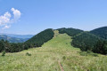
Turn right, at a 90° angle, climbing up the grassy ridge of the Serra de l’Ullat (mountain, ridge). Head north-west, keeping an eye out for and following the small wooden posts painted yellow.
Please note: You will need to leave the marked trail at around 1,850 m.
Offthe marked trail *
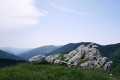
(6) Just before entering the forest, leave the yellow markings and the grassy ridge, and continue along what is now more like a ridge. I’ve placed a few cairns at the start. At the 1950-metre altitude, the route turns west and curves sharply to the left. Stay on the ridge. You’ll need to aim for all the small peaks, which serve as landmarks to guide your progress. The summit is clearly visible due west.
At the 2253-metre altitude, the route turns south-west. The summit is in sight and the gradient becomes steeper.
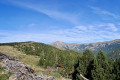
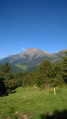
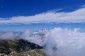
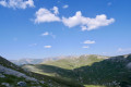
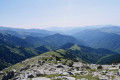
You’ll reach the summit platform of Pic de Costabona at an altitude of 2467. A majestic 360° panorama.
Generally from 11.30 am onwards, it gets quite busy as access from the Spanish side is easy. There is plenty of space to take a well-deserved break in peace and quiet.
Yellow markings on small wooden posts
(7) Look out for small wooden posts painted yellow on the south-eastern side once again.
Please note: the average gradient down to Coll de Siern is 21 per cent.
The route shown here takes into account the terrain and the detours required to safely avoid herds of cattle.
Caution: keep your distance from the cows and their calves; never cross these large herds.
So descend south-east from the summit along a stony, badly damaged and rutted path on the Soulanette ridge.
(8) At around 2,340 m, leave the winding path – which is faint and unmarked – on the left, as it descends over a grassy ridge towards the old garnet mines. The path to follow heads due south, keeping as close as possible to the France-Spain border fence. Descend towards a large, clearly visible pass at around 2,150 m.
(9) Please note: you must turn south-east at this point. Look out for and follow the yellow-painted posts.
Ignore the other grassy ridge heading due south into Spain. Do not descend via the wide path heading due south.
Follow the France–Spain border fence as closely as possible. Join the grassy ridge of Manarassous or Finestrol, staying on the border. The 360° view is stunning. Do not hesitate to turn round and admire the Pic du Costabona. Continue descending steadily, avoiding the herds and observing the safety precautions mentioned for the descent. Thank you.
(10) You’ll alternate between wooded areas and pastures. The path will rejoin the red and white markings –the GR® T – which can serve as a guide in addition to the yellow-painted wooden posts.
You’ll emerge onto a large pasture just before a climb. This is finally the Coll de Siern or Sizern, at around 1,630 m. There is a signpost and the freshly repainted boundary marker 514 (21 July 2020).
It’s also a lovely spot for a break before continuing on the next long descent through the forest.
(11) Head left into the forest, descending due north. Caution: after 50 m, at the fork, turn sharply right towards the east-north-east. There is an old wooden signpost. 600 m further on, ignore a right-hand fork leading to La Forga. You’ll reach a grassy track.
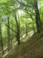
(12) Take care. Cross the track, veering slightly to the right, and a little further on you’ll find the path continues to the left beneath this track. Descend in hairpin bends through the forest.
Cross another track at an altitude of 1427. Continue along the path opposite, which also winds downwards.
Yellow and white markings
(13) Join another path. Old wooden signposts. Turn right onto this PR®.
Continue down the PR®. Cross another track again and continue the descent until you reach the wide track from the ascent at an altitude of 1166 metres.
(1) Continue to the right, following the route in reverse to the car park (S/E).


 Visorando Member
 Difficult
 Moderate