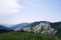
Les Esquerdes de Rotjà from Les Conques via the source of the Tech

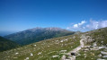
A very lovely walk in Vallespir, on a signposted path, but one that is rarely used, allowing you to spot chamois and marmots.
See the ‘Practical Information’ section regarding the crossing of the Tech at the Ouillat huts ¹.

Details

1260438
Creation:
Last update:
Last review:
  • Walking
    Activity: Walking
  • ↔
    Distance: 10.23 mi
  • ◔
    Average duration: 7h 20 
  • ▲
    Difficulty: Difficult

  • ⚐
    Back to start: Yes
  • ↗
    Ascent: + 3,051 ft
  • ↘
    Descent: - 3,038 ft

  • ▲
    Highest point: 7,815 ft
  • ▼
    Lowest point: 5,249 ft

Photos

Description of the walk

Start from the Chalet des Conques car park.

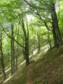
(S/E) Go through the gate and follow the yellow-marked route to Cabane de l’Ouillat, which climbs westwards, first along the old ski runs and then through the forest to reach Coll Baix.

(1) At the pass, continue straight ahead, still heading west, along the path which descends slightly towards Cabane de l’Ouillat, marked in yellow. This path generally runs along the hillside or descends to the River Tech.

(2) Please note that, depending on the time of year, crossing this river can be difficult, particularly during the snowmelt and after heavy rain.
You will then reach the Cabane Forestière de l’Ouillat (1,640 m), where there is a superb orri.

(3) From the huts, head towards “Coma del Tech”, still following the yellow markings, heading south-southeast. After a 120m climb, at 1,650m, the path turns west. It runs just above the Tech stream.

(4) At the “Baraque de la Coma del Tech” shelter (1,980 m), follow the signs for Pic du Costabonne, walking along the right bank of the Tech stream towards the south-west. The path is still marked in yellow.

(5) Just below the Coll del Pal (2,312 m), turn right, heading north-west towards Roc Colom (no signpost). The path stays on the hillside, skirting the headwaters of the Tech, then climbs gently towards the Porteilla de Rotjà, heading north-east.

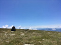
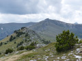
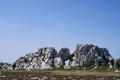
(6) At the Porteilla de Rotjà (2,332 m), you pass a rusty mountain hut, then a fence. You cross over to the other side of the slope and the path descends. Continue north-east along the Esquerdes de Rotjà ridge, towards Las Conques. Follow theGRP® Tour des Réserves Naturelles. The markings change to yellow and red. Follow the ridge for about 3 km, keeping to the left-hand side of the ridge, until you reach an altitude of 2,234 m.

(7) At the sign for Las Conques, turn right onto theGRP® Ronde du Canigó, still following the yellow and red markings. Go through the gate and head down towards the south-east. This path takes you back to Coll Baix.

(1) At the pass, head left towards the Chalet de Las Conques and return via the path you took on the way up to reach the car park (S/E).

Waypoints

  1. S/E : mi 0 - alt. 5,253 ft - Refuge de Las Conques
  2. 1 : mi 0.28 - alt. 5,548 ft - Coll de Baix (1691 m)
  3. 2 : mi 2.25 - alt. 5,305 ft - Tech (fleuve)
  4. 3 : mi 2.4 - alt. 5,367 ft - Ouillat Hut
  5. 4 : mi 3.77 - alt. 6,512 ft - Baraque de la Coma del Tech
  6. 5 : mi 5.02 - alt. 7,579 ft - Below the Coll del Pal
  7. 6 : mi 6.41 - alt. 7,776 ft - Porteilla de Rotjà
  8. 7 : mi 8.02 - alt. 7,329 ft - Pass 2234m
  9. S/E : mi 10.23 - alt. 5,256 ft - Refuge de Las Conques

Notes

¹ Caution: crossing the Tech, before the Ullat Forest Hut, can be dangerous during the snowmelt and after heavy rain.

This route passes through multiple protected areas, which may be subject to special regulations:

Reviews and comments

5 / 5
Based on 2 reviews

Reliability of the description
5 / 5
Ease of following the route
5 / 5
Route interest
5 / 5
lemarcheur65
lemarcheur65 ★
• Edited:

Overall rating : 5 / 5

Date of your route : Sep 03, 2024
Reliability of the description : Not used / Not applicable
Ease of following the route : ★★★★★ Very good
Route interest : ★★★★★ Very good
Very busy route : No

A walk I do regularly.
But, well, today there was heavy rain from the Cabanes de l’Ullat all the way to the Coll del Pal.
Then it eased off with just a little bit of sunshine. Then a light drizzle again.
A short break at the Cabane de Rotjà.
As beautiful as ever.
Below the Coll del Pal, a large herd of chamois.
Then two young chamois before the Porteilla des Avets.
What a sight.

Machine-translated

lecabos
lecabos

Overall rating : 5 / 5

Date of your route : Jul 16, 2020
Reliability of the description : ★★★★★ Very good
Ease of following the route : ★★★★★ Very good
Route interest : ★★★★★ Very good
Very busy route : No

A lovely hike on 16 July 2020 in fine weather, but taken in the opposite direction: Les Conques, Col de Baix, Porteilles des Avets, Porteille de Rotja, and down via the Col de Pal, the Jasse de l’Ouillat and the Col de Baix. A challenging hike. The path was well signposted. Quite busy between the Porteille de Rotja and the Col de Pal, and between the Jasse de l’Ouillat and the Refuge des Conques. Spotted a few marmots in the rocks above the Baraque de la Coma del Tech. Stunning views.

Machine-translated

Other walks in the area

For more walks, use our search engine .

The GPS track and description are the property of this route's author. Please do not copy them without permission.