Country:

 City:
City:


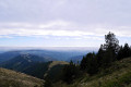
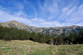
From Perpignan, head towards Le Boulou, then take the D115 towards Céret, followed by Amélie-les-Bains-Palada, Arles-sur-Tech and Prats-de-Mollo-la-Preste. Ignore the road leading to the Col d’Are and follow the D115A towards La Preste-les-Bains, where you’ll find a car park at the end of the road.
Red and yellow markings forthe GRP® Ronde du Canigou.
(S/E) Head back along the road you came on, passing through La Preste-les-Bains. Leave the road to Las Conques on your left and you’ll soon come to a major junction.
(1) Cross the road carefully and look for a path on the right that leads down towards Veïnat de la Farga (Hameau de la Forge). At the wash house, cross a bridge over the River Tech. You’ll reach the end of a tarmac road. Head left along the road for a few metres.
(2) Climb up to the right via some steps between the first houses. Very soon, turn right again at the fork in the path, heading towards Coll Pregon.
There is an information board explaining the origin of these paths. Please respect them; thank you.
Follow the path alongside a pasture on your right and a woodland on your left. At the fork in the path, turn left towards Espinabelle. The path then descends towards a stream (dry as of October 2019). Ford the stream and climb back up the other side.
(3) Pass through a fence via a designated gap. Continue straight ahead, following both the yellow markings and the red and yellow markings ofthe GRP® Ronde du Canigou along a wire fence.
(4) Further on, turn left at the fork. Ignore the yellow markings.
Now continue along a steep path, keeping an eye out for the red and yellow markings. Carry on climbing due south.
Stay on the path, without cutting across the bends. Pass through a fence via a designated gap. Continue the steep climb through the forest. You’ll reach a vast area of pasture on the border ridge.
Red and white + yellow + white markings.
(5) Coll Pregon. Pass through the newly installed (October 2019) four-wire fence via the designated opening. Border marker No. 515.
GRT 79 sign on this marker on the Spanish side. See possible alternative route in the ‘Practical Information’ section.
Head off to the right, due west; then north-west, keeping the recent fence on your right-hand side. Pass the Puig de l’Artiga del Rei. Around 1,560 m.
Caution: from this pass onwards, you are very likely to encounter herds of cattle. Please go round them, especially towards the end of the season as they are less tolerant.
Continue on the Spanish side, with the fence on your right.
(6) Coll de Maçanells. You’ll come to a large enclosure. Continue climbing.
(7) Cim de Portavella. You’ll reach another east-west fence running across the path, which descends to the right. Do not go down this path under any circumstances. Turn left, at a 90° angle, heading due west. Follow the border line shown on the IGN map. Look for a triangulation point (elevation 1687) to confirm you’re in the right place. Then follow the edge of the forest on your right-hand side. The route follows a track heading west on the Spanish side. The track then descends towards a pass.
(8) Coll de Siern. Border marker No. 514. Dilapidated signpost. Continue along the border ridge.
You will come across red and white markings, plus white and yellow, plus yellow, plus a few red ones. Follow the border fence on your right-hand side. The Costabonne is in sight. The route now follows the boundary of the Prats-de-Mollo Nature Reserve along the border ridge. The gradient increases. Look out for a large rock on the Spanish side, next to the fence.
No markings
(9) At around 2,030 metres, find a well-marked path to the right. I reinforced the cairn (17 September 2020). It heads due north, running along a ledge in a cleared area (October 2019). The felled trees have been left where they are. A few cairns help me find my way. After that, the path is obvious. Pass the Còrrec de la Solaneta.
The correct path turns right, heading due east, and comes out onto a flat area of pasture (work carried out in October 2019). This area shows that there has been intense human activity here. You are now in the Prats-de-Mollo Nature Reserve.
Yellow markings. Scattered in places but present all the way back to the car park.
(10) Continue to the right along the old mining track (or Costabonne track). The view due east is magnificent. Leave the climb up to Costabonne on your left.
This is where the old mines begin, where garnet – which still adorns much traditional Catalan jewellery – was once mined.
The track turns due north, still running along the ridge. Pass the Còrrec de la Font Negra (the valley of the Black Fountain). The track becomes very stony and rather rough going. It turns north-east.
Please note: in the field, follow the yellow markings carefully and take the various left or right turns as indicated.
(11) Turn right, heading south-west. 200 m further on, take a hairpin bend to the left, heading north-east.
Then the rough track turns north into the forest.
I’ve marked all the changes of direction: when descending, there’s a risk of taking a wrong turn.
It’s easier to follow on the map or on the GPS than on the ground.
(12) Turn sharply right at the point with an altitude of 1911 m, heading south-east.
(13) Take a sharp left-hand bend. There are numerous cairns and clear yellow markings. The track improves and emerges from the forest. The scenery here is also very pretty. There’s no longer any risk of getting lost. Descend via the clearly marked hairpin bends. Reach a fork in the track. Dilapidated signpost.
(14) Flat area. There is a large enclosure. Cross this area and head towards a simple wooden bench wedged at the foot of the rocks. There is a lovely view here too.
Continue due south along the Costabonne track, which descends steeply.
Pass three ‘còrrec’, then the track turns east.
Caution: after the third trough at around 1,510 m, pay close attention to the route description. The IGN map is inaccurate.
At the fork in the track, carry on straight ahead along the track. Ignore the path on the right towards the Coll de Siern. A little further on, at an altitude of 1,510 m, look out for a yellow sign indicating a left turn. Ignore the well-maintained track that continues on level ground.
(15) Turn left into the forest. Follow the old mining track (or Costabonne track), which is more or less wide and disused. This section through the forest is pleasant. After passing another còrrec, rejoin the old track, which improves and continues to descend.
You are now leaving the Prats-de-Mollo Nature Reserve.
(16) Join a stony track. Continue to the right along this rough track. Further on, at a fork, leave a path on your right which also climbs up to the Coll de Siern.
Join a new track and continue downhill along it.
Cut across a very wide DFCI track. Continue downhill. A little further on, you can cut across the bend in the track via a good path that’s clearly marked on the ground.
(17) You’ll arrive at a track open to vehicles, reserved for residents and authorised users, in front of the Can Torra Faves farm (at Torre Fabes). Turn right towards La Preste-les-Bains. Cross a road bridge over the River Tech and arrive at the car park (S/E).


 Visorando Member
 Moderate
 Very difficult