Country:

 City:




Starting point at the Las Conques mountain refuge. To reach it, drive past Prats de Mollo. Head towards La Preste. Before entering La Preste, turn right at the junction. Drive up towards the refuge along a tarmac road. Car park at the Las Conques mountain refuge.
(S/E) From the refuge, head due west along theGRP® path, marked in red and yellow, which climbs through the pasture towards a pass.
(1) Coll Baix. Turn right through the forest, following theGRP® Ronde du Canigó. Head uphill towards La Porteilla.
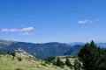
(2) Porteilla dels Avets. Views of Les Mantets, Canigó and, on a clear day, the Bay of Rosas.
TheGRP® des Réserves Naturelles heads off to the left, heading south-west. Follow the Esquerdes de Rotjà to the Porteille de Rotjà.
(3) The path branching off to the left leads to the Rotjà shepherd’s hut (made of sheet metal).
Confusing section: at the Porteille de Rotjà, carry straight on. The first few metres of the path are not easy to spot. However, the trail becomes clearer further on. The markings are yellow.
At the summit, continue due west. You’ll reach the Mort de l’Escolà plateau. Go through the fence.
(4) Crossroads. Carry on straight ahead, climbing due west towards the summit. Ignore the two paths branching off to the right.
(5) Roc Colom. A very unobstructed view of the surrounding peaks. Descend to the left, due south, following the border ridge. This ridge overlooks the streams that form the Tech, which flows into the sea at Argelès-sur-Mer.
(6) Continue to the summit of the Pic de Costabonne, via the Coll del Pal, still following the border ridge. Before starting the ascent, a marker indicates the Paris Meridian. This meridian was long used as a geographical reference before being superseded by the Greenwich Meridian.
(7) Pic de Costabonne. 360° panoramic view. On the Spanish side, the Costabonne refuge is not far away, should you need it.
Descend from Costabonne via the same route to the Paris Meridian cairn. Turn right onto a well-marked path.
Note: you can also follow the yellow markings to the Col del Pal and follow the yellow markings to the right (2,312 m).
(8) From there, follow the yellow-marked trail carefully, guided by markings or posts.
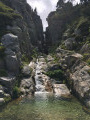
(9) Leave the track and head down to the left to admire the waterfall. The view is well worth the detour, especially when the Tech is flowing strongly.
Return to the path, marked in yellow, following the River Tech. Continue to the Baraque de la Coma del Tech
(10) A rough hut built of flat stones. Watch out for herds. Turn left, following the yellow markings, taking the alternative route that runs above the river on your left. Head down towards the huts.
(11) You’ll reach the Ullat Foresters’ Hut. A complex of two huts: a recent one and a large, old ‘orri’.
Please note: the path resumes, heading due west, at the top of the embankment behind the hut. Follow the yellow-marked path again. The path leading down, situated in front of the hut, leads to La Preste.
Please note: the Tech pass (1,616 m) can be difficult to cross after heavy rain or storms, and in spring.
Follow the path to the Col de Baix.
(1) Continue straight on, descending towards the refuge. Meals, drinks and accommodation are available (S/E).

 Visorando Member

 Moderate