Country:

 City:
City:


To get there, head to St Joan des Abadesses then to Ogassa; the walk starts from the chapel of Sant Marty d’Ogassa. Please note: narrow mountain road. Car park just before the chapel.
**Start:** the path leaves the road near the chapel, heading north-west.
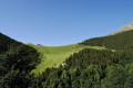
It initially runs through a small wooded area before winding its way northwards across the meadows.
The trail is marked with yellow signs, along with some older markings consisting of white circles and green circles.
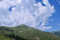
On emerging from the woodland, you begin a series of hairpin bends towards Portella d’Ogassa (from the VL to the pass or Portella, a 1½-hour climb).
**Stage 1:** At the Portella, turn left heading due west towards the Taga, which you should be able to see, marked by a cross at the summit.
**Stage 2:** To descend, head due east along the ridge, then after about 300 m, begin the descent ----> south; the path is clearly visible on the ground and leads down through the meadows to the road.To head back down, set off due east along the ridge, then after about 300 m, begin the descent ----> south; the path is clearly visible on the ground and leads down through the meadows to the road.
**Stage 3:** At the road, head east and, after the first bend, you’ll see a mountain hut below; head towards it and, below the hut, a path branches off to the north-east – it’s marked in yellow, though only sparsely. This path will take you back to the starting point.
**Finish:** back at the chapel
 Visorando Member
 Easy
Easy 
 Difficult
 Very difficult