The Col de Bise in the Vallespir

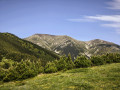
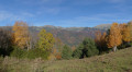
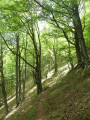
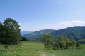
A lovely circular route in Vallespir, partly on a very good path and partly off-trail, offering varied scenery.

Details

318987
Creation:
Last update:
Last review:
  • Walking
    Activity: Walking
  • ↔
    Distance: 11.34 mi
  • ◔
    Duration according to the author: 7 hrs 
  • ▲
    Difficulty: Very difficult

  • ⚐
    Back to start: Yes
  • ↗
    Ascent: + 3,698 ft
  • ↘
    Descent: - 3,684 ft

  • ▲
    Highest point: 6,312 ft
  • ▼
    Lowest point: 2,828 ft

Description of the walk

Park at the hamlet of Saint Sauveur.

(S/E) Head down to the place known as Mas Pla.

(1) Take the road on the right and join the Rd115a.

(2) Follow the Rd115a to the right as far as Mas de Graffouil.

(3) Take the track on the right and pass through the hamlet of La Salle. At a hairpin bend, you’ll reach a crossroads of footpaths.

(4) After the hairpin bend, take the path leading uphill to the left (wooden sign) at an altitude of 1,160 metres; ignore the track which continues towards the chapel. Continue along this path, known as Bac Del Camp Llarg, passing through the ruins of Cortal Créma and then those of Paracon before reaching a small stream at an altitude of 1,480 metres.

(5) Head due north along the stream. From here, leave the path for a short off-trail section; it’s not difficult, just a bit overgrown depending on the season. This shortcut saves a few kilometres compared to following the path, which would take you to the road that you’d then have to follow up to Les Forquets. Head up along the stream then towards the 1550 mark; continue north-north-east across the meadow until you reach the track.

(6) Follow it to the right as far as the Ravin de la Bagasse and look out for a signpost for the Tour du Canigou.

(7) Go through the gate and carry on, off the track again, heading east-north-east, until you reach the track (altitude 1844 on the map).

(8) From there, follow the ridge, passing by the Cabane d’en Miquel (which is actually an orri), and continue to the Col de Bise (located next to the boundary marker and having an altitude of 1925m).

(9) Begin the descent as the terrain dictates, heading east-southeast to reach the cattle enclosure at the Col des Basses (a lovely viewpoint with a map and information board).

(10) Continue the descent, keeping close to the ridge, still off the beaten track towards the pine trees, until you reach them.

(11) You’ll come to a path that’s faint at first but becomes clearer, winding through the trees and leading to the Collada Grande. Join the excellent, well-marked path coming from Cal Cabous.

(12) Turn right onto it and descend through the forest via numerous hairpin bends. You’ll reach a track again in a clearing.

(13) Turn left and stay on it for about a hundred metres.

(14) Leave the track and turn right again onto the path that leads downwards. You’ll reach another track with a ford where you can dip your feet in the water.

(15) From there, follow the track down (southwards) to the junction at the hamlet of Mas Pla.

(1) Turn right and head for the Saint Sauveur car park (S/E).

Waypoints

  1. S/E : mi 0 - alt. 3,002 ft - St Sauveur
  2. 1 : mi 0.22 - alt. 2,920 ft - Mas Pla
  3. 2 : mi 0.45 - alt. 2,828 ft - On the right, follow the Rd115a to Mas de Graffouil – Tech (river)
  4. 3 : mi 1.26 - alt. 3,120 ft - Mas Graffouil
  5. 4 : mi 3.07 - alt. 3,766 ft - Start of the trail
  6. 5 : mi 5.25 - alt. 4,833 ft - Point 1487, end of the trail
  7. 6 : mi 5.75 - alt. 5,446 ft - Track
  8. 7 : mi 6.19 - alt. 5,571 ft - Bagasse Ravine
  9. 8 : mi 6.43 - alt. 6,027 ft - Track, altitude 1844
  10. 9 : mi 6.75 - alt. 6,312 ft - Waymark, altitude 1925
  11. 10 : mi 7.24 - alt. 5,883 ft - Col or Coll de les Basses (1,796 m)
  12. 11 : mi 7.3 - alt. 5,837 ft - Start of the trail, 1,780 m
  13. 12 : mi 7.44 - alt. 5,600 ft - Collada Grande
  14. 13 : mi 9.64 - alt. 3,734 ft - Clearing
  15. 14 : mi 9.76 - alt. 3,704 ft - End of track
  16. 15 : mi 10.2 - alt. 3,163 ft - Ford
  17. S/E : mi 11.34 - alt. 3,015 ft - St Sauveur

Notes

The first 2 km are along the road; there is little traffic but cars do travel fast, so take care.
As part of the walk is off-trail, it is essential to have a map and know how to find your way.

This route passes through a protected area, which may be subject to special regulations:

Reviews and comments

5 / 5
Based on 2 reviews

Reliability of the description
5 / 5
Ease of following the route
5 / 5
Route interest
5 / 5
BORIS MARVIER
BORIS MARVIER

Overall rating : 5 / 5

Date of your route : Sep 28, 2018
Reliability of the description : ★★★★★ Very good
Ease of following the route : ★★★★★ Very good
Route interest : ★★★★★ Very good

Do be careful, however, when cutting across country as you head up the stream (at point 4); depending on the season, it isn’t always easy to tell which one it is. From the ruins, follow the map carefully.

Machine-translated

pinel.alain@wanadoo.fr

Overall rating : 5 / 5

Date of your route : Oct 24, 2017
Reliability of the description : ★★★★★ Very good
Ease of following the route : ★★★★★ Very good
Route interest : ★★★★★ Very good

The start of the route along the road takes a while, but you soon forget about it. A lovely circular route. The off-track sections are fairly straightforward as long as you have a GPS. Beautiful views.

Machine-translated

Other walks in the area

For more walks, use our search engine .

The GPS track and description are the property of this route's author. Please do not copy them without permission.