The Refuge and the Estany de Malniu

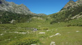
A beautiful, unspoilt route across the border, starting from the Guils Fontanera Nordic ski resort in southern Catalonia, taking us to the Refuge and then on to the Estany de Malniu.

Details

n°22576908
Creation:
Last update:
Last review:
  • Walking
    Activity: Walking
  • ↔
    Distance: 9.15 mi
  • ◔
    Average duration: 5h 30 
  • ▲
    Difficulty: Average

  • ⚐
    Back to start: Yes
  • ↗
    Ascent: + 1,506 ft
  • ↘
    Descent: - 1,496 ft

  • ▲
    Highest point: 7,421 ft
  • ▼
    Lowest point: 6,266 ft

Description of the walk

Park in the large car park at the Guils Fontanera Nordic ski resort.

(S/E) From the car park, head west to join the forest track, which you’ll follow for just under 5 km. Ignore all side paths. Further on, about a hundred metres after two hairpin bends, you’ll reach the Refuge de Feixa.
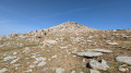
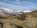
Stunning views of the peaks of the Pyrénées-Orientales (Carlit, Canigó, Puigmal d’Err, etc.).

(1) Continue along the track for another kilometre or so until you reach some signposts (you can park here and avoid the forest track).

(2) Leave the track and head west onto the yellow-marked route number 120 towards the Refuge de Malniu.
Take care with the markings on this section (as they are not very visible and are sometimes almost worn away on the trees); use the cairns instead, which are very common.
You will be following theGR®11on this stretch (though it is not very well signposted either).
After one kilometre, you’ll begin a descent leading to a junction.

(3) Treat yourself to a short 10-minute detour by turning left towards the Malniu Refuge (numbered 119).

::4: A magnificent, unusual refuge with a style of architecture we’re not used to seeing. Continue for a few metres towards the small Estany de Tarteres.

(5) Retrace your steps and return to the previous junction.

(3) This time, head towards Estany de Malniu (marked 119).
At the start of this section, follow the cairns as well, as the yellow markings numbered 119 are quite sparse. Don’t worry, however – as you continue along the route, they’ll become more frequent until you reach the lake.
You’ll climb a little, but there are no steep sections until you reach level ground again before coming to another junction.

(6) There are no signposts here (except for: Refugi Malniu 20 mins). Turn left onto the flat path which leads you, after about ten metres, to the magnificent spot where Estany de Malniu is situated.

(7) Enjoy this beautiful, unspoilt spot before retracing your steps back to the previous junction.

(6) Take the uphill path opposite, marked in yellow (numbered 120b).
You’ll walk through the forest for about 2 km before rejoining the trail you started on.

(2) All you have to do now is follow the route you took on the way there in the opposite direction to return to the car park (S/E).

Waypoints

  1. S/E : mi 0 - alt. 6,273 ft - Guils Fontanera Nordic Ski Centre car park
  2. 1 : mi 2.18 - alt. 7,106 ft - Feixa refuge
  3. 2 : mi 2.99 - alt. 7,211 ft - junction of the circular loop
  4. 3 : mi 3.76 - alt. 7,119 ft - Junction for the return route to the Malniu Refuge and towards - Estanyol de Tarterès
  5. 4 : mi 4.01 - alt. 6,998 ft - Malniu Refuge
  6. 5 : mi 4.11 - alt. 6,985 ft - Estanyol de Tarterès
  7. 6 : mi 4.87 - alt. 7,398 ft - Junction for the out-and-back route to - Estany de Malniu
  8. 7 : mi 5.1 - alt. 7,398 ft - Estany de Malniu
  9. S/E : mi 9.15 - alt. 6,270 ft - Guils Fontanera Nordic Ski Centre car park

Notes

You can watch a video of this walk via the following link: https://www.youtube.com/watch?v=rjrPdvJs...

There are few shaded sections, so remember to drink plenty of water and bring a hat or cap.

The two ponds provide a welcome chance to cool off.

You can shorten the route by parking at point (2).

Worth a visit

Guils Fontanera Nordic ski resort.

The Malniu Refuge is one of the stops onthe GR®11(SpanishGR®10). You can continue on towards the Engorgs Refuge.

Always be cautious and plan ahead when you're outdoors. Visorando and the author of this route cannot be held responsible for any accidents occurring on this route.

The GR® and PR® markings are the intellectual property of the Fédération Française de Randonnée Pédestre.

Reviews and comments

4.3 / 5
Based on 2 reviews

Reliability of the description
4.5 / 5
Ease of following the route
4 / 5
Route interest
4.5 / 5
NATGUIDO
NATGUIDO

Overall rating : 4.3 / 5

Date of your route : Sep 28, 2024
Reliability of the description : ★★★★☆ Good
Ease of following the route : ★★★★☆ Good
Route interest : ★★★★★ Very good
Very busy route : Yes

Hello, what a surprising walk! I decided to set off from your starting point, as following the track whilst being overtaken by cars seemed a bit of a chore. But what a lovely surprise when we reached the plateau and the Feixa mountain hut – the climb allowed us to soak up the beauty of the forest and the atmosphere. I followed the route and didn’t need to refer to the description. We got a bit confused before point 3 (we weren’t paying enough attention and missed the turn, heading straight for the pond). A very lovely pond in a superb setting. It was very busy. We carried on to Mal Pond, where there were fewer people. A lovely day. Thank you for this route
P.S. The track is in very good condition and a real joy to ride on.

Machine-translated

gres
gres

Overall rating : 4.3 / 5

Date of your route : Aug 29, 2022
Reliability of the description : ★★★★★ Very good
Ease of following the route : ★★★★☆ Good
Route interest : ★★★★☆ Good
Very busy route : Yes

The path leading to the Feixa mountain hut is utterly uninteresting. We walked it in the opposite direction. There were lots of people on the section leading to the lake; it has to be said that this area is very popular with Spaniards who are currently on holiday, and so even though the yellow markings were virtually non-existent, it was impossible to get lost. On the way back, we didn’t go to the Malniu refuge (we’re familiar with it). And we had a lovely haul of porcini mushrooms.
A very pleasant walk and well described. Well done!

Machine-translated

Other walks in the area

For more walks, use our search engine .

The GPS track and description are the property of this route's author. Please do not copy them without permission.