The Nahuja Pastoral Refuge

This route will take you deep into the heart of the forests of Nahuja and Osseja, with the Nahuja Pastoral Refuge as your destination.
You will walk approximately 14 km over a duration of 4 hours, with an elevation gain of 500 m. You will encounter three trail markings: the yellowPR®, the red and whiteGR®36, and the red and yellowGRP® Tour de Cerdagne.

Details

2931953
Creation:
Last update:
Last review:
  • Walking
    Activity: Walking
  • ↔
    Distance: 8.63 mi
  • ◔
    Average duration: 5h 25 
  • ▲
    Difficulty: Moderate

  • ⚐
    Back to start: Yes
  • ↗
    Ascent: + 1,624 ft
  • ↘
    Descent: - 1,617 ft

  • ▲
    Highest point: 5,696 ft
  • ▼
    Lowest point: 4,035 ft

Photos

Description of the walk

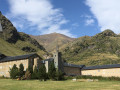
Park in the car park near Nahuja Church.

(S/E) Look for the red and white markings ofthe GR®36, which heads west towards Osseja (be careful not to take the path that climbs up into the village and heads towards Err).
This section is straightforward. TheGR®36markings lead you to Osseja without any trouble. Head for Osseja station.

(1) Walk past the station and leave theGR®36, which branches off to the right, and follow the red and yellow markings ofthe GRP® de Cerdagne, which heads straight along the main avenue. Make your way to the junction at Place Saint-Pierre.

(2) Leave theGRP® here and head straight ahead, following the yellow markings which lead uphill into the village. Turn left onto Rue des Pyrénées, then left again onto Ruelle Las Comas. Turn slightly right onto Traverse de Poujals. Finally, at a pylon, you’ll reach the junction with a forest track.

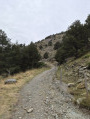
(3) Turn right onto this track; immediately on your right, ignore the track leading to the shooting range, and continue on to tackle a series of ten hairpin bends leading to the junction with the Route Forestière de Nahuja.

(4) Turn left onto this road and head downhill to reach the Nahuja Mountain Hut.

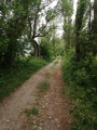
(5) Continue the descent by turning left onto the path, which is still marked in yellow. Walk through a mix of woodland and pasture. You’ll come to a large crossroads where theGR®36, theGRP® Tour de Cerdagne and thePR® meet.

(6) Turn sharply left onto theGR®36, marked in red and white, to quickly reach the car park at Nahuja Church (S/E).

Waypoints

  1. S/E : mi 0 - alt. 4,265 ft - Car park at Nahuja Church
  2. 1 : mi 1.26 - alt. 4,068 ft - Osseja station
  3. 2 : mi 1.57 - alt. 4,088 ft - Place Saint-Pierre
  4. 3 : mi 2.2 - alt. 4,400 ft - Forest track
  5. 4 : mi 5.39 - alt. 5,656 ft - Nahuja Forest Road
  6. 5 : mi 6 - alt. 5,522 ft - Nahuja Pastoral Refuge
  7. 6 : mi 8.09 - alt. 4,511 ft - GR-GRP-PR junction
  8. S/E : mi 8.63 - alt. 4,265 ft - Car park at Nahuja Church

Notes

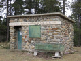
The Nahuja Refuge will provide shelter in the event of bad weather.

Worth a visit

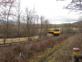
(Between S/E and 1) You may have the chance to discover the tourist attraction of Cerdagne between Nahuja and Osseja, namely the Train Jaune.
(2) Saint-Pierre Church is a listed historic monument.
(5) Nahuja Refuge: picnic area available, shelter provided.

Always be cautious and plan ahead when you're outdoors. Visorando and the author of this route cannot be held responsible for any accidents occurring on this route.

The GR® and PR® markings are the intellectual property of the Fédération Française de Randonnée Pédestre.

Reviews and comments

4.7 / 5
Based on 3 reviews

Reliability of the description
5 / 5
Ease of following the route
5 / 5
Route interest
4 / 5
bernard coulomb
bernard coulomb

Overall rating : 4 / 5

Date of your route : Jun 12, 2026
Reliability of the description : Not used / Not applicable
Ease of following the route : ★★★★★ Very good
Route interest : ★★★☆☆ Average
Very busy route : No

Apart from an original and very pleasant stretch at the start of the route, the rest of the walk is a good way to get some exercise whilst taking in sweeping views of the valley. A few slopes covered in flowering broom add a touch of colour and fragrance to the walk. The shelter’s terrace is a lovely spot for a picnic.
No problems following the route with the GPX file integrated into MAPS.ME.

Machine-translated

Helene L.
Helene L.

Overall rating : 4.7 / 5

Date of your route : Aug 26, 2024
Reliability of the description : ★★★★★ Very good
Ease of following the route : ★★★★★ Very good
Route interest : ★★★★☆ Good
Very busy route : No

A lovely, shaded walk that’s easy and suitable for everyone.

Machine-translated

Bob-Olobim
Bob-Olobim

Overall rating : 5 / 5

Date of your route : Apr 15, 2024
Reliability of the description : ★★★★★ Very good
Ease of following the route : ★★★★★ Very good
Route interest : ★★★★★ Very good
Very busy route : Yes

Nahunahunahujah!

Machine-translated

Other walks in the area

For more walks, use our search engine .

The GPS track and description are the property of this route's author. Please do not copy them without permission.