Costabona Peak from Las Conques

The ascent to the Baraque de la Coma del Tech differs from the classic route. The climb up the famous Pic de Costabone passes by the well-known Cairn du Méridien de Paris. The descent to the Baraque de la Coma del Tech is also a more challenging alternative route.

Please note: crossing the Tech stream can prove tricky. You may need to take off your shoes.
The descent from the summit can be considered very difficult. Alternative route details in the Practical Information section.

Warning: on 17 August 2026, a user reported:
> the section through the forest between points ::2:: and ::3::. An impressive number of uprooted or broken trees, some of them very large.
The Haut Vallespir suffered several storms in early 2026, causing extensive damage to all the forests.

Details

3289921
Creation:
Last update:
Last review:
  • Walking
    Activity: Walking
  • ↔
    Distance: 9.74 mi
  • ◔
    Average duration: 7h 25 
  • ▲
    Difficulty: Difficult

  • ⚐
    Back to start: Yes
  • ↗
    Ascent: + 3,419 ft
  • ↘
    Descent: - 3,425 ft

  • ▲
    Highest point: 8,087 ft
  • ▼
    Lowest point: 5,253 ft

Photos

Description of the walk

From Perpignan, head towards Le Boulou, Céret, Amèlie-les-Bains, Prats-de-Mollo and La Preste.
Just before reaching La Preste (elevation 1073), turn sharply right towards the Las Conques Refuge.
Towards the end, pass Les Forquets on your right and carry on towards the refuge. Large car park. Protected area.

Red and yellow markings for the Tour du Canigou.
Please note that theGR®® T78 is still not marked on the ground, although it is shown on the IGN base map.

(S/E) With your back to the car park, head due west, passing through a gap in the fence. Enter the forest and continue the climb, following the markings which lead to Coll Baix.
The Tour du Canigou joins the Ronde du Canigou, aPR®® route to the Cabane de l’Ullat, aPR®® route to the Cabane de Forquets, and aGR®® T78 route which is still unmarked. In short, plenty of scope for getting lost...

(1) At the signpost and directional marker, turn right heading due north-east into the pasture, following the red and yellow markings ofthe GRP®® for the Ronde du Canigou and heading towards the forest.
Leave theGRP®® heading towards La Preste and thePR®® leading to the Cabane de l’Ullat (the return route) on your left.

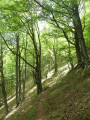
Continue through the forest. Numerous recently fallen trees obstruct progress along the path.
You will reach an open area. Take care as the slope levels out at Pla de les Euges at around 1,835 m.
Leave the GRP®® markings.

Off the marked trail

(2) Turn left, due west, on level ground, along a path very clearly marked on the ground. I’ve placed a cairn there.
“The path does not appear on the IGN base map but is shown on the OSM base maps.”
Passing through the Prats-de-Mollo Nature Reserve: you must stay strictly on the path and remain silent.
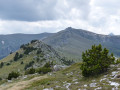
Enter the forest and continue along this very good path, generally heading west. It is in fact a balcony path that crosses ravines (còrrec) and offers views of some very beautiful, unspoilt landscapes. Cross two small streams.

Then cross the Còrrec del Pas del Faig, followed by the Còrrec dels Orris, before finally descending towards the Tech.
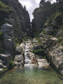
Please note: this section is completely safe, but the water level in the stream may mean you need to take off your shoes. You’ll rejoin a wider, signposted path.

Yellow markings

(3) Turn right and head north-west uphill. The slope is quite steep, leading to the Baraque de la Coma del Tech. It is in a rather poor state despite frequent repairs...

(4) Descend towards the wetland and cross the small streams. Wooden posts painted yellow and numerous cairns will help you find your way. Continue the steep south-westerly ascent, following the right bank of the Tech. Cross a small tributary of the Tech and continue up this steep slope towards the Coll del Pal. In spring, keep quiet: chamois, marmots…

(5) At the pass, the signpost is damaged and the wooden post has fallen over… Head left, due east, still following the wooden posts and the few cairns. You must follow the stony ridge that serves as the border ridge.
Spain is on your right.

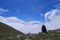
(6) At the large cairn on the path, head slightly to the right, climbing towards the Cairn du Méridien de Paris.
‘The outcrops have been carved between these two cairns to indicate the direction of this meridian.’

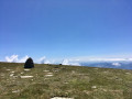
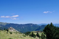
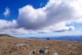
Continue the ascent, heading due east. At around 2,410 m, the slope becomes steeper as you approach the summit of the Pic de Costabona. There are two summits here. Crosses are erected on them. An orientation table has recently been installed. It is often a windy area. The 360° view from here is perfect for taking in this region of peaks.
After a well-deserved break, start thinking about the descent.

Off the marked trail

(7) Alternative route in ‘Practical Information’.
Descend steeply along the north-east ridge. Pass the altitude of 2358, then 2253.
Take care: from this small summit, which is covered in numerous rocks and boulders, head due east as you descend over very slippery gravel. Then go round a small rocky spur to the right and turn due north into a pasture. The Tech valley floor can be made out below.
Please note that, provided there is no snow, there is no danger; there is no need to use your hands whilst following this description and this perfectly accurate route. If this is not the case, you must reposition yourself on the route.

Yellow markings

(8) About 150 m from the Baraque de la Coma del Tech, turn right, keeping to level ground, to rejoin the yellow markings on wooden posts. The markings and the path are badly damaged in places: the young forest has recently been clear-cut in the pastureland. Make sure you keep heading consistently south-east.

The path then enters the old forest. Be sure to keep an eye out for the very sparse yellow markings. The path leads into pastureland and ends at a crossroads at around 1,715 m.

(9) At Serra de l’Ullat, the signpost is in very poor condition. Head down to the left, turning 90°. Use the two Cabanes de l’Ullat at the bottom of the valley as your landmark. You can take a break at the Cabanes forestières de l’Ullat, which consist of a large, accessible ‘orri’. The hut is reserved for the shepherd. The orri has been fitted with a wood-burning stove, but this magnificent spot is very damp...

(10) At the signpost, turn due west, climbing up the hill towards the forest. Then head down towards the Tech.

(11) Caution: this is a safe passage, but the level of the stream may mean you need to take off your shoes.

Then head due east along a good path that climbs through open terrain. Reach the entrance to the Serra Mitjana forest. Turn left at a 90° angle, descending towards the Còrrec de Roques Roges. Three very damp areas will hinder your progress. It is advisable to go round them by climbing up on the left-hand side each time. You will then cross a small stream and then the Còrrec del Talaiador.

The path remains more or less level, with a few sections where you’ll need to take care.
You’ll emerge into a lovely grazing area with the ruins of a large sheepfold.

(12) Turn left onto the correct path heading due east, then climb one last time towards Coll Baix.
Signpost and directional marker.

Red and yellow markings for theGRP®® Tour du Canigou

(1) At the crossroads, continue straight ahead, heading downhill to reach the car park at the Prats-de-Mollo Nature Reserve (S/E).

Waypoints

  1. S/E : mi 0 - alt. 5,259 ft - Car park at the Prats-de-Mollo Nature Reserve - Refuge de Las Conques
  2. 1 : mi 0.28 - alt. 5,548 ft - Turn right towards the forest - Coll de Baix (1691 m)
  3. 2 : mi 0.99 - alt. 6,020 ft - On the left. Cairn
  4. 3 : mi 2.76 - alt. 6,060 ft - On the right as you ascend. PR
  5. 4 : mi 3.2 - alt. 6,526 ft - Coma del Tech Hut
  6. 5 : mi 4.46 - alt. 7,582 ft - Coll del Pal. Left
  7. 6 : mi 4.62 - alt. 7,687 ft - Cairn at the Méridien de Paris
  8. 7 : mi 4.98 - alt. 8,087 ft - Via the ridge. North-east - Pic de Castelbone (2467m)
  9. 8 : mi 5.96 - alt. 6,562 ft - On the right. PR
  10. 9 : mi 7.11 - alt. 5,617 ft - To the left on the descent - Col de la Solana de l'Ullat (1723m)
  11. 10 : mi 7.36 - alt. 5,344 ft - Ullat Forest Hut
  12. 11 : mi 7.49 - alt. 5,305 ft - Crossing the - Tech (fleuve)
  13. 12 : mi 9.18 - alt. 5,420 ft - Ruins of a sheepfold
  14. S/E : mi 9.74 - alt. 5,253 ft - Car park at the Prats-de-Mollo Nature Reserve - Refuge de Las Conques

Notes

Alternative route from the summit (7). Turn back via (6) and (5) and return to (4). To the right, above the hut, find a yellow-marked path heading south-east and follow the route description from (8).

This is a mountainous area. So, as you’d expect, you’ll need: warm clothing, rain and wind protection, water, a snack, a GPX track, route description, a map, a GPS device or the Visorando app, a camera, walking boots and a walking stick.

There is a spring at the start/end point (S/E), due south at the start of the track behind the refuge. All streams have a strong flow; water should be filtered or disinfected.

Shelter is available at the Cabane del Tech (4) and at the Orri de l’Ullat (10). A canopy on the (S/E) can serve as shelter.

Hike completed by the author on 24 May 2020. Plenty of water everywhere. Crossing the Tech was very tricky without taking off your shoes.

This route passes through a protected area, which may be subject to special regulations:

Worth a visit

Always be cautious and plan ahead when you're outdoors. Visorando and the author of this route cannot be held responsible for any accidents occurring on this route.

The GR® and PR® markings are the intellectual property of the Fédération Française de Randonnée Pédestre.

Reviews and comments

4.2 / 5
Based on 3 reviews

Reliability of the description
4 / 5
Ease of following the route
3.7 / 5
Route interest
5 / 5
lemarcheur65
lemarcheur65 ★

Hello
I still don’t understand this sort of comment.
Because it says in the introduction:

Please note: crossing the Tech can prove challenging. You may need to take off your boots.
The descent from the summit may be considered very difficult. Alternative route in ‘Practical Information’.

Practical Information

Alternative route from the summit (7). Turn back via (6) and (5) and return to (4). To the right, above the hut, look for a yellow-marked path heading south-east and follow the route description from (8).

So!

Machine-translated

Frédéric66
Frédéric66

Overall rating : 4 / 5

Date of your route : Aug 10, 2026
Reliability of the description : ★★★★☆ Good
Ease of following the route : ★★★☆☆ Average
Route interest : ★★★★★ Very good
Very busy route : No

Climbing Costabona Peak is a ‘must’. As well as the magnificent 360° panorama from the summit, the climb up the upper Tech Valley is very scenic. The downside of this walk is the section through the forest between points 2 and 3. There is an impressive number of uprooted or broken trees, some of them very large. Lying across the path, they block the way and force you to take long, arduous detours, with the risk of getting lost. The first part of the descent, down a steep slope strewn with stones and boulders, means you have to proceed very slowly. Overall, it is not the elevation gain that poses a problem, but the ‘quality’ and technical nature of the path. The description was last updated in early 2022: several details are therefore out of date.

Machine-translated

BANTOURE
BANTOURE

Overall rating : 4.3 / 5

Date of your route : Dec 24, 2022
Reliability of the description : ★★★★☆ Good
Ease of following the route : ★★★★☆ Good
Route interest : ★★★★★ Very good
Very busy route : No

The COSTABONNE Grand Tour on 24 December 2022 was a memorable experience, offering panoramic views of the department and the Spanish side.
The yellow markings have been repainted.

Machine-translated

calmar
calmar

Overall rating : 4.3 / 5

Date of your route : Oct 18, 2021
Reliability of the description : ★★★★☆ Good
Ease of following the route : ★★★★☆ Good
Route interest : ★★★★★ Very good
Very busy route : No

Thank you for this route to the summit of Pic de Costabonne. It was an interesting walk that allowed us to find some shelter from the Tramontane wind whilst passing through a magnificent forest of fir trees. At the summit (2,465m), there’s a splendid view over both northern and southern Catalonia. The signposting between the Refuge des Conques and Pic de Costabonne is sometimes missing over long stretches or simply in need of renewal – something to bear in mind in bad weather. A superb hike 🐙

Machine-translated

Other walks in the area

For more walks, use our search engine .

The GPS track and description are the property of this route's author. Please do not copy them without permission.