


Refine your search for walks in La Salvetat-Peyralès
La Salvetat-Peyralès walks


 Viaur Valley
 Visorando Member
 12.20 mi
 +1,493 ft
 -1,447 ft
 6h 55
6h 55
 Difficult
 Departure from La Salvetat-Peyralès (Aveyron)
A walk along the Viaur, through rivers, woods and plateaus.
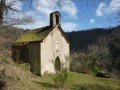
Le Cheval du Roi and the Saint-Amans de Cadoule Chapel from Flauzins
 9.00 mi
+1,568 ft
-1,552 ft
5h 30
9.00 mi
+1,568 ft
-1,552 ft
5h 30
 Moderate
Departure from Lescure-Jaoul (Aveyron)
Moderate
Departure from Lescure-Jaoul (Aveyron)
On the edge of the Viaur valley, this rural hike offers a variety of pleasures. History buffs will not be indifferent to the various sites visited: the Mégalithe du Cheval du Roi, the Chapelle Saint-Amans de Cadoule and, finally, the Roman bridge at Bergougnoux. Nature lovers, meanwhile, will be delighted by the many panoramic views stretching as far as the Monts du Cantal and the Pyrenees, a real treat for the eyes.
Jouqueviel trail and the Viaur valley
 7.37 mi
+1,093 ft
-1,063 ft
4h 20
Moderate
Departure from Jouqueviel (Tarn)
7.37 mi
+1,093 ft
-1,063 ft
4h 20
Moderate
Departure from Jouqueviel (Tarn)
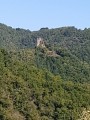
Perched on its rocky outcrop, Jouqueviel Castle, from the Occitan "joc" meaning perch and "vielh" meaning old, lives up to its name. Its ruins remain a testament to feudal life, having valiantly resisted the ravages of time.
You will walk along the banks of the Viaur, which will take you to the 12th-century Chapelle des Infournats, and continue on through the pretty little hamlets of L'Ouradou and Lauretié.
Follow the signs for "sentiers de Lauretié L'ouradou".
Viaur Valley - Le Carrelié - Pont de Cirou - Pampelonne
 14.98 mi
+1,893 ft
-1,890 ft
8h 30
Difficult
Departure from Mirandol-Bourgnounac (Tarn)
14.98 mi
+1,893 ft
-1,890 ft
8h 30
Difficult
Departure from Mirandol-Bourgnounac (Tarn)
A beautiful hike that will take you from the shady banks of the Viaur to the Pont de Cirou site. In Pampelonne, if you wish, you can visit the ruins of the Château de Thuriès, which overlooks the rocky bend of the Viaur. Finally, to finish, stop at the Vieux Mirandol viewpoint before returning to your car.
Moderator's note Trail closed by municipal decree due to risk of rockfall from 31 May 2022 until further notice, see notices.
Viaur Valley - The Boudou Trail
 6.73 mi
+1,030 ft
-1,014 ft
4h 00
Moderate
Departure from Crespin (Aveyron)
6.73 mi
+1,030 ft
-1,014 ft
4h 00
Moderate
Departure from Crespin (Aveyron)
Hike in the wild Viaur Valley.
Mostly shaded trail with pleasant passages along the Viaur and beautiful views of the valley.
Discover the landscapes that inspired the Occitan poet and writer Jean Boudou.
Best done in summer as the path along the Viaur is impassable during high water periods.
The Devil’s Bridge from Bor-et-Bar
 2.58 mi
+581 ft
-581 ft
1h 40
Moderate
Departure from Bor-et-Bar (Aveyron)
2.58 mi
+581 ft
-581 ft
1h 40
Moderate
Departure from Bor-et-Bar (Aveyron)
A short walk offering magnificent views of a little-visited part of the Viaur Valley. The path provides access, via a 100-metre detour, to the remains of the ancient Pont du Diable, which was swept away by a flood in 1786.
The Lo Puech Pounchut Trail
 Tourism professional
 9.97 mi
+1,073 ft
-1,096 ft
5h 30
Moderate
Departure from Mirandol-Bourgnounac (Tarn)
9.97 mi
+1,073 ft
-1,096 ft
5h 30
Moderate
Departure from Mirandol-Bourgnounac (Tarn)
From the square in front of Mirandol-Bourgnounac Town Hall, a path will take you to the Pont de Cirou, an ancient Roman road, on the banks of the Viaur.
Take care on the first few technical kilometres by mountain bike up to the Pont de Cirou. This 14th-century bridge, the oldest crossing over the Viaur, was used to link the Aveyron to the Tarn. Along the Viaur you will discover the Moulin de Pignac,
This route can be done on foot or by mountain bike (marked for both mountain biking and walking).
The old Viaur Mill
 4.93 mi
+1,037 ft
-1,060 ft
3h 10
4.93 mi
+1,037 ft
-1,060 ft
3h 10
 Easy
Departure from Mirandol-Bourgnounac (Tarn)
Easy
Departure from Mirandol-Bourgnounac (Tarn)
This is a lovely half-day walk to enjoy in all seasons, offering a chance to discover the local heritage of the Carmausin region.
From the Vicasse bridge to Laguarde Viaur
 7.01 mi
+479 ft
-479 ft
3h 40
Moderate
Departure from Montirat (Tarn) (Tarn)
7.01 mi
+479 ft
-479 ft
3h 40
Moderate
Departure from Montirat (Tarn) (Tarn)
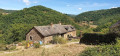
Wild and secretive, the Viaur valley reveals its charms only to the most curious. The Viaur flows peacefully, surrounded by deep gorges and dotted with numerous mills and swimming areas.
 Between Lézert and Serènes
 Local authority
 24.12 mi
+2,661 ft
-2,657 ft
4 hrs
Difficult
Departure from La Bastide-l'Évêque (Aveyron)
24.12 mi
+2,661 ft
-2,657 ft
4 hrs
Difficult
Departure from La Bastide-l'Évêque (Aveyron)
A mountain bike route to explore the Bas Ségala area, criss-crossed by the picturesque streams of the Lézert and the Serènes. This route connects the villages of La Bastide-l’Évêque, Saint-Salvadou and Vabre-Tizac. Alternative routes allow the route to be split into two sections for walking tours.
Along the Viaur between Pampelonne and the Cirou Bridge
9.16 mi
+873 ft
-873 ft
5h 00
Moderate
Departure from Pampelonne (Tarn)
From the village of Pampelonne, enjoy a walk along the River Viaur towards the Pont de Cirou. The route is shaded almost all the way. The distinctive feature of the hamlet of Pont de Cirou is that it straddles two municipalities and two departments: the Aveyron and the Tarn. The Pont de Cirou was one of the first bridges used to cross the Viaur on the Lyon–Toulouse road.
From Pampelonne to Las Planques
 8.39 mi
+2,093 ft
-2,116 ft
5h 40
Difficult
Departure from Pampelonne (Tarn)
8.39 mi
+2,093 ft
-2,116 ft
5h 40
Difficult
Departure from Pampelonne (Tarn)
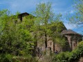
A beautiful excursion for lovers of unspoilt wilderness.
Almost the entire hike is on narrow paths, grassy or rocky tracks.
The return journey is a rollercoaster ride, mostly through the Gorges du Viaur Sauvage.
The Viaur Valley via Thuriès, starting from Pampelonne
 5.99 mi
+1,135 ft
-1,145 ft
3h 45
Moderate
Departure from Pampelonne (Tarn)
5.99 mi
+1,135 ft
-1,145 ft
3h 45
Moderate
Departure from Pampelonne (Tarn)
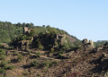
From Pampelonne, your steps will take you to the Viaur Valley via the ruins of Château de Thuriès.
A beautiful hike, mostly through woods, then along the banks of the Viaur, where you can enjoy the coolness in summer.
Naucelle–Sauveterre-de-Rouergue circular loop
10.62 mi
+1,614 ft
-1,601 ft
6h 15
Moderate
Departure from Naucelle (Aveyron)
This circular route, which constantly goes up and down, follows mostly narrow paths through the woodland alongside a stream; it may therefore prove difficult, or even impassable, in wet weather.
It is well signposted in yellow in the first section, but once you’ve left Sauveterre, there are no signposts, so you’ll need to follow the route description carefully.
The Lagarde-Viaur valley
 7.75 mi
+1,037 ft
-1,004 ft
4h 30
Moderate
Departure from Montirat (Tarn) (Tarn)
7.75 mi
+1,037 ft
-1,004 ft
4h 30
Moderate
Departure from Montirat (Tarn) (Tarn)
A varied route, with changes in elevation and scenery, mostly flat, along the shaded banks of the Viaur to enjoy some coolness in hot weather and a bit of elevation to build up your legs.
Lagarde Viaur
 10.05 mi
+1,604 ft
-1,591 ft
6h 00
Moderate
Departure from Montirat (Tarn) (Tarn)
10.05 mi
+1,604 ft
-1,591 ft
6h 00
Moderate
Departure from Montirat (Tarn) (Tarn)
This unpretentious hike, between river, woods and meadows, allows you to follow the Viaur and admire its valley. Don't forget to visit the pretty little village of Lagarde Viaur, a former stronghold, which has retained its beautiful, well-restored houses. This hike is recommended in spring when the trees are in leaf and the flowers are in bloom.
Towards the banks of the Viaur and Lagarde Viaur from Saint-André-de-Najac
 10.55 mi
+1,096 ft
-1,066 ft
5h 50
Moderate
Departure from Saint-André-de-Najac (Aveyron)
10.55 mi
+1,096 ft
-1,066 ft
5h 50
Moderate
Departure from Saint-André-de-Najac (Aveyron)
Starting from the village of Saint-André de Najac, passing through woods, meadows and hamlets, this pleasant circular walk takes you along the banks of the Viaur to the village of Lagarde Viaur, which is well worth a visit.
Hiking trail no. 5
Loop around the village of Saint-André-de-Najac
3.72 mi
+525 ft
-528 ft
2h 10
Easy
Departure from Saint-André-de-Najac (Aveyron)
Short circular walk around the village of Saint-André-de-Najac through woods and countryside.
Hiking trail no. 2
Discover hamlets from Saint-André-de-Najac via the Viaur river
5.57 mi
+906 ft
-912 ft
3h 20
Moderate
Departure from Saint-André-de-Najac (Aveyron)
Starting from the village of Saint-André-De-Najac, this lovely hike with a few steep climbs and beautiful views will take you through the hamlets of La Boucarie, Granouillet and La Séverie, through woods, along the Viaur River and across the countryside.
Hike signposting no. 1
Towards Notre-Dame de Laval from Saint-André-de-Najac
 9.94 mi
+1,447 ft
-1,437 ft
5h 50
Moderate
Departure from Saint-André-de-Najac (Aveyron)
9.94 mi
+1,447 ft
-1,437 ft
5h 50
Moderate
Departure from Saint-André-de-Najac (Aveyron)
Starting from Saint-André-de-Najac, an almost non-stop walk through the woods towards the small village of Laval, passing through the hamlets of La Capélanie, Laval, L’Herm, Fouloubal, La Boucarie, La Séverie and Le Combal.
Hiking trail 6 ( markings: white arrow numbered 6)
Walk to the Chapel of Las Planques
 2.05 mi
+436 ft
-449 ft
1h 20
Easy
Departure from Tanus (Tarn)
2.05 mi
+436 ft
-449 ft
1h 20
Easy
Departure from Tanus (Tarn)
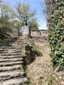
Discover the Las Planques Chapel for modest walkers such as children or elderly people and/or non-athletic people.
Walkers can enjoy a stroll through the woods and admire the chapel, the Viaur river and the unspoilt, wild surroundings.
Le Ségala on foot: The ancient mills trail
 Tourist office
 4.42 mi
+558 ft
-584 ft
2h 30
Easy
Departure from Gramond (Aveyron)
4.42 mi
+558 ft
-584 ft
2h 30
Easy
Departure from Gramond (Aveyron)
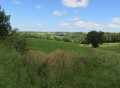
Gathered around its church, Gramond is a village rich in history. The valley is wild along the Lézert with a view of Boussac that will amaze you.
Las Planques, Short Version
 5.06 mi
+1,309 ft
-1,309 ft
3h 30
Moderate
Departure from Tanus (Tarn)
5.06 mi
+1,309 ft
-1,309 ft
3h 30
Moderate
Departure from Tanus (Tarn)
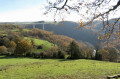
A beautiful, small but challenging unpaved circuit for a half-day of physical exertion.
Although classified as moderately difficult, you will need to be reasonably fit to tackle the rollercoaster ride of the Viaur.
Woods, water, views and old stones are here for your viewing pleasure.
Discover the Chapel of Las Planques
 4.52 mi
+958 ft
-958 ft
2h 55
Moderate
Departure from Tanus (Tarn)
4.52 mi
+958 ft
-958 ft
2h 55
Moderate
Departure from Tanus (Tarn)
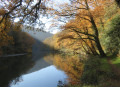
A shortened circular route to explore the Chapel of Las Planques, nestled in the woods. Although short, this route requires some effort to tackle the numerous ascents and descents that follow one another in succession.
The Old Tanus Route
 4.38 mi
+486 ft
-512 ft
2h 25
Easy
Departure from Tanus (Tarn)
4.38 mi
+486 ft
-512 ft
2h 25
Easy
Departure from Tanus (Tarn)
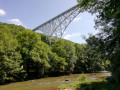
This easy midday walk is best undertaken in hot or very hot weather. Indeed, it takes place entirely in the woodland and along the Viaur, and almost entirely on signposted paths. However, it is not a circular route; nevertheless, the view over the Viaur is very pleasant and, above all, it is very comfortable there, sheltered from the heat. This path is little used. It is situated on the Chemin des Planques.
A walk in the Ségala region around Sainte-Gemme
 5.18 mi
+748 ft
-755 ft
3h 00
Easy
Departure from Sainte-Gemme (Tarn) (Tarn)
5.18 mi
+748 ft
-755 ft
3h 00
Easy
Departure from Sainte-Gemme (Tarn) (Tarn)
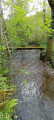
This route will take you through part of the Ségala region in the Tarn and along the paths once used by mining peasants to reach the mines around Carmaux.
Le Cayla
 10.02 mi
+1,296 ft
-1,312 ft
5h 45
Moderate
Departure from La Bastide-l'Évêque (Aveyron)
10.02 mi
+1,296 ft
-1,312 ft
5h 45
Moderate
Departure from La Bastide-l'Évêque (Aveyron)
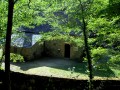
Passing by the Tower and the Roman bridge of Cayla, come and discover these wild valleys of the Aveyron and Lézert rivers.
The Cayla Bridge circular from Cadour
 5.73 mi
+1,043 ft
-1,060 ft
3h 35
Moderate
Departure from La Bastide-l'Évêque (Aveyron)
5.73 mi
+1,043 ft
-1,060 ft
3h 35
Moderate
Departure from La Bastide-l'Évêque (Aveyron)
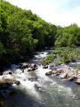
A beautiful hike in the heart of the wild gorges of the Aveyron, following in the footsteps of a distant past, of which the Pont du Cayla is a magnificent reminder. Panoramic views of the Aveyron valley and a walk along the riverbank.
Route of the Seven Crosses
 4.44 mi
+463 ft
-459 ft
2h 25
Easy
Departure from Sanvensa (Aveyron)
4.44 mi
+463 ft
-459 ft
2h 25
Easy
Departure from Sanvensa (Aveyron)
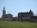
Circling the village of Sanvensa, this route will take you past seven crosses, a church, a castle and a chapel. The view over the Monteils valley is a highlight of this walk.
Along the Céret from the Roucarié Reservoir
 5.47 mi
+620 ft
-646 ft
3h 05
Easy
Departure from Monestiés (Tarn)
5.47 mi
+620 ft
-646 ft
3h 05
Easy
Departure from Monestiés (Tarn)
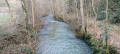
A walk that will allow you to discover the landscapes of the Ségala Carmausin, a land of farmers and miners. This walk is fully signposted (PR® Yellow) and also features directional signs. The entire route follows small roads and local paths. Small signs featuring quotes on biodiversity adorn this trail. Scan the QR code for information about the route and other walks.
From Tanus to Las Planques
 9.86 mi
+1,759 ft
-1,759 ft
6h 05
Moderate
Departure from Tanus (Tarn)
9.86 mi
+1,759 ft
-1,759 ft
6h 05
Moderate
Departure from Tanus (Tarn)
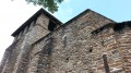
The Las Planques chapel is a remarkable example of southern Romanesque art.It is nestled on a rocky promontory in the middle of the woods and majestically overlooks the Viaur Gorges.This long circular route is less difficult to access than the one from Pampelonne (published on Visorando).Although classified as moderately difficult, you will need to be reasonably fit to cover the distance and negotiate the rollercoaster terrain of the Viaur.
PLEASE NOTE: Following the flooding of the Viaur, as of 20 February 2026, the trail is inaccessible between the Viaduct and the Tanus Bridge, and most likely for the section leading to the Las Planques footbridge.
Around La Bessière and Pont de Vézis
 4.43 mi
+791 ft
-817 ft
2h 45
Easy
Departure from La Bastide-l'Évêque (Aveyron)
4.43 mi
+791 ft
-817 ft
2h 45
Easy
Departure from La Bastide-l'Évêque (Aveyron)
A route to discover the diversity of the landscapes and architecture around La Bastide l’Évêque: the picturesque village of La Bessière; the Pont de Vézis, a bridge dating from the early 20th century built to support the commune’s mining industry; and the plateaus offering magnificent views over the Ségala and the unspoilt valleys of the Lézert and the Aveyron.
The Bardeliers Trail
 6.10 mi
+1,070 ft
-1,024 ft
3h 45
Moderate
Departure from La Bastide-l'Évêque (Aveyron)
6.10 mi
+1,070 ft
-1,024 ft
3h 45
Moderate
Departure from La Bastide-l'Évêque (Aveyron)
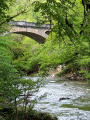
This route, running between the Lézert Valley, the Aveyron Gorges and the Ségala Plateau, allows you to explore the landscapes and villages that have been shaped over time around La Bastide l’Évêque.
Le Ségala: Castelpers and Roc de Miramont
 6.96 mi
+1,375 ft
-1,378 ft
4h 25
Moderate
Departure from Saint-Just-sur-Viaur (Aveyron)
6.96 mi
+1,375 ft
-1,378 ft
4h 25
Moderate
Departure from Saint-Just-sur-Viaur (Aveyron)
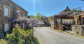
This walk is situated at the confluence of three valleys and between two picturesque villages, Saint-Just and Castelpers.The site of Castelpers is an ancient fortified settlement, mentioned in the Book of Miracles of Sainte-Foy de Conques. It has become a very popular destination. Of this former seigneury and barony belonging to the Castelpers family (13th to 17th centuries), all that remains on the rock is the pre-Romanesque chapel known as Notre-Dame du Roc.This small sanctuary overlooks the Giffou Gorges from a height of 150 metres and houses a statue of the Virgin Mary crushing three black snakes.The Chapel of Saint-Jean de Castelpers (2 km away), nestled amidst the woods, was originally a small abbey which became a flourishing priory until the end of the Crusades.
Circular Puy de Bar to Moulares
 6.32 mi
+696 ft
-673 ft
3h 30
Moderate
Departure from Moularès (Tarn)
6.32 mi
+696 ft
-673 ft
3h 30
Moderate
Departure from Moularès (Tarn)
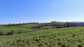
This circular is part of the Grand 8 route in Ségala Carmausin. You will walk through the Tarn countryside along pretty paths lined with low walls and wooden bridges, enjoying lovely views of the surrounding area.
From Cérou to Zère via Saint-Hippolyte
 9.41 mi
+715 ft
-732 ft
4h 55
Moderate
Departure from Monestiés (Tarn)
9.41 mi
+715 ft
-732 ft
4h 55
Moderate
Departure from Monestiés (Tarn)
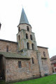
A varied hike through woods, fields and meadows that joins the Zère, a tributary of the Cérou, passing by the Château de Saint-Hippolyte, built in the 14th century and since restored.
Two medieval villages offer an interesting heritage: Monesties, one of the most beautiful villages in France, and Salles-sur-Cérou with its picturesque red sandstone houses.
Monestiés -Salles - Combefa
 14.83 mi
+991 ft
-997 ft
7h 40
Difficult
Departure from Monestiés (Tarn)
14.83 mi
+991 ft
-997 ft
7h 40
Difficult
Departure from Monestiés (Tarn)
This beautiful hike will take you through three villages that are well worth a visit for their location and architectural heritage. The route is varied and offers beautiful views of the Albigeois and Carmausin regions.
The heights of Monestiés
 3.77 mi
+390 ft
-384 ft
2h 05
Easy
Departure from Monestiés (Tarn)
3.77 mi
+390 ft
-384 ft
2h 05
Easy
Departure from Monestiés (Tarn)
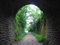
This short walk in the hills around Monestiès offers beautiful views of the village and the Ségala mountains. After crossing the Lauzeral forest, the trail winds along the old railway line.
Remember to take a torch to get through the unlit tunnel.
Yellow markings "La Borie Blanche"
Circular route from the Château de Saint-Hippolyte to Monestiés
 7.70 mi
+794 ft
-794 ft
4h 15
Moderate
Departure from Monestiés (Tarn)
7.70 mi
+794 ft
-794 ft
4h 15
Moderate
Departure from Monestiés (Tarn)
A good walk with a slight incline but not too steep and varied landscapes.
Exploring the Ségala on foot: Towards Belcastel
 6.62 mi
+1,283 ft
-1,306 ft
4h 10
Moderate
Departure from Colombiès (Aveyron)
6.62 mi
+1,283 ft
-1,306 ft
4h 10
Moderate
Departure from Colombiès (Aveyron)
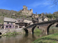
Set in the heart of the Ségala’s rich agricultural landscape, the village of Colombies still boasts beautiful medieval houses, some dating back to the 15th century. This village has retained a certain harmony even in its official buildings, such as the town hall and its porch. Its Romanesque-style church, built in 1880, stands in the centre of a small square near a landscaped fountain.
This walk, marked with yellow signposts, will take you to one of the Most Beautiful Villages in France, Belcastel.