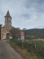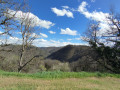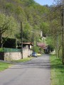
Towards the Pontal and Bouscal mills in Saint-André-de-Najac

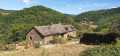
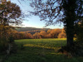
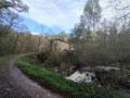
A lovely walk that will take you past the old mills of Bouscal and Le Pontal through countryside and woodland. 

Hiking trail no. 3

Details

n°65979746
Creation:
Last update:
Last review:
  • Walking
    Activity: Walking
  • ↔
    Distance: 5.28 mi
  • ◔
    Average duration: 3h 05 
  • ▲
    Difficulty: Easy

  • ⚐
    Back to start: Yes
  • ↗
    Ascent: + 781 ft
  • ↘
    Descent: - 801 ft

  • ▲
    Highest point: 1,358 ft
  • ▼
    Lowest point: 899 ft

Photos

Description of the walk

Park in the car park at Saint-André-de-Najac Town Hall. Alternative parking is available at the church.

Hiking trail no. 3

(S/E) Walk down the street towards the bar-restaurant “Le Mazuk” and pass the hotel “Le Relais Mont Le Viaur” and the Post Office.

(1) Cross the D922 with care and take the Route de la Pendarie opposite. At the junction, turn right until you reach the house at No. 356, then turn right onto the path leading down into the woods (not shown on the map). When you reach a fork, turn left, cross the small car park and head towards the Moulin de Bouscal.

(2) Walk past the house, cross the bridge and follow the dirt track which initially runs alongside the Serène before veering off to the left. Continue until you come out onto a small road.

(3) Turn left towards the hamlet of Toulzanes, then head downhill to the right along the Route de Cassurex until you reach the D239.

(4) Head uphill to the right for 1 km.

(5) Leave the departmental road by turning left towards Les Combes. Pass through the hamlet and continue to a small crossroads at Le Burgas.

(6) Head straight down to the left along a dirt track (Chemin du Pontal) for 500 m. Ignore the track branching off to the right and continue down the one on the left, which becomes passable by vehicle. Turn right at the next junction, cross the small bridge at Moulin du Pontal and follow the track until you reach a road, which you follow to the right. Negotiate the bend and leave the road leading to Le Bosc on your left.

(7) A few dozen metres further on, turn straight left onto a dirt track for 1 km and rejoin the road you left just before. Continue to the left.

(8) Cross the D922 with care and turn immediately left onto Rue du Stade. Walk past the stadium and reach a junction at the entrance to Saint-André-de-Najac.

(9) Continue straight on along the small road, passing the cemetery. Pass a cluster of houses on the left; when you reach Impasse du Belvédère on your left, turn right onto Chemin de la Sablière, which leads out opposite the Post Office and the Town Hall. Turn right to return to the car park (S/E).

Waypoints

  1. S/E : mi 0 - alt. 1,253 ft - Town hall car park
  2. 1 : mi 0.12 - alt. 1,227 ft - D922
  3. 2 : mi 0.8 - alt. 948 ft - Bouscal Mill - Serène (rivière) - Affluent de l'Aveyron
  4. 3 : mi 1.21 - alt. 1,089 ft - Road junction
  5. 4 : mi 1.66 - alt. 1,083 ft - D239
  6. 5 : mi 2.11 - alt. 1,253 ft - Les Combes
  7. 6 : mi 2.46 - alt. 1,178 ft - Le Burgas
  8. 7 : mi 3.45 - alt. 1,004 ft - Path on the left
  9. 8 : mi 4.11 - alt. 1,270 ft - D922
  10. 9 : mi 4.87 - alt. 1,322 ft - Crossroads
  11. S/E : mi 5.28 - alt. 1,253 ft - Town hall car park

Notes

Access via the D922 from Villefranche-de-Rouergue or Laguépie.

Hiking trail marker no. 3

Reviews and comments

3.8 / 5
Based on 2 reviews

Reliability of the description
3.5 / 5
Ease of following the route
4.5 / 5
Route interest
3.5 / 5
Remaff
Remaff

Hike without much interest. Far too many roads

Machine-translated

Pascall
Pascall

Hello ;-)
Thank you for your comment ;-)

Unfortunately, it's not always possible to have only dirt roads or trails!
there aren't many available in this area!
I hope you still enjoyed the region ;-))))
There are other hikes starting from the village where there are almost only dirt roads (see our profile).

Best regards
Kind regards
Pascal

Machine-translated

Remaff
Remaff

Overall rating : 3.7 / 5

Date of your route : Oct 20, 2025
Reliability of the description : ★★★☆☆ Average
Ease of following the route : ★★★★★ Very good
Route interest : ★★★☆☆ Average
Very busy route : No

Too much walking on the road! What a shame

Machine-translated

Pascall
Pascall

Hello ;-)
Thank you for your comment ;-)
We’re planning to put up signposts on this walk and others in the area.
Kind regards
Pascal

Machine-translated

Lepiaf
Lepiaf

Overall rating : 4 / 5

Date of your route : Dec 02, 2024
Reliability of the description : ★★★★☆ Good
Ease of following the route : ★★★★☆ Good
Route interest : ★★★★☆ Good
Very busy route : No

A pleasant walk with no signposts, but if you follow the directions, there’s no problem

Machine-translated

Other walks in the area

For more walks, use our search engine .

The GPS track and description are the property of this route's author. Please do not copy them without permission.