Route of the Seven Crosses

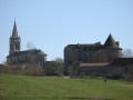
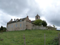
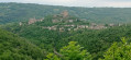
Circling the village of Sanvensa, this route will take you past seven crosses, a church, a castle and a chapel. The view over the Monteils valley is a highlight of this walk.

Details

468464
Creation:
Last update:
Last review:
  • Walking
    Activity: Walking
  • ↔
    Distance: 4.44 mi
  • ◔
    Average duration: 2h 25 
  • ▲
    Difficulty: Easy

  • ⚐
    Back to start: Yes
  • ↗
    Ascent: + 463 ft
  • ↘
    Descent: - 459 ft

  • ▲
    Highest point: 1,591 ft
  • ▼
    Lowest point: 1,355 ft

Photos

Description of the walk

The walk starts from the Espace Savignac car park near the church in Sanvensa.

(S/E) Turn right towards the church, go round the castle on the right, then round the cemetery, and continue to the Croix du Champ.

(1) Croix du Champ. Turn left towards Les Oulières. Cross a road, pass by the pumping station and continue towards Aujals. Cross the D922 and reach the Croix d’Aujals.

(2) Croix d’Aujals. Follow the Route de la Bessièrre for about fifty metres and turn left until you reach the second Croix d’Aujals.

(3) Second Croix d’Aujals. Then continue along the Chemin de Cousteils to the Chemin de la Molinière and the Croix du Coustel.

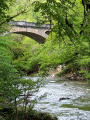
(4) Coustel Cross. Turn right onto the Chemin de la Molinière, cross the bridge over the Serène de Sanvensa and continue to the hamlet of La Griffoul and its cross.

(5) La Griffoul Cross. As you leave the hamlet, take the path on the left to the cross at the hamlet of Le Cassan.

(6) Le Cassan Cross. Take the road leading uphill to the left, passing through the Puech de la Griffoul, and continue to the junction with the D648, where the La Ferrandie Cross is situated.

(7) La Ferrandie cross. Take the D648 towards the hamlet of Nègreport. Cross the Serène de Sanvensa and take the second road on the right towards Valat. Continue to the junction with the D922.

(8) Turn left for about 20 metres, then head down to the right along the Chemin du Cun. The first road on the left will take you back to your starting point (S/E).

Waypoints

  1. S/E : mi 0 - alt. 1,585 ft - Espace Savignac car park
  2. 1 : mi 0.56 - alt. 1,480 ft - Croix du Champ
  3. 2 : mi 1.3 - alt. 1,526 ft - Croix d’Aujals
  4. 3 : mi 1.42 - alt. 1,499 ft - Second Aujals Cross
  5. 4 : mi 1.69 - alt. 1,457 ft - Croix du Coustel
  6. 5 : mi 2.24 - alt. 1,378 ft - Croix de la Griffoul
  7. 6 : mi 2.53 - alt. 1,404 ft - Croix de le Cassan
  8. 7 : mi 3.21 - alt. 1,486 ft - Croix de la Ferrandie
  9. 8 : mi 4.11 - alt. 1,588 ft - Junction with the D922
  10. S/E : mi 4.44 - alt. 1,585 ft - Espace Savignac car park

Notes

Suitable for walkers, this route follows only tarmac roads.

Worth a visit

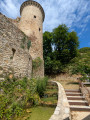
Next to the starting point are the 18th-century Church of Sainte-Anne and the 16th-century (private) castle.

Reviews and comments

4 / 5
Based on 4 reviews

Reliability of the description
4 / 5
Ease of following the route
4.5 / 5
Route interest
3.5 / 5
User 24480764
• Edited:

could be improved...in terms of the information provided about this route

Machine-translated

Philippe G.
Philippe G.

Overall rating : 3.7 / 5

Date of your route : Nov 03, 2022
Reliability of the description : ★★★★☆ Good
Ease of following the route : ★★★★☆ Good
Route interest : ★★★☆☆ Average
Very busy route : No

A walk along the road, all the way.
It’s hilly but never really climbs, so it’s easy.
Lovely views over the surrounding valleys.

Machine-translated

Mounie G
Mounie G

Overall rating : 4 / 5

Date of your route : Feb 09, 2020
Reliability of the description : ★★★★☆ Good
Ease of following the route : ★★★★★ Very good
Route interest : ★★★☆☆ Average

A short, undulating road (not tracks) with pleasant scenery and a slight climb. If you follow the map, it’s very easy to find the crosses

Machine-translated

lavoixdudésir
lavoixdudésir

Overall rating : 4 / 5

Date of your route : May 31, 2019
Reliability of the description : ★★★★☆ Good
Ease of following the route : ★★★★☆ Good
Route interest : ★★★★☆ Good

Hello,
We’ve done the walk; it’s essential to follow the route description and the marked path, not the yellow markings.
The yellow markings do not correspond at all to the route described in the guide, so you need to be careful.

Have a lovely day, everyone.

Machine-translated

PapyDD12
PapyDD12

Actually, I should have been more specific; thank you for your feedback.

Machine-translated

babeth007chat
babeth007chat

Overall rating : 4.3 / 5

Date of your route : Nov 19, 2018
Reliability of the description : ★★★★☆ Good
Ease of following the route : ★★★★★ Very good
Route interest : ★★★★☆ Good

Please note: the second cross in AUJALS is opposite the last house set back from the road on the right, under the branches of a tree; it is resting on a millstone just before the right-hand bend.

Machine-translated

Other walks in the area

For more walks, use our search engine .

The GPS track and description are the property of this route's author. Please do not copy them without permission.