Cabanes and Les Martinets du Lézert

This route allows you to discover the rich heritage and natural beauty around La Bastide-l’Évêque: the episcopal bastide founded in the 13th century and its characteristic church, the 16th-century Château de Réquista, the traditional village of Cabanes, the typical landscapes and hamlets, as well as the remarkable heritage of the Martinets du Lézert copper forges.

Details

n°45430870
Creation:
Last update:
Last review:
  • Walking
    Activity: Walking
  • ↔
    Distance: 3.29 mi
  • ◔
    Average duration: 1h 50 
  • ▲
    Difficulty: Easy

  • ⚐
    Back to start: Yes
  • ↗
    Ascent: + 387 ft
  • ↘
    Descent: - 397 ft

  • ▲
    Highest point: 1,588 ft
  • ▼
    Lowest point: 1,260 ft

Photos

Description of the walk

Start from the village of La Bastide-l’Évêque, setting off from the Tourist Office car park. This route is signposted SP4.

(S/E) Head down the second alleyway on the right towards the Place de l’Église. Take the road on the right under the church porch and continue to the junction with the D69.

(1) Cross over towards the D269 and take the path opposite that runs alongside two fields. At the end of a narrow track, you’ll reach the Route de Réquista. Turn slightly right to reach the entrance to Réquista Castle.

(2) Carry on straight along the path, crossing the woodland whilst following the GR® 62B. You’ll reach the village of Cabanes. Note the 19th-century pink granite church built to the right of the old castle, as well as two typical Rouergue houses with dovecotes and an ‘anatori’ (shelter). Continue to the cross in the square.

(3) Turn left towards “Le Rieu”. You’ll soon come to a Fork in the road with a small path on the right.

(4) Follow this and join the Route du Rieu. Once you reach this hamlet, continue along the road to the right, which runs past houses and farm buildings, until you reach a track. Carry on straight ahead along this stony track before joining the D269 and the River Lézert at a place called Camaillou.

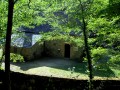
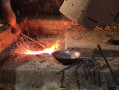
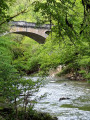
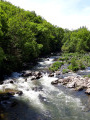
(5) Turn left and follow the GR® 62B, which runs alongside the Lézert Valley. Then turn right and pass by the Martinets du Lézert site. This remarkable heritage site, which was once a water-powered forge for hammering copper, has been restored by volunteers and is open to visitors from May to September. Carry on past the Moulin du Roc and head up the road until you reach the junction with the D269.

(6) Carry on to the right until you reach the next junction by a pond.

(7) Turn left towards Le Rieu, Cabanes. Carry on until you reach the path that starts opposite, at the left-hand bend.

(8) Take this dirt track which runs alongside Réquista Castle, still following the GR® 62B. You’ll reach the junction with the road you passed on the way there.

(2) Follow the route back in the opposite direction to the A-road and the Bastide-l’Évêque crossroads, which you also passed on the way out.

(1) Carry on straight ahead to reach the village centre. Head up the first alleyway on the left, towards the car park where you started. (S/E).

Waypoints

  1. S/E : mi 0 - alt. 1,549 ft - Car park at the La Bastide-l’Évêque Tourist Office
  2. 1 : mi 0.27 - alt. 1,509 ft - D269 junction
  3. 2 : mi 0.5 - alt. 1,512 ft - Réquista Castle. Junction of the circular loop
  4. 3 : mi 0.84 - alt. 1,585 ft - Cabins
  5. 4 : mi 0.93 - alt. 1,575 ft - Path to Le Rieu
  6. 5 : mi 1.8 - alt. 1,293 ft - Lézert Valley, towards Martinets du Lézert
  7. 6 : mi 2.12 - alt. 1,329 ft - D269, exit at - Les Martinets du Lézert
  8. 7 : mi 2.35 - alt. 1,381 ft - Le Rieu crossroads, Cabanes
  9. 8 : mi 2.59 - alt. 1,437 ft - Junction towards Réquista
  10. S/E : mi 3.29 - alt. 1,545 ft - Tourist Office car park - Eglise St Jean Baptiste

Worth a visit

Along the route:
La Bastide l’Évêque, a bastide founded in the 13th century, and its 14th-century church.
The ‘Oreilles en Balade’ audio trail at La Bastide l’Évêque.
Les Martinets du Lézert, copper forges.
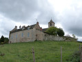
16th-century Château de Réquista (private).
Moulin du Roc (private).
Traditional Rouergue houses with dovecotes in Cabanes.
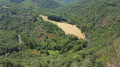
The Aveyron and Lézert valleys.

Nearby:
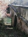
The Cayla Bridge in the Gorges de l’Aveyron at La Bastide l’Evêque, 5 km away.
Saint-Salvadou and its neo-Gothic church, 12 km away.
Fontaine des Fées and Neolithic remains, 14 km away.
Vabre-Tizac and its ancient fortified village with a 13th-century arched gateway, 15 km away.
The Croix de Bleyssol (15th century, listed as a Historic Monument), 16 km away.
Bois du Bruel, a fun interpretive trail 16 km away: the trail is dotted with little games and puzzles about the biodiversity and history of the woodland. This site is one of the Aveyron’s sensitive natural areas.

Always be cautious and plan ahead when you're outdoors. Visorando and the author of this route cannot be held responsible for any accidents occurring on this route.

The GR® and PR® markings are the intellectual property of the Fédération Française de Randonnée Pédestre.

Reviews and comments

5 / 5
Based on 1 review

Reliability of the description
5 / 5
Ease of following the route
5 / 5
Route interest
5 / 5
User 21984781

Overall rating : 5 / 5

Date of your route : Aug 11, 2025
Reliability of the description : ★★★★★ Very good
Ease of following the route : ★★★★★ Very good
Route interest : ★★★★★ Very good
Very busy route : No

A very beautiful hike with little elevation gain. About three-quarters of the way along the route, there are picnic tables near the Aveyron.
Suitable for dogs, although there are a few sections on roads.

Machine-translated

Other walks in the area

For more walks, use our search engine .

The GPS track and description are the property of this route's author. Please do not copy them without permission.