The Ségala: the Marsende Stream

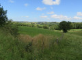
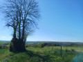
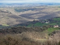
A walk through the ‘Land of 100 Valleys’, following a secret and unspoilt valley,

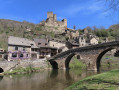
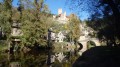
In the heart of the village of Boussac, with its traditional houses, stands a remarkable church, originally built in the 13th century and subsequently fortified by its inhabitants during the 14th and 15th centuries to protect the local population from the English invasion. Battlements, arrow slits and machicolations still bear witness today to the building’s defensive purpose.

Details

n°632995
Creation:
Last update:
Last review:
  • Walking
    Activity: Walking
  • ↔
    Distance: 3.37 mi
  • ◔
    Average duration: 2h 00 
  • ▲
    Difficulty: Easy

  • ⚐
    Back to start: Yes
  • ↗
    Ascent: + 548 ft
  • ↘
    Descent: - 535 ft

  • ▲
    Highest point: 2,129 ft
  • ▼
    Lowest point: 1,785 ft

Description of the walk

From the D911 (Baraqueville–Rieupeyroux), follow signs for Boussac. Before reaching the village, follow signs for the stadium. At the cemetery, turn right and continue to the stadium, where there is a car park.

(S/E) From the stadium, take the road leading up towards La Sicarie, passing the entrance to the arboretum on your left and the Route de Membre on your right. Continue to the farm.

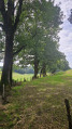
(1) Opposite, take a path leading down towards a small stream. Pass the first path on your right, then a second on your left; go round a pasture and head downhill to reach the Ruisseau de Marsende.

(2) Cross a concrete footbridge and take a sunken track to the left for 100 m. Then turn left onto a stony track which continues as a sunken track – sometimes damp – towards the road leading to La Sarrette.

(3) Opposite, take a grassy track which leads into a pasture. Cross the small stream and take the path which, through woods and pastures, climbs towards Mas Viel, keeping to the left at all times.

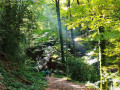
(4) At the entrance to the hamlet of Mas Viel, after the first farm, turn left, walk downhill for 300 metres and then turn left onto a dirt track leading down into the valley. Follow a small stream, a tributary of the Marsende stream. Cross this tributary and then cross the Marsende stream three times (via footbridges). Before the third footbridge, walk past the ruins of the old mill.

(5) Cross the footbridge and follow the stream to the right for a short while, then head up to the left through the woods, before skirting a pasture towards the arboretum. As you climb, turn right onto a steep path, head into the woods and follow a forest path to the arboretum and the stadium (S/E).

Waypoints

  1. S/E : mi 0 - alt. 1,785 ft - Stadium
  2. 1 : mi 0.68 - alt. 2,047 ft - Sicarie
  3. 2 : mi 1.17 - alt. 1,890 ft - Marsende stream
  4. 3 : mi 1.41 - alt. 2,054 ft - Route
  5. 4 : mi 1.94 - alt. 2,129 ft - Mas Viel
  6. 5 : mi 2.72 - alt. 1,804 ft - Marsende stream
  7. S/E : mi 3.37 - alt. 1,785 ft - Arrival

Notes

Picnics are possible in Boussac.

Worth a visit

Along the way:

Marsende site.
A very comprehensive arboretum featuring species from the Ségala region.

Nearby:

The church and altarpiece at Boussac.
The royal bastide of Sauveterre-de-Rouergue
16th-century Pietà and Oratory at Gramond
Val de Lenne Lake in Baraqueville

Reviews and comments

5 / 5
Based on 1 review

Reliability of the description
5 / 5
Ease of following the route
5 / 5
Route interest
5 / 5
FrancineR
FrancineR

Overall rating : 5 / 5

Date of your route : May 01, 2025
Reliability of the description : ★★★★★ Very good
Ease of following the route : ★★★★★ Very good
Route interest : ★★★★★ Very good
Very busy route : No

A very pleasant walk, hardly any tarmac, a lovely forest, the chance to cool off in the streams, and very good signposting. Thank you for suggesting this.
An added bonus: on the way back, we stopped to see the fortified church at Boussac, which was very impressive even from the outside. As luck would have it, a gentleman had been asked by a small group to give a full tour, so we were able to tag along and hear the explanations, explore the upper floors, and climb up to the bell tower,

Machine-translated

Other walks in the area

For more walks, use our search engine .

The GPS track and description are the property of this route's author. Please do not copy them without permission.