


 Country:

 City:
City:


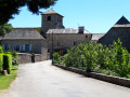
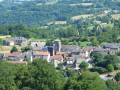
Starting point at Solville (car park), La Baraque Lortal near the D911.
This route is signposted in blue as “between Lézert and Serènes”
(S/E) From the car park, walk along the D911 to the right and, at the next junction, turn left with care to reach Le Cammas. Continue along a footpath until you reach a road.
(1) Turn left and head towards Lonnac, leaving a road on your left.
(2) Take the hairpin bend to the right towards Teulières. Follow the road to the left, which passes the Moulin de Mourtayrol. Carry on until you reach a Fork in the road.
(3) Take the path on the right which leads close to the cemetery onto the road to Capredonde. Turn right and carry on to the next junction.
(4) At the entrance to the hamlet of Capredonde, take the road on the left, pass a Fork in the road and take the road opposite. Join the next path on the left.
(5) Follow this path, go through the woods, cross a road and reach the junction with another path on the right.
(6) Take this path, which leads close to the hamlet of Paurès and joins the road. Follow it to the left, then you’ll soon come to a four-way junction.
(7) Turn right and continue along the road to the square in La Bastide-l’Evêque.
(8) Keep going straight ahead, pass between the church and the town hall, and carry on to the junction with the D269.
(9) Cross over to the D269, heading towards Les Martinets du Lézert, and immediately turn right onto a path that runs alongside two fields and leads to a road.
(10) Turn right towards Réquista and you’ll come to a junction.
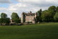
(11) Carry on straight ahead, passing the château and a pond, before reaching the square in Cabanes.
(12) Keep left towards Le Rieu.
(13) At the fork in the road, carry on straight ahead, then turn left onto a track until you reach a road running alongside the Lézert valley.
(14) Turn left onto this road until you reach the entrance to the Martinets du Lézert site.
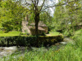
(15) Turn right, cross the copper smelting site and pass close to the Moulin du Roc to return to the road.
(16) Follow the road to the right until you reach the junction signposted La Rieu, Cabanes, Le Cayla.
(17) Carry on straight ahead in this direction, joining the path that runs alongside the main façade of Réquista Castle and the junction you have already passed.
(11) Turn right onto the road and take the same route as on the way there to reach the square in Labastide-l’Évêque.
(8) Turn into the lane on the right, ignore a road on the left, pass through the hamlet of Porgue and carry on until you reach a junction.
(18) Carry on to the left (D69) until you reach the next junction.
(19) Turn left towards Teulières, ride past the Moulin de Cassanis and carry on to the Route de Combret.
(20) Turn right onto this road and you’ll reach the hamlet.
(21) At the junction, head slightly to the right towards Cazèles.
(22) Before the hamlet, take the path on the left to reach a crossroads.
(23) Cross carefully and head straight on towards Plaussergues. Pass through the hamlet and continue past it to the second crossroads.
(24) Turn right towards Mas del Sol, until you reach a right-hand bend with a path opposite.
(25) Carry on left along this track, which passes close to the hamlet of Marsaguettes, until you reach a fork in the road.
(26) Carry on to the left until you reach the hamlet of Lagarrigue.
(27) In the hamlet, turn left onto a track leading to the Mas de Mouly. Walk through the village.
(28) Take the path on the right which joins the road to Garrigol.
(29) Continue along the road to the left, towards Marmont.
(30) Turn right, then left, to join the Saint-Salvadou road (D71). Follow it to the left at every junction until you reach the hamlet of Baudas.
(31) Turn left, uphill, and follow the path to Le Puech.
(32) Turn right, then left onto the track leading to the D71.
(33) Carry on to the left towards Saint-Salvadou until you reach a Fork in the road at the entrance to the village.
(34) Carry on straight ahead, passing the cemetery, the church and the last few houses. To go round the old village centre, turn right after the church, then take the second alleyway on the right and head towards the village hall. Go up the second street on the right until you reach the crossroads by the town hall. Turn left towards the cemetery to join the D648.
(34) At the exit, turn right onto the D648 towards Rieupeyroux. Carry on straight ahead until you reach a four-way junction.
(35) Turn right onto Chemin de La Vitarelle, heading towards La Plaine de Bor. Cross the departmental road and another road, pass the Fontaine des Fées and join the Route de Pierrechange towards Vabre.
(36) At the junction, turn right towards Le Puech de la Cédène and carry on until you reach the multi-way junction with a small cross on your right.
(37) Carry on for about ten metres straight ahead, then turn left and cross the hamlet of Le Puech to join the Vabre road.
(38) Turn right towards Vabre. At the junction with the Route de Tizac, carry on straight ahead along the street to reach the church square. Go round the church on the left. After the church, continue to the left, passing the Les Platanes residential complex, and take the path on the right to reach the Route du Bois du Bruel.
(39) At the end of the path, turn right until you reach a crossroads.
(40) Turn left, cross the Petite Serène river and follow a path leading to the hamlet of Laubiès.
(41) At the end of the hamlet, turn left to reach Bleyssol.
(42) Walk through the hamlet of Bleyssol until you reach a four-way junction.
(43) Cross the road and carry on towards Rieuprésens.
(44) Carry on to the left towards Rieuprésens, enter the hamlet by first turning right then left, and carry on to the junction with the departmental road.
(45) Carry on almost straight ahead along the path that leads to Le Bouscatel. At the road, first turn left then right and follow the path until you reach Le Bouscatel. Walk through the hamlet until you reach a four-way junction.
(46) At the Le Bouscatel/La Coste junction, turn right to join the departmental road.
(47) Turn left and follow this road with care until you reach the car park in the hamlet of Solville (S/E).
 Visorando Member
 Moderate

