Along the Viaur between Pampelonne and the Cirou Bridge

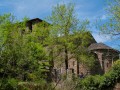
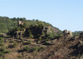
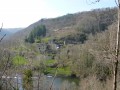
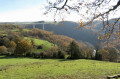
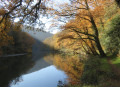
From the village of Pampelonne, enjoy a walk along the River Viaur towards the Pont de Cirou. The route is shaded almost all the way. The distinctive feature of the hamlet of Pont de Cirou is that it straddles two municipalities and two departments: the Aveyron and the Tarn. The Pont de Cirou was one of the first bridges used to cross the Viaur on the Lyon–Toulouse road.

Details

75380240
Creation:
Last update:
Last review:
  • Walking
    Activity: Walking
  • ↔
    Distance: 9.16 mi
  • ◔
    Average duration: 5h 00 
  • ▲
    Difficulty: Moderate

  • ⚐
    Back to start: Yes
  • ↗
    Ascent: + 873 ft
  • ↘
    Descent: - 873 ft

  • ▲
    Highest point: 1,407 ft
  • ▼
    Lowest point: 797 ft

Description of the walk

Parking is available in the village near the town hall.

(S/E) Opposite the town hall, turn left onto Rue Eustache de Beaumarchais and walk past the church.

Yellow PR® signposting for the “Sentier des Crêtes” route

(1) You will immediately come out onto Allée des Fossés; follow it to the right. Shortly afterwards, turn left onto Rue de Rodières. Take the first left (dead end). At the end, in front of a gate, follow the path to the right and head down to the River Viaur.

No signposting

(2) Cross the Claude-Rivenq footbridge and continue along the path on the left until you reach the footbridge over the Lieux stream

Yellow PR® signposting

(3) Cross it, then immediately turn sharply left onto the path. The path then veers to the right and runs close to the Viaur. Continue along this path by the river, which leads to the hamlet of La Roque. In the hamlet, carry on straight ahead along the road to cross it.

No signposting

(4) At the Fork in the road, in front of a cross, continue along the left-hand road until you reach the junction with the RD58.

Yellow and red GR® signposting for the Pays des Gorges du Viaur

(5) Continue left along the departmental road as far as the Pont de Cirou.

(6) Cross the bridge, then continue along the road to the left. Before the sign marking the exit from the Pont de Cirou, take the Pignac path on the left towards the Viau.

(7) Pass through the hamlet of Pignac and, after the last buildings, take the path on the left and continue to a Fork in the road.

(8) At the junction with a path coming from the right, carry on straight ahead along the footpath.

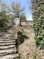
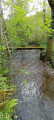
(9) Take the steps on the right, then cross a small stream – be careful, as the footbridge looks rather rickety. It’s best to cross at the ford, taking care not to slip on the wet rocks.

(10) Cross the Ruisseau du Bruel ford and continue straight on along the path to the Moulin de Tourene. Walk for about 150 m. When the path takes a hairpin bend, continue for 50 m.

(11) Turn onto the path on the left; further on, go down the steps on the left to reach the banks of the Viaur again. Continue along the path for about 1 km.

(12) Pay close attention to the signposts. When the path splits in two, take the one on the right. The path begins to climb, leading to the hamlet known as Le Pesquié de Cazor. Cross the hamlet and continue straight on until you reach the junction with the Allée des Fossés, which you should follow to the left.

No signposting

(1) Turn right into Rue Eustache de Beaumarchais to quickly reach the town hall (S/E).

Waypoints

  1. S/E : mi 0 - alt. 1,404 ft - Pampelonne Town Hall
  2. 1 : mi 0.04 - alt. 1,401 ft - Église Notre-Dame (Pampelonne)
  3. 2 : mi 1.27 - alt. 830 ft - Claude-Rivenq Footbridge - Viaur (rivière)
  4. 3 : mi 1.45 - alt. 837 ft - Footbridge over the Le Lieux stream
  5. 4 : mi 3.46 - alt. 840 ft - Fork in the road on leaving La Roque
  6. 5 : mi 4.66 - alt. 906 ft - Junction with the D58
  7. 6 : mi 4.91 - alt. 804 ft - The Cirou Bridge - Viaur (rivière)
  8. 7 : mi 5.27 - alt. 804 ft - Pignac
  9. 8 : mi 5.64 - alt. 833 ft - Path junction
  10. 9 : mi 5.81 - alt. 807 ft - Stairs on the right
  11. 10 : mi 6.23 - alt. 814 ft - Ford
  12. 11 : mi 7.57 - alt. 965 ft - Path junction
  13. 12 : mi 8.23 - alt. 823 ft - Three-way junction
  14. S/E : mi 9.16 - alt. 1,404 ft - Pampelonne Town Hall

Notes

Some sections may be impassable during periods of high water. This route is strongly discouraged in the event of a risk of thunderstorms or following heavy rain.

Worth a visit

Always be cautious and plan ahead when you're outdoors. Visorando and the author of this route cannot be held responsible for any accidents occurring on this route.

The GR® and PR® markings are the intellectual property of the Fédération Française de Randonnée Pédestre.

Reviews and comments

3.7 / 5
Based on 1 review

Reliability of the description
4 / 5
Ease of following the route
4 / 5
Route interest
3 / 5
jeanmarieeliane
jeanmarieeliane

Overall rating : 3.7 / 5

Date of your route : Jun 10, 2025
Reliability of the description : ★★★★☆ Good
Ease of following the route : ★★★★☆ Good
Route interest : ★★★☆☆ Average
Very busy route : No

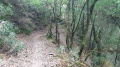
Difficulty: rated by the author as moderate. For us, aged over 70, it was considered difficult, due to the very steep slopes and dangerous steps on the Tarn side. There are four clumps of trees blocking the path, making it difficult to pass through. Definitely not recommended for people with hip or knee replacements.
On the Aveyron side, there is only one tree blocking the path. After that, the route is much better and there are far more people using it.

Machine-translated

Other walks in the area

For more walks, use our search engine .

The GPS track and description are the property of this route's author. Please do not copy them without permission.