The Bardeliers Trail

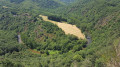
This route, running between the Lézert Valley, the Aveyron Gorges and the Ségala Plateau, allows you to explore the landscapes and villages that have been shaped over time around La Bastide l’Évêque.

Details

53583283
Creation:
Last update:
Last review:
  • Walking
    Activity: Walking
  • ↔
    Distance: 6.10 mi
  • ◔
    Average duration: 3h 45 
  • ▲
    Difficulty: Moderate

  • ⚐
    Back to start: Yes
  • ↗
    Ascent: + 1,070 ft
  • ↘
    Descent: - 1,024 ft

  • ▲
    Highest point: 1,788 ft
  • ▼
    Lowest point: 1,043 ft

Photos

Description of the walk

Starts at Les Martinets du Lézert, RD 269 in La Bastide l’Evêque. On-site car park.
This route is signposted SP1.

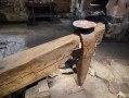
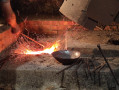
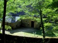
(S/E) From the car park, head towards Les Martinets du Lézert. (Follow the GR® 62B.) This remarkable heritage site, which was once a water-powered forge for hammering copper, has been restored by volunteers and is open to visitors from May to September. Continue past the Moulin du Roc and follow the road uphill to the junction with the D269. Carry on to the crossroads at Pertus.

(1) Leave the GR®. Turn right towards the village. After crossing the Lézert, you’ll arrive in Pertus.Admire a traditional Rouergue house with its dovecote, as well as an old bread oven. Carry on to the end of the hamlet.

(2) Turn right and take a small path lined with oak trees. Carry on straight ahead and follow the track through the woodland of chestnut and oak trees. All along the way, you’ll notice the undergrowth consisting of male ferns, ivy, holly and moss. As you emerge from the woods, near the fields, you’ll be treated to a magnificent panoramic view of the villages of La Bastide l’Evêque, Cabanes and Réquista Castle. You’ll reach the road .

(3) Turn right onto it, heading towards the hamlet of La Bessière. You’ll be treated to some magnificent views. At the bottom of the descent, cross the Ruisseau de La Bessière and reach the hamlet. You’ll see several wells, a bread oven and two magnificent old houses (one with a dovecote, the other with a tower). Continue to the crossroads in the centre of the hamlet.

(4) Take the road on the left, towards Les Cabanelles.

(5) Keep to the right and walk through the hamlet. Just before you leave the hamlet, you’ll come to a dirt track on the right.

(6) Take this track.You’ll catch sight of La Bessière and can admire the typical vegetation: oaks, chestnut trees, etc., as well as the ‘rius’ (small streams). This track ends at a bend and joins the road to the hamlet of Gaudiès.

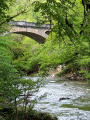
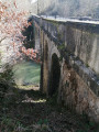
(7) Turn right and head towards Gaudiès. Then follow the GR® 62B to the right, which descends towards the Aveyron valley. This path is home to several types of vegetation: oak and chestnut trees, bushes, and then, as you approach the Aveyron, boxwood and moss… You’ll also come across small streams. You’ll reach the Pont de Vézis, built in 1908 for the town’s mining operations.

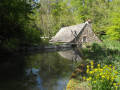
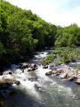
(8) Continue to the right along the road (D269). Cross two footbridges over the Ruisseau du Lézert and make your way back through the Lézert Valley , home to the ruins of old copper-hammering forges and adorned with snowdrops in winter. Continue until you reach the road at Falgairenc.

(9) Follow it to the right along the Lézert on the GR® 62B and head for the Martinets car park (S/E).

Waypoints

  1. S/E : mi 0 - alt. 1,257 ft - Les Martinets du Lézert - Les Martinets du Lézert
  2. 1 : mi 0.44 - alt. 1,375 ft - Pertus crossroads
  3. 2 : mi 0.73 - alt. 1,378 ft - The hamlet of Pertus
  4. 3 : mi 1.85 - alt. 1,772 ft - Le Vialardel/La Bessière crossroads
  5. 4 : mi 2.18 - alt. 1,683 ft - The hamlet of La Bessière
  6. 5 : mi 2.59 - alt. 1,765 ft - The hamlet of Les Cabanelles
  7. 6 : mi 2.71 - alt. 1,788 ft - Chemin des Cabanelles in Gaudiès
  8. 7 : mi 3.61 - alt. 1,624 ft - Road to the hamlet of Gaudiès
  9. 8 : mi 5.28 - alt. 1,106 ft - Aveyron - Pont de Vézis
  10. 9 : mi 5.84 - alt. 1,247 ft - Le Falgairenc
  11. S/E : mi 6.1 - alt. 1,302 ft - Les Martinets du Lézert - Les Martinets du Lézert

Worth a visit

Along the route:
Les Martinets du Lézert, copper forges
Traditional Rouergue farmhouses with dovecotes in Pertus and La Bessière
Panoramic views of the villages of La Bastide l’Evêque, Cabanes, Réquista Castle and the Aveyron valley
The Aveyron and Lézert valleys

Nearby:
La Bastide l’Évêque, a bastide founded in the 13th century, and its 14th-century church, 2 km away.
The Pont du Cayla bridge in the Gorges de l’Aveyron at La Bastide l’Évêque, 5 km away.
The ‘Oreilles en Balade’ audio trail in La Bastide l’Évêque, Vabre-Tizac and Saint-Salvadou.
Saint-Salvadou and its neo-Gothic church, 12 km away.
The Fontaine des Fées and Neolithic remains, 14 km away.
Vabre-Tizac and its ancient fortified village with a 13th-century arched gateway, 15 km away.
The Bleyssol Cross (15th century, listed as a Historic Monument), 16 km away.
Bois du Bruel, a fun nature trail 16 km away: the trail is dotted with little games and puzzles about the biodiversity and history of the woodland. This area is one of the Aveyron’s sensitive natural areas.

Always be cautious and plan ahead when you're outdoors. Visorando and the author of this route cannot be held responsible for any accidents occurring on this route.

The GR® and PR® markings are the intellectual property of the Fédération Française de Randonnée Pédestre.

Reviews and comments

5 / 5
Based on 2 reviews

Reliability of the description
5 / 5
Ease of following the route
5 / 5
Route interest
5 / 5
Christ77
Christ77
• Edited:

Overall rating : 5 / 5

Date of your route : Jun 14, 2026
Reliability of the description : ★★★★★ Very good
Ease of following the route : ★★★★★ Very good
Route interest : ★★★★★ Very good
Very busy route : No

A walk through the woods, which is very pleasant in hot weather (30°C). It’s a very varied route: paths through fields and woodland, following several rivers (the Aveyron and the Lézert), and passing through villages with magnificent views. It’s all there in a three-hour walk that’s suitable for everyone.

Machine-translated

alainzimmermann
alainzimmermann

Overall rating : 5 / 5

Date of your route : Jul 05, 2025
Reliability of the description : ★★★★★ Very good
Ease of following the route : ★★★★★ Very good
Route interest : ★★★★★ Very good
Very busy route : No

We did the tour in scorching heat (38 degrees). That certainly explains why we were the only ones there.
A very beautiful route. We will do it again in September and finish with a visit to the mill. I think it will be a real treat.

Machine-translated

Other walks in the area

For more walks, use our search engine .

The GPS track and description are the property of this route's author. Please do not copy them without permission.