Around La Bessière and Pont de Vézis

A route to discover the diversity of the landscapes and architecture around La Bastide l’Évêque: the picturesque village of La Bessière; the Pont de Vézis, a bridge dating from the early 20th century built to support the commune’s mining industry; and the plateaus offering magnificent views over the Ségala and the unspoilt valleys of the Lézert and the Aveyron.

Details

53577841
Creation:
Last update:
Last review:
  • Walking
    Activity: Walking
  • ↔
    Distance: 4.43 mi
  • ◔
    Average duration: 2h 45 
  • ▲
    Difficulty: Easy

  • ⚐
    Back to start: Yes
  • ↗
    Ascent: + 791 ft
  • ↘
    Descent: - 817 ft

  • ▲
    Highest point: 1,775 ft
  • ▼
    Lowest point: 1,004 ft

Photos

Description of the walk

Starts at Les Martinets du Lézert, RD 269 in La Bastide l’Évêque. On-site car park.
This route is signposted SP2.

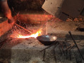
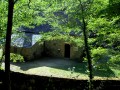
(Out and back) From the car park, head towards Les Martinets du Lézert. This remarkable heritage site, which was once a water-powered forge for hammering copper, has been restored by volunteers and is open to visitors from May to September. Continue past the Moulin du Roc and follow the road uphill to the junction with the D269. Carry on to the Pertus crossroads. (Follow the GR® 62B.)

(1) Turn right towards this village. After crossing the Lézert, you’ll arrive in Pertus, where you can admire a traditional Rouergue house with its dovecote, as well as an old bread oven. Carry on to the end of the hamlet.

(2) Turn right onto a small path lined with oak trees. Carry on straight ahead and follow the path through the woodland of chestnut and oak trees. All along the way, you’ll notice the undergrowth consisting of male ferns, ivy, holly and moss. As you emerge from the woods, near the fields, you’ll be treated to a magnificent panoramic view of the villages of La Bastide l’Evêque, Cabanes and Réquista Castle. Join the road.

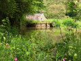
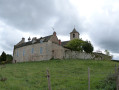
(3) Turn right towards the hamlet of La Bessière. There are some magnificent views to enjoy. At the bottom of the descent, cross the Ruisseau de La Bessière and reach the hamlet. You’ll see several wells, a bread oven and two magnificent old houses (one with a dovecote, the other with a tower). Continue to the crossroads in the centre of the hamlet.

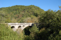
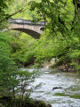
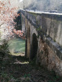
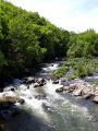
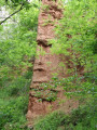
(4) Turn right, walk through the village and follow the road to the junction with a dirt track, which you should take. On the horizon, you’ll see the hamlet of La Moussouse. Follow this track through the woods of chestnut and oak trees, which offers views over the Aveyron Valley and the village of Lestibie on the right bank of the Aveyron. In the undergrowth, you’ll notice large blocks of schist forming a rocky outcrop. Continue along the track which descends through the woods to reach the Aveyron Valley and the Vézis Bridge (built in 1908 for the local mining operations) on the GR® 62B.

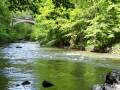
(5) Continue to the right. Cross two footbridges over the Lézert stream. Walk alongside the D269 and make your way back through the Lézert valley, home to the ruins of old copper-hammering huts and adorned with snowdrops in winter. Continue until you reach the road at Falgairenc.

(6) Follow the road to the right along the Lézert on the GR® 62B and return to the Martinets car park (S/E).

Waypoints

  1. S/E : mi 0 - alt. 1,257 ft - The - Les Martinets du Lézert
  2. 1 : mi 0.41 - alt. 1,375 ft - Pertus crossroads
  3. 2 : mi 0.71 - alt. 1,381 ft - The hamlet of Pertus
  4. 3 : mi 1.83 - alt. 1,775 ft - Road, Le Vialardel/La Bessière junction
  5. 4 : mi 2.18 - alt. 1,686 ft - The hamlet of La Bessière
  6. 5 : mi 3.58 - alt. 1,010 ft - Vézis Bridge - Pont de Vézis
  7. 6 : mi 4.16 - alt. 1,198 ft - Le Falgairenc
  8. S/E : mi 4.43 - alt. 1,253 ft - The - Les Martinets du Lézert

Worth a visit

Along the route:
Les Martinets du Lézert, copper forges
Traditional Rouergue farmhouses with dovecotes in Pertus and La Bessière
Panoramic views of the villages of La Bastide l’Evêque and Cabanes, Réquista Castle, and the Aveyron and Lézert valleys

Nearby:
La Bastide l’Évêque, a bastide founded in the 13th century, and its 14th-century church, 2 km away.
The Cayla Bridge in the Gorges de l’Aveyron at La Bastide l’Évêque, 5 km away.
The ‘Oreilles en Balade’ audio trail in La Bastide l’Évêque, Vabre-Tizac and Saint-Salvadou.
Saint-Salvadou and its neo-Gothic church, 12 km away.
Fontaine des Fées and Neolithic remains, 14 km away.
Vabre-Tizac and its ancient fortified village with a 13th-century arched gateway, 15 km away.
The Croix de Bleyssol (15th century, listed as a Historic Monument) 16 km away.
Bois du Bruel, a fun nature trail 16 km away: the trail is dotted with little games and puzzles about biodiversity and the history of the woodland. This site is one of the Aveyron’s sensitive natural areas.

Always be cautious and plan ahead when you're outdoors. Visorando and the author of this route cannot be held responsible for any accidents occurring on this route.

The GR® and PR® markings are the intellectual property of the Fédération Française de Randonnée Pédestre.

Reviews and comments

4.4 / 5
Based on 3 reviews

Reliability of the description
4.3 / 5
Ease of following the route
4.3 / 5
Route interest
4.7 / 5
User 13350312

Overall rating : 3.7 / 5

Date of your route : Jun 14, 2026
Reliability of the description : ★★★★☆ Good
Ease of following the route : ★★★☆☆ Average
Route interest : ★★★★☆ Good
Very busy route : No

A PRETTY NICE HIKE: a refreshing stretch through the woods given the current heat, beautiful scenery, and a lovely river at the end of the route. The difficulty level is moderate.

Machine-translated

Fa31
Fa31
• Edited:

Overall rating : 4.7 / 5

Date of your route : Sep 17, 2025
Reliability of the description : ★★★★☆ Good
Ease of following the route : ★★★★★ Very good
Route interest : ★★★★★ Very good
Very busy route : No

A very enjoyable, varied hike, with lots of woods in the Aveyron and Lézert gorges, and interesting things to see along the way (villages, bridges, etc.).
The start/finish point at Les Martinets du Lézert is both beautiful and very interesting, with facilities for picnics, barbecues, etc.
I recommend it!

Machine-translated

User 21984781

Overall rating : 5 / 5

Date of your route : Aug 08, 2025
Reliability of the description : ★★★★★ Very good
Ease of following the route : ★★★★★ Very good
Route interest : ★★★★★ Very good
Very busy route : No

An incredible hike, mostly through very shady woods with a shorter section through fields offering beautiful views.
Suitable for dogs with only very short sections on roads.
Arrival at the banks of the Aveyron river about 1 km before the end of the hike, perfect for a picnic.

Machine-translated

Other walks in the area

For more walks, use our search engine .

The GPS track and description are the property of this route's author. Please do not copy them without permission.