


sbe68

 Visorando Member
 Premium user
 Sign up:
Published route(s)
 Weil, Otterbach, Wiese and Dreiländergarten
 3.28 mi
 +33 ft
 -49 ft
 1h 30
1h 30
 Easy
Easy
 Departure from Weil am Rhein (Regierungsbezirk Freiburg)
A short, picturesque and exotic route from Weil am Rhein to the Wiese (in Switzerland) via the Dreiländergarten.
Märkt, Rhine and Kander
3.16 mi
+69 ft
-69 ft
1h 30
Easy
Departure from Weil am Rhein (Regierungsbezirk Freiburg)
The landscapes are very varied as you walk along the Rhine and then the Kander, passing through Eimeldingen. They are urban but also bucolic: the village of Märkt, the bridge over the A5 motorway, the gravel pit, the path along the Rhine, the mouth of the Kander, the path along the Kander with two small bridges, the fish pass and the forest.
Vineyards and mountains around Fischingen
 3.23 mi
+358 ft
-348 ft
1h 50
Easy
Departure from Fischingen (Regierungsbezirk Freiburg)
3.23 mi
+358 ft
-348 ft
1h 50
Easy
Departure from Fischingen (Regierungsbezirk Freiburg)
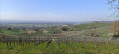
This walk crosses the vineyards between Hartberg and Hummelberg, follows the ridge line between the vineyards and the plain, runs alongside the Läufelberg and the Reckholder, skirts around Fischingen and finally leads to a meal at the Fünfschilling inn. Beautiful views along the route towards Alsace, the Jura and the Black Forest.
Between the vineyards and orchards of Huttingen and Blansingen
3.70 mi
+233 ft
-220 ft
1h 55
Easy
Departure from Efringen-Kirchen (Regierungsbezirk Freiburg)
A very beautiful short hike through vineyards and orchards with breathtaking views of the Alps, the Jura, the city of Basel, the Alsatian villages of Sundgau, the Rhine Valley and Kembs just opposite on the way there, and the Black Forest and Blauen on the way back. In the first half of the route, follow the Wiiwegli (wine trail) markings, red diamond with a yellow bunch of grapes, towards Blansingen. The markings are present at each fork. However, you will need to be vigilant at the start of the route and look out for the markings so as not to give in to the temptation to continue straight ahead on a more visible path. Our path branches off twice to the right between the orchards and then twice with a left-right turn on grassy paths.
Rötteln Castle and Southern Black Forest Nature Park
2.90 mi
+207 ft
-203 ft
1h 30
Easy
Departure from Lörrach (Regierungsbezirk Freiburg)
A pleasant walk, mainly through the forest. Panoramic view from the castle, which is open to visitors: see § practical information. Restaurant, terrace in good weather. Rötteln Castle car park, 120 spaces.
Through the vineyards from Binzen to Fischingen
3.50 mi
+236 ft
-233 ft
1h 50
Easy
Departure from Binzen (Regierungsbezirk Freiburg)
The entire route is open country through vineyards with beautiful views of Basel, the Jura, Alsace, the Vosges and the Piedmont hills of the Black Forest. The outward journey is mostly along the Wiiwegli (wine trail), while the return journey is mostly along a local trail marked with yellow diamond signs.
From Rührberg in Germany to Sankt Chrischona in Switzerland
 3.06 mi
+374 ft
-344 ft
1h 45
Easy
Departure from Grenzach-Wyhlen (Regierungsbezirk Freiburg)
3.06 mi
+374 ft
-344 ft
1h 45
Easy
Departure from Grenzach-Wyhlen (Regierungsbezirk Freiburg)
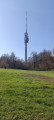
On the itinerary: a panoramic view, the highest point in the canton of Basel-Stadt, the tallest tower in Switzerland, an evangelical mission, two restaurants, the countryside and tranquillity close to the city. We first descend through woods and fields before climbing back up to the charming Bettingen district of Sankt Chrischona, at an altitude of 522 metres. Numerous paths and benches invite us to stroll around and discover this peaceful spot.
On the heights of Habsheim and Rixheim
2.87 mi
+259 ft
-246 ft
1h 35
Easy
Departure from Habsheim (Haut-Rhin)
La Bellevue de Habsheim, an apiary, donkeys, sheep, goats and cows, a remarkable garden, calvaries, a shelter, the Rixheim school orchard, the reservoirs and relay antenna in Habsheim, numerous viewpoints over the Rhine plain, the Black Forest, the Vosges, the Tour de l'Europe, Habsheim, Rixheim, the Stellantis site, Entremont Park... so much to see on such a short route!
Reservoir and view of the Alps from Zimmersheim
4.20 mi
+377 ft
-354 ft
2h 15
Easy
Departure from Zimmersheim (Haut-Rhin)
Walk from the centre of Zimmersheim up a steep climb towards the Schoofberg, where the reservoir is located. Pass through the Buchwald and Zuhrenberg woods to enjoy views of the Alps in good weather and a bit of cool air. Return via the south of Zimmersheim, across open terrain.
On the heights of Rheinweiler, Maria Hügel and Bamlach
 4.07 mi
+341 ft
-367 ft
2h 10
Easy
Departure from Bad Bellingen (Regierungsbezirk Freiburg)
4.07 mi
+341 ft
-367 ft
2h 10
Easy
Departure from Bad Bellingen (Regierungsbezirk Freiburg)
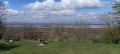
A Way of the Cross, a golf course, a chapel, viewpoints, vineyards, a village, a campsite – this is what this trail, which is signposted all the way, has to offer. We will walk along the Wiiwegli (Red Diamond with a yellow bunch of grapes) and the Way of St James (yellow shell on a blue background), following a Way of the Cross (Stationenweg) on the way there. At the Maria Hügel pilgrimage chapel, we will stop to admire the view over the Rhine plain and the Vosges. There are plenty of benches, and a flight of steps leads to a shelter and picnic tables. The return journey will follow a marked local path. The walk passes through the charming village of Bamlach and its campsite.
The hills of Hésingue
3.90 mi
+381 ft
-358 ft
2h 05
Easy
Departure from Hésingue (Haut-Rhin)
Partly in the forest and partly in open countryside, this route will allow you to discover the forest and countryside to the west of Hésingue: the passage over and under the D105, the Fichtag discovery trail with its numerous informative and entertaining displays and panels, the Liesbach passage with its beautiful wooden footbridges, the Finnish track, the tranquillity of the forest, the beauty of the countryside and the views towards the Black Forest.
Isteiner Klotz, Huttingen and Römerstrasse through the vineyards
 3.77 mi
+486 ft
-492 ft
2h 10
Easy
Departure from Efringen-Kirchen (Regierungsbezirk Freiburg)
3.77 mi
+486 ft
-492 ft
2h 10
Easy
Departure from Efringen-Kirchen (Regierungsbezirk Freiburg)
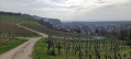
The route is mainly open, winding through the vineyards. There are stunning views throughout the route of the villages in the Rhine Valley, the Jura, the Vosges and Istein. There are numerous benches and picnic tables along the route. Information boards (in German) on wine, history and geology are dotted along the route. From the car park, information boards and the Saint-Vit Chapel opposite, set in the rock, herald the richness of the route, which is “to be savoured”.
Eichener See: in search of a lake that appears and disappears
3.96 mi
+302 ft
-318 ft
2h 05
Easy
Departure from Schopfheim (Regierungsbezirk Freiburg)
The main attraction is Eichener See. You’ll probably need to visit several times as it’s quite rare. It may appear once or twice a year; in some years, not at all. After a period of heavy rain, groundwater from a cavity 50 metres deep rises through the subsoil and fills the basin. It’s a magical spot. We’ll then head up into the hills north of the Dinkelberg.
Nordschwaben, Hunzelbachtal and Hohe Flum
 4.26 mi
+423 ft
-404 ft
2h 20
Easy
Departure from Rheinfelden (Baden) (Regierungsbezirk Freiburg)
4.26 mi
+423 ft
-404 ft
2h 20
Easy
Departure from Rheinfelden (Baden) (Regierungsbezirk Freiburg)
The route is shaped like a figure of eight. The first part involves walking around the Hunzelbachtal via the sculpture trail, St Maurice’s Chapel and the remarkable little stream, 800 metres long, which disappears into a sinkhole (3 km route). In the second part, back in Nordschwaben, the walk heads to the highest point of the Dinkelberg, the Hohe Flum, at 535 metres. Here you can visit the tower with its panoramic view and the café-hotel-restaurant (closed on Thursdays and Fridays).
Kandern Wolfsschlucht Eitentalweg
 3.66 mi
+410 ft
-417 ft
2h 00
3.66 mi
+410 ft
-417 ft
2h 00
 Moderate
Departure from Kandern (Regierungsbezirk Freiburg)
Moderate
Departure from Kandern (Regierungsbezirk Freiburg)
A visit to the Wolfsschlucht is the main attraction of this route, which runs largely through woodland. There is a picnic and barbecue area in the middle of the gorge. Several other spots ideal for a break are located along the route, starting with the car park at the start. In the gorges, with their astonishing rock formations, you are transported to another world. Well worth a visit.
Eichener See and Wehrer Boden
3.53 mi
+417 ft
-407 ft
2h 00
Easy
Departure from Schopfheim (Regierungsbezirk Freiburg)
The route is largely in open country. The paths are wide and well signposted. On the way there, we’ll walk past Eichener See to see if it’s there, as it’s a seasonal lake. Information boards along the route and inside the shelter explain how this lake works. We will then cross a small wood and the Dinkelberg hills to the south of Eichener See before reaching the village of Eichen. We will cross the Dorfbach, which flows only through Eichen, and leave the village after a short walk through its eastern part.
The Blauen from the Egerten car park
3.86 mi
+778 ft
-778 ft
2h 25
Easy
Departure from Malsburg-Marzell (Regierungsbezirk Freiburg)
A pleasant walk through the forest. It’s still a bit of a climb to reach the summit of the Blauen. Follow the Westweg Red Diamond route to the Blauen on the way up; the return is via an unmarked path and then the Yellow Diamond route. The view is magnificent. Sometimes the weather is fine up there whilst it is overcast in the valley, with the Blauen emerging from a sea of clouds. At other times, the view stretches far across the Rhine plain, the Jura, the Alps and the Vosges.
Hauingen Soormattbach Rechberg
4.16 mi
+633 ft
-640 ft
2h 30
Easy
Departure from Lörrach (Regierungsbezirk Freiburg)
Set amongst deep forests, clearings, sun-drenched pastures, streams and ponds, this route offers varied and contrasting landscapes. The paths are wide and signposted, except for the picturesque trail along the Soormattbach stream, between the start and the point (1). This walk is best undertaken in dry weather, as the Soormattbach stream, which we will follow, sometimes to the right, sometimes to the left, can burst its banks during rainy or stormy periods. To cross the village and reach the Schützenhaus restaurant as well as the Hauingen shooting club’s premises in the middle of the forest, we will walk along tarmac roads.
Above Hägelberg: Schöne Aussicht and Saatschulhütte
 2.95 mi
+341 ft
-328 ft
1h 40
Easy
Departure from Steinen (Regierungsbezirk Freiburg)
2.95 mi
+341 ft
-328 ft
1h 40
Easy
Departure from Steinen (Regierungsbezirk Freiburg)
A walk mainly through woodland on the heights of Hägelberg. As the car park is situated almost at the highest point, the walk initially descends slightly towards the village across open ground, offering stunning views of the Alps in good weather. The paths are wide and signposted, except for the first section.
The two Rheinfelden, the Rhine Island and the hydroelectric power station
4.75 mi
+108 ft
-115 ft
2h 15
Easy
Departure from Rheinfelden (Baden) (Regierungsbezirk Freiburg)
A walk along the banks of the Rhine, close to the water’s edge and across the river. It runs from Germany to Switzerland via a bridge and an island, and from Switzerland to Germany via the Rheinfelden dam. There are numerous vantage points along the way, including a section through the old town of Rheinfelden (CH).
Hills around Hagenthal-le-Haut
4.19 mi
+423 ft
-423 ft
2h 20
Easy
Departure from Hagenthal-le-Haut (Haut-Rhin)
A walk partly through the forest and partly in open countryside on the heights of Hagenthal-le-Haut. Several benches and picnic spots along the route. On the return journey, beautiful views of the Jura, Basel, Chrischona and the surrounding hills.
Obertüllingen, Tüllinger Berg, Daur Hütte
 2.83 mi
+197 ft
-194 ft
1h 30
Easy
Departure from Lörrach (Regierungsbezirk Freiburg)
2.83 mi
+197 ft
-194 ft
1h 30
Easy
Departure from Lörrach (Regierungsbezirk Freiburg)
A pleasant little route through the forest, going from Obertüllingen to the Daur Hütte and back. Magnificent panoramic views from the car park over Basel, the Jura, the Alsatian villages and the Kembs-Loechlé lock, the Vosges... On the way back, views of the villages of the Black Forest foothills, Lörrach, Rötteln Castle, the Wiesental, Riehen and St. Chrischona with its tower and, depending on the weather, a few Alpine peaks can be seen to the east through the gap in the hills.
Kembs lock between the Grand Canal d'Alsace and the Old Rhine
 3.26 mi
+52 ft
-52 ft
1h 35
Easy
Departure from Haut-Rhin
3.26 mi
+52 ft
-52 ft
1h 35
Easy
Departure from Haut-Rhin
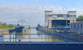
A short walk between the wild Old Rhine and the tamed canal, with its array of industrial installations: the locks, the German motorway which you cannot see but can hear, the high-voltage power lines you pass under at the start of the route, as well as its natural beauty: the winding, sand-filled Rhine, exposed at the Barre d’Istein. To make the most of the views of the Rhine, the route is best enjoyed in winter when the trees are still bare.
Discovering Badenweiler
 3.11 mi
+335 ft
-341 ft
1h 45
Easy
Departure from Badenweiler (Regierungsbezirk Freiburg)
3.11 mi
+335 ft
-341 ft
1h 45
Easy
Departure from Badenweiler (Regierungsbezirk Freiburg)
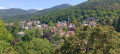
Visit the Sensory Park and the centre of Badenweiler, featuring the Swan Lake, the ruins of the Roman baths, the Kurhaus, the ruins of Baden Castle, the view of the Vosges, the castle grounds and the town centre with its shops. The walk is short, allowing you to try out the facilities in the Park of the Senses, discover the remarkable trees and gardens, statues, pavilions and viewpoints in the Spa Park, stroll through the town’s streets, take a ‘coffee and cake’ break at one of the many cafés and terraces, sit for a moment at the Vogesenblick and simply take in the view.
Wasserschloss and Erstelweg starting from Inzlingen
 3.25 mi
+420 ft
-404 ft
1h 50
Easy
Departure from Inzlingen (Regierungsbezirk Freiburg)
3.25 mi
+420 ft
-404 ft
1h 50
Easy
Departure from Inzlingen (Regierungsbezirk Freiburg)
A pleasant little stroll through Inzlingen, going round the castle and then up towards the Eiserne Hand with a snack break in the shelter of the Buttenberg. Return via the Erstelweg and the sports facilities on the heights of Inzlingen.
Rümminger Moos Dünert Binzerweg
 3.41 mi
+410 ft
-427 ft
1h 55
Easy
Departure from Lörrach (Regierungsbezirk Freiburg)
3.41 mi
+410 ft
-427 ft
1h 55
Easy
Departure from Lörrach (Regierungsbezirk Freiburg)
A pleasant walk entirely through the forest on wide, shaded paths. There are numerous benches along the Moosweg. Beautiful views from the Fohrenbuck car park towards Lörrach, as well as from points (2) and (4) over the Alsatian villages of the Sundgau and the Rhine plain.
Glashütte Col de Judenhut Firstacker
 4.20 mi
+581 ft
-581 ft
2h 25
Easy
Departure from Soultz-Haut-Rhin (Haut-Rhin)
4.20 mi
+581 ft
-581 ft
2h 25
Easy
Departure from Soultz-Haut-Rhin (Haut-Rhin)
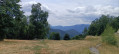
A hike entirely through the forest, suitable even in hot weather. On the way to the Col de Judenhut, we choose to take the stony path only for part of the way, preferring the wide track leading to the pass. There, a lovely shaded picnic area awaits us, along with a shelter and a fountain. The path towards Firstacker runs along the hillside, with very little elevation gain, and crosses numerous streams. For the return journey to the Glashütte, we’ll follow the wide track downhill.
Rechberg via Dornhalde and Haberackerweg
 3.05 mi
+545 ft
-545 ft
1h 55
Easy
Departure from Lörrach (Regierungsbezirk Freiburg)
3.05 mi
+545 ft
-545 ft
1h 55
Easy
Departure from Lörrach (Regierungsbezirk Freiburg)
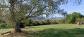
The route runs partly through woodland and partly through open countryside, and involves a steep climb up the Dornhalde slope. There are stunning views from this same slope towards Basel, Chrischona, the Wiese Valley and even the Alps, weather permitting. You can stop for a break halfway along the route at Café Hygge on the Rechberg.
Eiblen Park and Lake Gerteis in Ensisheim
 4.25 mi
+16 ft
-16 ft
2h 00
Easy
Departure from Ensisheim (Haut-Rhin)
4.25 mi
+16 ft
-16 ft
2h 00
Easy
Departure from Ensisheim (Haut-Rhin)
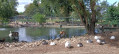
Visit the Eiblen Wildlife Park, walk along the Ill and the Thur, go round Lake Gerteis, reach the confluence of the Thur and the Ill, and cross the Himalayan footbridge. This is what this idyllic walk has to offer; it also takes you through the western part of Ensisheim and introduces you to the eco-neighbourhood developed in 2021 along the lake, with its many play and sports facilities. The paths are wide, partly signposted, flat and mostly open.
The Chemin des Pierres-Frontière, starting from Grenzach
 2.76 mi
+482 ft
-476 ft
1h 40
Easy
Departure from Grenzach-Wyhlen (Regierungsbezirk Freiburg)
2.76 mi
+482 ft
-476 ft
1h 40
Easy
Departure from Grenzach-Wyhlen (Regierungsbezirk Freiburg)
A short walk, mainly through woodland, on the hills above Grenzach. To the west of the forest, there is a magnificent view of the Rhine, the hydroelectric power station and the locks, as well as the port of Birsfelden, the city of Basel, the Swiss Jura and Alsace. On the way back, we walk alongside the border and its boundary markers for two kilometres. At the eastern edge of the forest, there is a lovely view of St-Chrischona before heading back down to the car park, skirting the small gardens. The route is signposted throughout along wide paths; it is pleasant and easy.