Eiblen Park and Lake Gerteis in Ensisheim

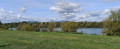
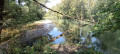
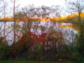
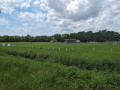
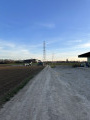
Visit the Eiblen Wildlife Park, walk along the Ill and the Thur, go round Lake Gerteis, reach the confluence of the Thur and the Ill, and cross the Himalayan footbridge. This is what this idyllic walk has to offer; it also takes you through the western part of Ensisheim and introduces you to the eco-neighbourhood developed in 2021 along the lake, with its many play and sports facilities. The paths are wide, partly signposted, flat and mostly open.

Details

107702291
Creation:
Last update:
Last review:
  • Walking
    Activity: Walking
  • ↔
    Distance: 4.25 mi
  • ◔
    Average duration: 2h 00 
  • ▲
    Difficulty: Easy

  • ⚐
    Back to start: Yes
  • ↗
    Ascent: + 16 ft
  • ↘
    Descent: - 16 ft

  • ▲
    Highest point: 722 ft
  • ▼
    Lowest point: 702 ft
  • ⚐ Country: France
  • ⚐ City: Ensisheim (68190)
  • ⚑
    Start/End: N 47.873298° / E 7.348166°
  • ❏
    IGN map(s): Ref. 3719OT, 3719OTR, 3720ET
  • Hour-by-hour weather

Photos

Description of the walk

The car park is the Parc de l’Eiblen car park on Chemin de l’Eiblen, where there are plenty of spaces.

(S/E) Head towards the park entrance and walk round it on the right-hand side.

(1) At the south-western corner of the park, do not turn right towards the playground, but cross the meadow diagonally to the left to reach a path leading to the River Thur; follow this path to the left until you reach the end.

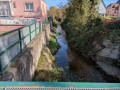
(2) Turn left, walk alongside the Ill and carry on straight ahead until you reach Rue de Colmar at the footbridge.

(3) Turn right onto the bridge and carry on until you reach Rue de la Chapelle 150 metres further on. Follow it to the right until the end of the street. Turn left, go round the roundabout on the left, pass the gendarmerie, then take Rue de Castroville and walk alongside the gendarmerie.

(4) At the end of the gendarmerie, cross the road, take the path on the right marked by a barrier and a ‘No Motorised Vehicles’ sign. 50 m further on, turn left and go round Étang Gerteis on the left.

(5) Walk alongside the pond and stay on this path, turning right twice until you reach the River Thur.

(6) Turn right onto the path closest to the pond, below the path running alongside the River Thur. It is more shaded than the latter. Stay on this path and, at the end of the pond, head right then left to join a path leading to Rue de la Gare (D4bis).

(7) Cross the road carefully by taking a right then a left, and continue along Rue des Marronniers. Pass the travellers’ campsite and the mosque. Carry on until you reach the recycling bins.

(8) Take the first path on the left where there is a gate. Go round it and continue to the end of the path. Turn right and follow the River Thur until you reach a hairpin bend.

(9) Take a return trip along a barely visible, unmarked path down the left-hand side to reach the point where the Thur meets the Ill.

(10) Cross the river via the Himalayan footbridge, turn left and follow the same path as on the way there, but in the opposite direction, until you reach the park entrance.

(1) Turn right to finish your tour of the wildlife park, then head back to the car park (S/E).

Waypoints

  1. S/E : mi 0 - alt. 705 ft - Car park at the Chemin de l’Eiblen leisure park
  2. 1 : mi 0.13 - alt. 705 ft - South-west exit from the park
  3. 2 : mi 0.22 - alt. 712 ft - Ill Trail
  4. 3 : mi 0.62 - alt. 722 ft - Pedestrian footbridge over the Ill, Rue de Colmar
  5. 4 : mi 1.07 - alt. 715 ft - Gendarmerie
  6. 5 : mi 1.23 - alt. 712 ft - Étang Gerteis
  7. 6 : mi 2.12 - alt. 722 ft - La Thur
  8. 7 : mi 2.81 - alt. 719 ft - Junction with Rue de la Gare
  9. 8 : mi 2.99 - alt. 712 ft - Fishing ponds (private)
  10. 9 : mi 3.55 - alt. 712 ft - Confluence of the Thur - Ill (rivière)
  11. 10 : mi 3.93 - alt. 715 ft - Himalayan suspension bridge
  12. S/E : mi 4.25 - alt. 705 ft - Car park at the Chemin de l’Eiblen Leisure Park

Notes

There are plenty of picnic tables around the Parc de l’Eiblen, as well as a playground.

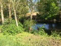
Lake Gerteis is a 20-hectare artificial lake created from a former gravel pit. It is named after the family who operated the gravel pit until 1997. It is less commonly known as Lake ORSA, after the company that took over operations from the Gerteis family until 2002, or as Lake des Oréades, after the eco-neighbourhood being developed along the lake from 2021 onwards on the former MDPA brownfield site. There are numerous benches and playground equipment all along the south-eastern shore of the lake, bordering the eco-neighbourhood. The western shore is more unspoilt and offers beautiful views of Ensisheim and its slag heap. Swimming, fishing, boating and camping are prohibited there.

Worth a visit

Other walks in the area

For more walks, use our search engine .

The GPS track and description are the property of this route's author. Please do not copy them without permission.