Country:

 City:
City:


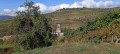
Parking is available in the cemetery car park on Rue de l’Église.
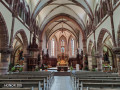
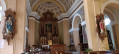
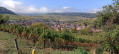
(S/E) From the car park, head towards the church; note the adjoining Lourdes Grotto on your right. Head down towards the village, then take the first street on the left, Rue Haute, and follow the purple and white sign for ‘Vignoble et collines sèches’ towards Strangenberg (Red Triangle markings). The climb is steep, but everyone can adjust their pace to ensure it remains enjoyable. Continue straight up, passing a small retention basin, until you reach a crossroads surrounded by vineyards.
(1) Turn left, then right, following the signposting towards Strangenberg. Ignore all paths on the left until you reach a hairpin bend.
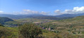
(2) The signposts indicate you should continue straight on along a grassy path, but it’s better to follow the bend to the right to avoid a short, stony slope, leading to the summit of the Strangenberg. Take the first path immediately on the left and follow it due north to the end of the hilltop ridge.
(3) Turn right to join the small access road to the summit car park, and follow it to the left. Ignore the access road to the mast on the right, and head down towards the Col du Neuland on the left, passing by the three well-shaded car parks.
(4) Take the path marked with a Red Triangle on the right, towards the Oelberg Chapel. See the ‘Places to see’ section.
(5) Return along the same path, in the opposite direction, to the Col du Neuland.
(4) Walk past the picnic area. Take the tarmac road on the left, which leads back down towards Westhalten. Follow it to the entrance to the village, where you’ll find the car park on the left (S/E).
 Visorando Member

 Moderate
  Difficult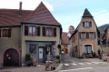
 Very difficult