Country:

 City:
City:


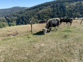
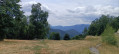
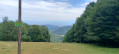
The car park is at the bottom of the Rimbach-près-Guebwiller valley, overlooking the Glashütte farmhouse inn.
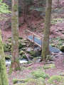
(S/E) Return to the access road to the farmhouse inn, follow it to the left towards the village for a few dozen metres, then take the path marked with a Blue Triangle. It starts off gently uphill to the left, running alongside the road. Follow it, keeping to the same level, for several hundred metres, until you reach the footbridge over the Rimbach stream. It turns right, begins to climb and very quickly joins a wide track.
(1) Leave the Blue Triangle markings and follow the wide track to the left. Ignore the paths branching off to the left; continue along the track until you reach a Y-junction, shortly after a 90° bend to the right.
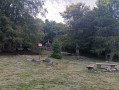
(2) Follow the left-hand branch uphill to the Judenhut Pass. There is a shelter and a picnic area.
(3) Turn left twice, and follow the Blue Cross markings towards Glashütte and Firstacker. Stay on this path until you reach the junction – at the end of a long left-hand bend – with the path marked with a red Rectangle crossed out in white.
(4) Continue straight on towards Firstacker, still following the Blue Cross markings. The path heads south, remaining on level ground, until a left-hand bend where it begins a descent to reach the large crossroads at Firstacker. Picnic area; the Sudel Chapel is nearby.
(5) From the post bearing the Club Vosgien directional signs, head left towards the entrance to the Soultz communal forest. The track is marked with a Red Triangle. Walk along this wide, gently sloping forest path towards the Glashütte and, on leaving the forest, head for the car park (S/E).

 Visorando Member
 Moderate
 Tourism professional