Country:
 City:


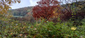
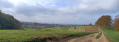
(S/E) From the car park at the youth hostel, Steinenweg 40, head towards the forest, uphill, until you reach the signpost “Bei der Jugendherberge”.
(1) Turn right, following the Yellow Diamond, onto the “Unterer Maienbühlweg” path. Follow this path along the edge of the forest, keeping straight on, until you reach a fork at the edge of the forest.
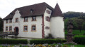
(2) Continue left, uphill, along the “Maienbühlsträssschen”, enter Switzerland and pass a lovely farm. Just after the farm, there is a fork in the path.
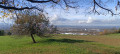
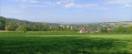
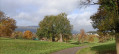
(3) Carry on straight ahead and, 50 metres further on, after the “Landesgrenze” sign, just before a wayside cross and a tree surrounded by benches, turn left onto the path leading up through the meadows, marked with a Yellow Diamond. It will follow a wide bend to the right to reach the heights of Inzlingen, at the “Erstellhalle” signpost.
(4) Turn left, walk past the village hall, then 50 metres further on, turn left again, following the Yellow Diamond to join Waldstrasse and the “Erstelweg”, which runs alongside sports facilities. Enter the forest and continue straight on until you reach a large crossroads. Take the first path on the left, the “Eiserne Hand Weg”, and continue straight on.
(5) Go straight on and continue straight ahead, following the Blue Diamond and the “Eiserne Hand Weg” path. As you approach the Salzert neighbourhood, the path joins and becomes the “Alter Steinweg”, still marked with a Blue Diamond. Follow it to the left until you reach the “Salzert Finnenbahn” signpost.
(6) Carry on straight ahead, following the “Alter Steinweg” path marked with Blue Diamonds, down a steep descent, until you reach the “Bei der Jugendherberge” signpost.
(1) Carry on straight ahead to the car park (S/E).
 Visorando Member

 Moderate