Country:

 City:
City:



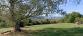
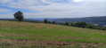
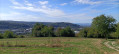
Car park at the sports ground, Brückenstrasse 3 in Hauingen (municipality of Lörrach), opposite the scooter shop. Go right to the end of the lane. The car park is on the left, behind the village hall.
(S/E) Head north, then turn left onto Ziegelgässle. You’ll reach the main road, Steinenstrasse. Turn right and walk 15 metres to the pedestrian crossing. Cross it and head slightly to the left towards the fountain and Rechbergstrasse, straight ahead. Follow this road, passing the health centre on your right and the cemetery on your left. Continue to the Y-junction at Dornhaldestrasse.
(1) Take the right-hand fork and head up Dornhaldestrasse until you reach another Y-junction at No. 8.
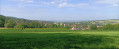
(2) Take the right-hand branch, which climbs steeply. Ignore the first path on the right (Lehbühl). Carry on uphill, and feel free to turn round to admire the views. Ignore the paths on either side.
(3) Pass the return path on your left and carry on straight ahead until you reach the three-way junction at the edge of the forest, where there is a picnic area.
(4) Take the middle path, the Haberackerweg, which is wide and covered with a mixture of gravel and loose stone. The path on the far left, which is barely visible and which you will take on the return journey, is not signposted and is overgrown with grass. Follow the wide, signposted path until you reach the edge of the forest.
(5) Take the path on the left, running alongside the forest. The Rechberg buildings are visible on the left. Continue straight on, towards Rechberg and its buildings.
(6) Walk past the return path and take the one on the right.
(7) At Café Hygge, retrace your steps back towards the forest until you reach the fork you passed earlier.
(6) At the edge of the forest, take the grassy path – barely visible and unmarked – which branches off at a right angle to the right. This path runs almost parallel to the access road to Rechberg, but it goes through the forest. Carry on straight ahead along this path, ignoring the path on the left, until you reach the fork you passed on the way out, with its picnic area.
(4) Follow the path back in the opposite direction to the outward journey for about 200 metres. Ignore the road on the right and continue to the Y-junction you also passed on the outward journey.
(3) Take the right-hand branch, which enters the woodland a little further on, and stay on this wide path, which becomes tarmac before reaching the first houses in the village.
(2) Follow the path back along the same route as on the way there until you reach the car park (S/E).
 Visorando Member
 Moderate
 Difficult