Country:

 City:
City:


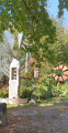
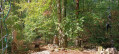

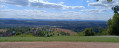
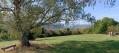
“Schöne Aussicht” walkers’ car park in Hägelberg, in the municipality of Steinen. To get there, follow Rue Im Rebgarten, past the Waldschänke. The car park is at the very end of the street, on the hillside at the edge of the forest.
(S/E) From the car park, looking out over the valley, take the unmarked path to the right, heading west at the far end of the car park; this path runs alongside the forest. Ignore the paths branching off to the right and follow this path to the end, then turn left and head downhill towards the village. Continue to the junction with No. 33 Rechbergerstrasse.
(1) Turn right onto the path marked with a Yellow Diamond. Stay on this marked path, heading straight on until you reach the edge of the forest and the signpost.
(2) Follow this path marked with a Yellow Diamond to the right, towards Lochhalde, ignoring the paths on either side until you reach a Y-junction and another signpost.
(3) Take the right-hand branch, Neuer Weg, towards Saatschulhütte, staying on the signposted path and ignoring the numerous paths on either side.
(4) At the junction, follow the marked path to the right until you join the Blue Diamond-marked trail coming from the Nasse Küche. Continue straight on until you reach the “Saatschulhütte” signpost.
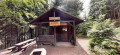
(5) Turn left to reach the Saatschulhütte shelter.
(6) Retrace your steps.
(5) Turn left onto the Mittlerer Haupweg, which is still marked with a Blue Diamond. Ignore the unmarked paths on the right.
(7) At the Fork in the road, keep right onto the Rütteleweg, marked with a Blue Diamond, and follow this marked path to the car park (S/E).
 Visorando Member
 Moderate
 Difficult