Bürgeln Castle Kalte Küche

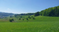
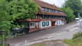
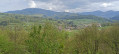
Wide, well-signposted paths; a visit to a castle with a café-restaurant in an adjoining building; a panoramic view from the terrace over the Rhine plain, the Vosges and the Alps in good weather; and a remarkable woodland cemetery near the start: this is what this route has to offer, taking place entirely in the forest apart from the return journey to the castle.

Details

n°109650557
Creation:
Last update:
Last review:
–
  • Walking
    Activity: Walking
  • ↔
    Distance: 3.43 mi
  • ◔
    Average duration: 2h 10 
  • ▲
    Difficulty: Easy

  • ⚐
    Back to start: Yes
  • ↗
    Ascent: + 673 ft
  • ↘
    Descent: - 699 ft

  • ▲
    Highest point: 2,516 ft
  • ▼
    Lowest point: 2,064 ft

Description of the walk

Large car park for walkers below Bürgeln Castle, Parkplatz von Schloss Bürgeln 79400 Kandern, Germany.

(S/E) From the car park, head due east towards the wooden signpost detailing the walks. Continue along the path which runs alongside the road. At the crossroads, take the path on the left towards Kalte Küche, following route 1.

(1) Walk past the woodland cemetery on your left into the forest. Continue along this wide path, which climbs at first, then levels out or even descends slightly; ignore the paths to the left and right, as they are dead ends. After just under half an hour, you’ll reach a Y-junction where two wide paths meet: the Hauptweg and the Kalte-Kücheweg.

(2) Take the left-hand branch, which goes uphill – the Kalte-Kücheweg – until you reach the junction before the Kalte Küche shelter.

(3) Turn left, then after about twenty metres turn left again to join the Ameisenkopfweg. Stay on this wide path, the Ameisenkopfweg, until you reach a multi-way junction.

(4) Turn left twice onto the Salzleckeweg and follow it to the end, ignoring the paths on either side. Initially heading south, it curves to the left and leads to a picnic area.

(5) Walk past the picnic area (Sandboden) with its shelter. Continue to the right and join the road. Turn left onto it to reach the car park. Continue along the road to the right to climb up to the castle.

(6) Head back down via the same route you took on the way up to the car park (S/E).

Waypoints

  1. S/E : mi 0 - alt. 2,090 ft - Bürgeln car park for walkers and visitors
  2. 1 : mi 0.12 - alt. 2,146 ft - Cimetière boisé de Schliengen
  3. 2 : mi 1.03 - alt. 2,369 ft - Junction: Hauptweg and Kalte Küche Weg; turn left
  4. 3 : mi 1.21 - alt. 2,444 ft - Crossroads – Picnic area - Kalte Küche (Abri)
  5. 4 : mi 2.26 - alt. 2,241 ft - Am brennten Buck
  6. 5 : mi 2.88 - alt. 2,080 ft - Picnic area
  7. 6 : mi 3.18 - alt. 2,169 ft - Bürgeln Castle - Schloss Bürgeln
  8. S/E : mi 3.43 - alt. 2,090 ft - Hikers’ and visitors’ car park at Bürgeln

Notes

Shelter, barbecue area and picnic area at the Kalte Küche (4).

Picnic area (5) (Sandboden) in the forest to the north-west, 100 metres from the car park, on the way back.

The castle restaurant/café (6) is closed on Mondays and Tuesdays: https://stuebli-buergeln.de/

Worth a visit

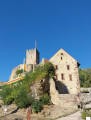
Bürgeln Castle: (6) Guided tours cost €7 (price as of 2026). No self-guided tours. Closed on Mondays and in January. See opening times on the website https://schlossbuergeln.de/

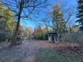
Forest cemetery (1) (Bestattungswald “Lichtung der Ruhe”) in the woodland to the north of the car park. The route passes along the eastern edge of the forest cemetery.

Other walks in the area

For more walks, use our search engine .

The GPS track and description are the property of this route's author. Please do not copy them without permission.